Old Maps of Cocoa, Brevard County for Genealogy
Trace your family roots with 41 historic maps of Cocoa. These high-res maps reveal old neighborhoods, homesites, landmarks, and streets — helping you uncover where your ancestors lived and how the area evolved over time.
- Explore historic neighborhoods: Identify where your relatives may have lived in the 1800s or 1900s.
- Compare maps over time: Trace the changes in streets, buildings, and landmarks for multi-generational research.
- Perfect for genealogy & ancestry research: Used by family historians and researchers to map out lineage and migration.
These maps are an incredible resource for exploring your personal connection to Cocoa's past.
Cocoa, Brevard County maps
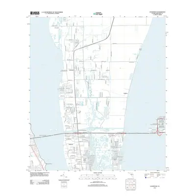
(41)- 1949 Map of Courtenay, 1960 Print
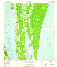 1949 Courtenay1960 Print · USGSMerritt Island and the Florida coast appear here just before the dawn of the space age, when citrus groves and river life defined the region. Researchers can trace early family sites at Courtenay and Indianola or locate historic landmarks like St Lukes Ch and Bethel Cem.3 unique versions available
 - 1949 Map of Eau Gallie, 1960 Print
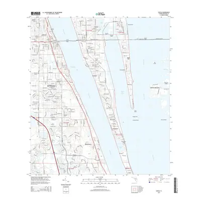
 1949 Eau Gallie1960 Print · USGSThe Florida coast near the Indian River comes to life in the late 1940s, showing a landscape defined by its waterways and railways. Trace family history or local growth through labels for Eau Gallie, the Gleason Cem, and the Florida East Coast line.7 unique versions available
 - 1949 Map of Sharpes, 1962 Print
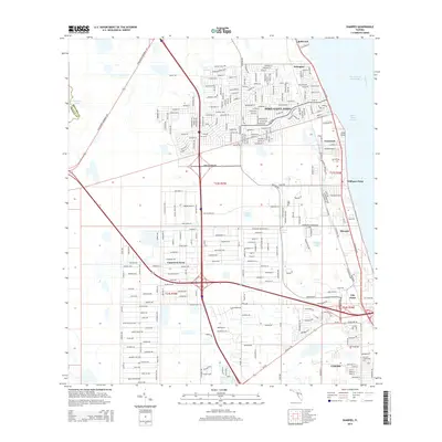
 1949 Sharpes1962 Print · USGSBrevard County’s riverfront communities are captured here in the late 1940s, just as the coastal infrastructure was maturing along the Indian River. Researchers can trace early settlements like Frontenac, City Point, and Sharpes along the Florida East Coast rail corridor.6 unique versions available
 - 1949 Map of Cocoa, 1962 Print
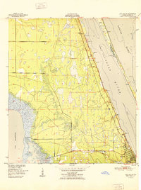
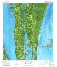
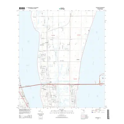
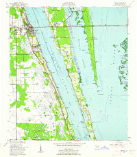 1949 Cocoa1962 Print · USGSThe Florida Space Coast appears in its pre-launch era, centered on the riverside towns of Cocoa and Rockledge. Researchers can trace the mid-century waterfront along the Indian River and explore early island settlements like Georgiana and Fairyland.2 unique versions available
 - 1951 Map of Eau Gallie
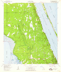
 1951 Eau Gallie1951 Print · USGSBrevard County's coastline before the height of the space age reveals a landscape of isolated settlements and winding waterways. Genealogists and historians can trace the early footprints of Eau Gallie, the Gleason Cem, and small railroad stops like Pineda.
 - 1951 Map of Cocoa
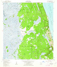
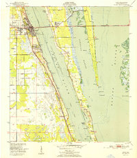 1951 Cocoa1951 Print · USGSThe Space Coast was just beginning its transformation in the early fifties, with the Indian River separating established towns from the citrus groves of Merritt Island. Researchers can trace the path of the Dixie Highway through Rockledge or locate vanished landmarks like Fairyland and the Cocoa Municipal Airport.
 - 1951 Map of Courtenay
 1951 Courtenay1951 Print · USGSMerritt Island and the adjacent mainland appear in the early fifties, before the nearby space center transformed the local geography. Researchers can trace early community sites like Courtenay, Indianola, and Audubon, alongside landmarks like St Lukes Ch and Bethel Cem.2 unique versions available
 - 1951 Map of Sharpes
 1951 Sharpes1951 Print · USGSIn the early 1950s, the Brevard County coast was defined by riverside settlements and narrow rail corridors. Researchers can trace the Florida East Coast rail line through Sharpes and City Point, or locate the old Cem and Pinkerton Pier (C).
 - 1953 Map of Lake Poinsett
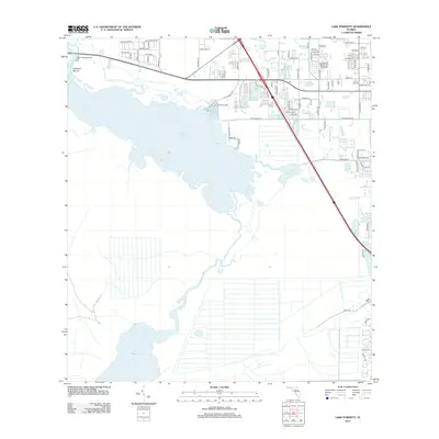
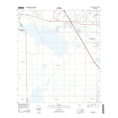
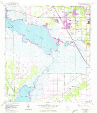 1953 Lake Poinsett1953 Print · USGSBrevard County was a land of transition in the 1950s as modern highways began to bypass the traditional river life of the St. Johns. Genealogists and local historians can trace early outposts like Lone Cabbage Camp, the Trailer Park Cem, and the riverfront Poinsett Lodge.4 unique versions available
 - 1955 Map of Orlando, 1969 Print
 1955 Orlando1969 Print · USGSCentral Florida was entering the space age in the mid-fifties, balancing its citrus heritage with new military and aerospace frontiers. You can trace early developments at Kennedy Space Center or locate interior settlements like Eatonville and Pine Castle.3 unique versions available
 - 1957 Map of Orlando
 1957 Orlando1957 Print · USGSCovers Cocoa, including Orlando, Palm Bay, and other nearby areas
 - 1958 Map of Orlando
 1958 Orlando1958 Print · USGSCentral Florida was a landscape of citrus, rail, and emerging aerospace technology during the late fifties. Researchers can trace the early footprints of Cape Canaveral and Patrick Air Force Base or locate inland citrus and rail hubs like Sanford and Lakeland.
 - 1962 Map of Orlando
 1962 Orlando1962 Print · USGSCentral Florida was transformed by aerospace and citrus at the start of the sixties. Genealogists and historians can trace old community footprints from Eau Gallie to Leesburg, alongside landmarks like McCoy AFB and the winding Econlockhatchee River.
 - 1976 Map of Courtenay, 1977 Print
 1976 Courtenay1977 Print · USGSMerritt Island's landscape reveals the intersection of aerospace history and coastal ecology in the mid-seventies. Trace old Florida landmarks like Courtenay, Indianola, and Mt Zion Ch alongside the expansive Kennedy Space Center.
 - 1976 Map of Cocoa, 1977 Print
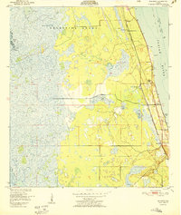
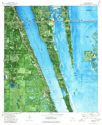 1976 Cocoa1977 Print · USGSBrevard County in the mid-seventies shows a thriving coastal corridor during the height of the space era. You can trace early island life through settlements like Georgiana and Fairyland, or locate landmarks like the Merritt Island Airport and Cocoa's waterfront.2 unique versions available
 - 1981 Map of Cape Canaveral, 1983 Print
 1981 Cape Canaveral1983 Print · USGSThe Space Coast and the Florida marshlands meet in the early eighties as aerospace technology and nature preserves sit side-by-side. Trace the development of Cocoa Beach, the sprawling grounds of the Kennedy Space Center, and the inland waters of Lake Poinsett.
 - 2012 Map of Eau Gallie, 2012 Print
 2012 Eau Gallie2012 Print · USGSCovers Cocoa, including Melbourne, Viera, and other nearby areas
 - 2012 Map of Lake Poinsett, 2012 Print
 2012 Lake Poinsett2012 Print · USGSCovers Cocoa, including Cocoa West, Orange County, and other nearby areas
 - 2012 Map of Cocoa, 2012 Print
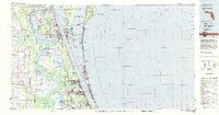
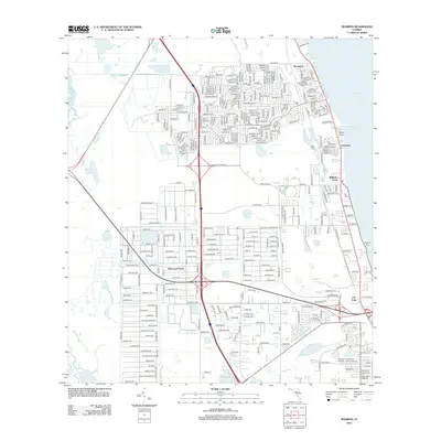
 2012 Cocoa2012 Print · USGSCovers Cocoa, including Merritt Island, Rockledge, and other nearby areas
 - 2012 Map of Sharpes, 2012 Print
 2012 Sharpes2012 Print · USGSCovers Cocoa, including Titusville, Port Saint John, and other nearby areas
 - 2012 Map of Courtenay, 2012 Print
 2012 Courtenay2012 Print · USGSCovers Cocoa, including Audubon, Indianola, and other nearby areas
 - 2015 Map of Cocoa, 2015 Print
 2015 Cocoa2015 Print · USGSCovers Cocoa, including Merritt Island, Rockledge, and other nearby areas
 - 2015 Map of Courtenay, 2015 Print
 2015 Courtenay2015 Print · USGSCovers Cocoa, including Audubon, Indianola, and other nearby areas
 - 2015 Map of Sharpes, 2015 Print
 2015 Sharpes2015 Print · USGSCovers Cocoa, including Titusville, Port Saint John, and other nearby areas
 - 2015 Map of Lake Poinsett, 2015 Print
 2015 Lake Poinsett2015 Print · USGSCovers Cocoa, including Cocoa West, Orange County, and other nearby areas
Showing maps 1-25 of 41
Frequently asked questions
- What are the different types of historical maps available for Cocoa?
- What is the oldest map of Cocoa?
- Where can I purchase historical maps of Cocoa for my home or office?
- Where can I download high-res historical maps of Cocoa?
- Are there historical topographic maps available for Cocoa?
- Is there historical aerial imagery available for Cocoa?
- Where are historical maps of Cocoa sourced from?