Old Maps of Brevard County, Florida for Hiking & Exploration
Hike through history with 234 historic maps of Brevard County. Explore old trails, ghost towns, and forgotten backroads — perfect for outdoor adventurers and local explorers.
- Rediscover forgotten places: Map out old mining camps, roads, and footpaths that no longer exist on modern maps.
- Layer with modern tools: Combine with LiDAR or satellite views to plan hikes through historical terrain.
- Made for exploration: Popular among hikers, overlanders, and local history lovers.
Use these maps to find adventure and explore the hidden past of Brevard County.
Brevard County, FL maps
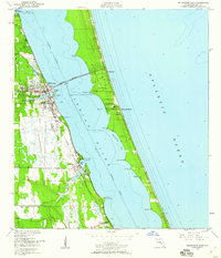
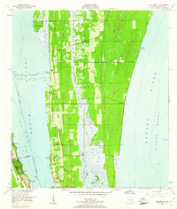
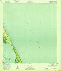
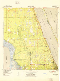
(234)- 1949 Map of Oak Hill, 1952 Print
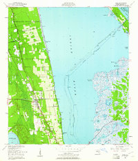
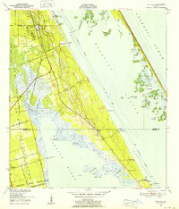 1949 Oak Hill1952 Print · USGSThe Volusia and Brevard County coastlines come alive in the late 1940s, showing a landscape shaped by colonial land grants and the railway. Genealogists and historians can trace old homesteads and docks near Oak Hill, Shiloh, and the Florida East Coast rail line.7 unique versions available
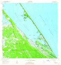
 - 1949 Map of Pardon Island, 1958 Print
 1949 Pardon Island1958 Print · USGSCoastal Florida in the late 1940s is defined here by the intricate wetlands of the Atlantic shore. Genealogists and historians can trace the early boundaries of Volusia and Brevard County near Pardon Island and Widgeon Bay.4 unique versions available
 - 1949 Map of Melbourne West, 1958 Print
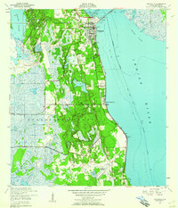
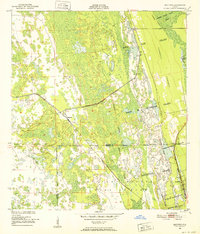
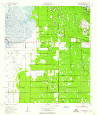 1949 Melbourne West1958 Print · USGSBrevard County underwent a post-war transition as the aviation industry and land reclamation reshaped the interior marshlands. Researchers can trace the layout of the Malabar Naval Air Station and early residential pockets like Melbourne Village or June Park.8 unique versions available
 - 1949 Map of Fellsmere, 1959 Print
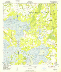
 1949 Fellsmere1959 Print · USGSThe town of Fellsmere and its surrounding marshlands are captured here in the post-war era, showing a landscape defined by drainage and rail. Researchers can trace the path of the Trans Florida Central Line and locate the Old Sebastian Cem.5 unique versions available
 - 1949 Map of Orsino, 1960 Print
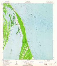
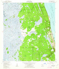
 1949 Orsino1960 Print · USGSMerritt Island and the Florida coast appear here in a series of intricate wetlands and lagoons just before the mid-century space era. Researchers can trace early settlements and landings like Orsino, Hubs Landing, and the unique Banana Creek Fish Camp Humpback Bridge.3 unique versions available
 - 1949 Map of Melbourne East, 1960 Print
 1949 Melbourne East1960 Print · USGSThe Florida coast near the mid-century shows a network of citrus and rail towns connected by the Melbourne Causeway. Genealogists and researchers can trace the early development of Eau Gallie, find the cemetery at Crane Creek, or locate the Ruins near Malabar.5 unique versions available
 - 1949 Map of False Cape, 1960 Print
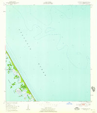
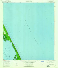
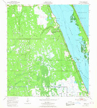
 1949 False Cape1960 Print · USGSBrevard County's barrier islands appear here in the late 1940s, shortly before the arrival of the space program transformed the local landscape. Genealogists and coastal historians can trace early landmarks like the Canaveral Club, De Soto Beach, and Penny Hammock.3 unique versions available
 - 1949 Map of Sebastian NW, 1960 Print
 1949 Sebastian NW1960 Print · USGSCoastal Brevard County in the late 1940s reveals a sparsely developed barrier island landscape before modern expansion. Trace the early layout of Evans Pines, locate the Lookout Tower, and follow the Intracoastal Waterway past Latham Island.5 unique versions available
 - 1949 Map of Titusville, 1960 Print
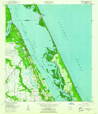
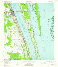
 1949 Titusville1960 Print · USGSBrevard County’s riverfront comes alive in this late-1940s survey of the bustling rail and water hub of the Indian River. Genealogists and historians can trace the foundations of Titusville, locate the County Farm, and explore early aviation at the Titusville Cocoa Airport.6 unique versions available
 - 1949 Map of Courtenay, 1960 Print
 1949 Courtenay1960 Print · USGSMerritt Island and the Florida coast appear here just before the dawn of the space age, when citrus groves and river life defined the region. Researchers can trace early family sites at Courtenay and Indianola or locate historic landmarks like St Lukes Ch and Bethel Cem.3 unique versions available
 - 1949 Map of Wilson, 1960 Print
 1949 Wilson1960 Print · USGSThe Florida coast at the end of the 1940s reveals a quiet landscape of lagoon-side camps and citrus groves. Genealogists and historians can locate the old settlement of Wilson and trace the waterways around Ragin Fish Camp and Dummit Grove.6 unique versions available
 - 1949 Map of Sebastian, 1960 Print
 1949 Sebastian1960 Print · USGSThe Florida coast near Sebastian and Roseland appears here just after the war, showing a landscape shaped by the rail and river. You can trace the Florida East Coast Railway through the Fleming Grant or locate early landmarks like Macedonia Ch and the Pelican Island Bird Sanctuary.5 unique versions available
 - 1949 Map of Eau Gallie, 1960 Print
 1949 Eau Gallie1960 Print · USGSThe Florida coast near the Indian River comes to life in the late 1940s, showing a landscape defined by its waterways and railways. Trace family history or local growth through labels for Eau Gallie, the Gleason Cem, and the Florida East Coast line.7 unique versions available
 - 1949 Map of Mims, 1961 Print
 1949 Mims1961 Print · USGSCoastal Brevard County is captured in the late 1940s as the rail-side citrus and fishing communities of the Indian River thrived. Researchers can trace the layout of early Spanish land grants or find local landmarks like the Indian Mound, the community of La Grange, and the waterfront at Allenhurst.5 unique versions available
 - 1949 Map of Sharpes, 1962 Print
 1949 Sharpes1962 Print · USGSBrevard County’s riverfront communities are captured here in the late 1940s, just as the coastal infrastructure was maturing along the Indian River. Researchers can trace early settlements like Frontenac, City Point, and Sharpes along the Florida East Coast rail corridor.6 unique versions available
 - 1949 Map of Cocoa, 1962 Print
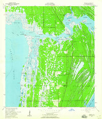
 1949 Cocoa1962 Print · USGSThe Florida Space Coast appears in its pre-launch era, centered on the riverside towns of Cocoa and Rockledge. Researchers can trace the mid-century waterfront along the Indian River and explore early island settlements like Georgiana and Fairyland.2 unique versions available
 - 1949 Map of Cocoa Beach, 1966 Print
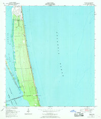
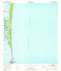 1949 Cocoa Beach1966 Print · USGSCoastal Brevard County is seen here just after the war, when the barrier island was a quiet stretch of dunes and wetlands. Trace early settlement patterns in Cocoa Beach or explore the intricate waterways of the Thousand Islands and Shortys Banks.2 unique versions available
 - 1949 Map of Grant, 1968 Print
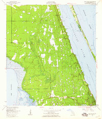
 1949 Grant1968 Print · USGSThe Florida coastline between Malabar and Micco appears here just after the war, featuring the Valkaria Naval Air Station. Researchers can trace the Florida East Coast rail line through Grant and explore islands like Grant Farm Island.4 unique versions available
 - 1949 Map of Tropic, 1969 Print
 1949 Tropic1969 Print · USGSBrevard County's barrier islands and shoreline are captured here in the late 1940s, just as modern infrastructure began to reshape the coast. Researchers can trace early settlements like Tropic and Ensey or locate the original footprint of the U S Military Reservation and the Eau Gallie Bridge during its construction.4 unique versions available
 - 1950 Map of Maytown, 1952 Print
 1950 Maytown1952 Print · USGSIn the mid-century Florida marshlands, historical land grants and the railroad define the local landscape. Genealogists and historians can trace the exact boundaries of the Delespine Grant and Peter Fouchard Grant near the settlement of Maytown.6 unique versions available
 - 1950 Map of Aurantia, 1952 Print
 1950 Aurantia1952 Print · USGSBrevard County was a landscape of Spanish land grants and sprawling wetlands at the mid-century point. Researchers can trace the Florida East Coast rail line as it passes through Aurantia, and locate landmarks like Southmere and the Brevard County Game Refuge.5 unique versions available
 - 1951 Map of False Cape
 1951 False Cape1951 Print · USGSThe Atlantic coast and Merritt Island are seen here in the early fifties before the space age transformed the region. Researchers can trace early coastal settlements and landmarks like the Canaveral Club, De Soto Beach, and the wild expanses of the State Game Refuge.
 - 1951 Map of Sebastian NW
 1951 Sebastian NW1951 Print · USGSThe Florida barrier islands south of Melbourne appear in the early fifties as a quiet stretch of coastal road and maritime coves. Trace the early footprints of Evans Pines or find the Lookout Tower and Light used for mid-century navigation.
 - 1951 Map of Melbourne East
 1951 Melbourne East1951 Print · USGSThe Space Coast shoreline comes alive in the early fifties, showing the mainland growth of Melbourne and Eau Gallie before the height of the space race. Trace the early layout of Indialantic, the path of the Florida East Coast rail line, and waterfront landmarks like Wells Park.
 - 1951 Map of Eau Gallie
 1951 Eau Gallie1951 Print · USGSBrevard County's coastline before the height of the space age reveals a landscape of isolated settlements and winding waterways. Genealogists and historians can trace the early footprints of Eau Gallie, the Gleason Cem, and small railroad stops like Pineda.
Showing maps 1-25 of 234
Top cities of Brevard County
- Palm Bay historical maps
- Melbourne historical maps
- Titusville historical maps
- Merritt Island historical maps
- Rockledge historical maps
- West Melbourne historical maps
See more
Frequently asked questions
- What are the different types of historical maps available for Brevard County?
- What is the oldest map of Brevard County?
- Where can I purchase historical maps of Brevard County for my home or office?
- Where can I download high-res historical maps of Brevard County?
- Are there historical topographic maps available for Brevard County?
- Is there historical aerial imagery available for Brevard County?
- Where are historical maps of Brevard County sourced from?