1970s Maps of Brevard County, Florida
Explore 7 historic maps of Brevard County from the 1970s. These maps offer a rare glimpse into what life looked like during the 1970s — showing old roads, neighborhoods, homes, and landmarks that have changed or disappeared over time.
Whether you're researching your family's past, planning a metal detecting trip, or studying how Brevard County's landscape evolved across the 1970s, these high-resolution maps are a powerful tool for exploring the history of this region.
- Focus on a specific era: All maps on this page are from the 1970s, giving you a focused view of this time period.
- See what’s changed: Compare century-old streets, trails, and buildings to today's modern landscape using overlays and satellite layers.
- Research with precision: Use these maps for genealogy, historical research, land use analysis, or educational projects.
- View, download, or print: Maps are fully viewable online in high resolution, and can be downloaded or printed for your own records.
Start exploring Brevard County's history through authentic maps from the 1970s. This is your window into the past.
Brevard County, FL maps
(7)- 1976 Map of Orsino
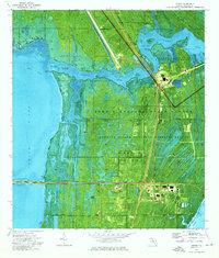 1976 Orsino1976 Print · USGSMerritt Island during the mid-seventies reveals the massive infrastructure of the American space program carved into Florida's coastal wetlands. Track the alignment of the U. S. Government Railroad as it passes the Launch Control Center and the old settlement of Orsino.
 - 1976 Map of Cape Canaveral
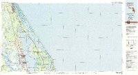
 1976 Cape Canaveral1976 Print · USGSBrevard County's Atlantic coast is shown at the height of the Space Race era, revealing the intricate launch and tracking infrastructure of the Cape. Researchers can trace the layout of Port Canaveral, the Lighthouse, and historical sites like Indian Mound Cem.2 unique versions available
 - 1976 Map of False Cape
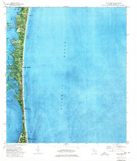
 1976 False Cape1976 Print · USGSThe Florida coast near the peak of the Space Race comes into focus on this orthophotomap, showing the massive infrastructure of the space program. Trace the path of the U S Government Railroad to Launch Complex 39A and the iconic Crawlerway.2 unique versions available
 - 1976 Map of Courtenay, 1977 Print
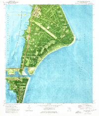
 1976 Courtenay1977 Print · USGSMerritt Island's landscape reveals the intersection of aerospace history and coastal ecology in the mid-seventies. Trace old Florida landmarks like Courtenay, Indianola, and Mt Zion Ch alongside the expansive Kennedy Space Center.
 - 1976 Map of Cocoa Beach, 1977 Print
 1976 Cocoa Beach1977 Print · USGSThe Space Coast shoreline was rapidly evolving during the mid-seventies, featuring dense coastal development and military presence. Researchers can trace canal developments in the Thousand Islands, the layout of Patrick Air Force Base, and landmarks like Canaveral Pier.2 unique versions available
 - 1976 Map of Cocoa, 1977 Print
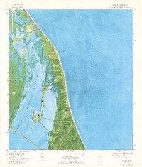
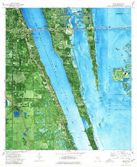 1976 Cocoa1977 Print · USGSBrevard County in the mid-seventies shows a thriving coastal corridor during the height of the space era. You can trace early island life through settlements like Georgiana and Fairyland, or locate landmarks like the Merritt Island Airport and Cocoa's waterfront.2 unique versions available
 - 1979 Map of Titusville, 1980 Print
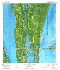
 1979 Titusville1980 Print · USGSThe Florida coast near Titusville shows a unique duality in the late seventies between aerospace ambition and coastal wilderness. Genealogists and historians can trace property boundaries of early land grants like Joseph Wales alongside the John F Kennedy Space Center (NASA).
End of results
Showing maps 1-7 of 7
Top cities of Brevard County
- Palm Bay historical maps
- Melbourne historical maps
- Titusville historical maps
- Merritt Island historical maps
- Rockledge historical maps
- West Melbourne historical maps
See more
Frequently asked questions
- What are the different types of historical maps available for Brevard County?
- What is the oldest map of Brevard County?
- Where can I purchase historical maps of Brevard County for my home or office?
- Where can I download high-res historical maps of Brevard County?
- Are there historical topographic maps available for Brevard County?
- Is there historical aerial imagery available for Brevard County?
- Where are historical maps of Brevard County sourced from?