Old Maps of Villa Sabine, Florida for Hiking & Exploration
Hike through history with 15 historic maps of Villa Sabine. Explore old trails, ghost towns, and forgotten backroads — perfect for outdoor adventurers and local explorers.
- Rediscover forgotten places: Map out old mining camps, roads, and footpaths that no longer exist on modern maps.
- Layer with modern tools: Combine with LiDAR or satellite views to plan hikes through historical terrain.
- Made for exploration: Popular among hikers, overlanders, and local history lovers.
Use these maps to find adventure and explore the hidden past of Villa Sabine.
Villa Sabine, FL maps
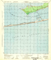
(15)- 1921 Map of Pensacola
 1921 Pensacola1921 Print · USGSCoastal Florida in the early twentieth century reveals a landscape of maritime industry and military reserves. Map collectors and genealogists can trace the waterfront piers of Muscogee Wharf, the historic U. S. Live Oak Plantation, and early settlements like Bohemia.
 - 1941 Map of Pensacola, 1956 Print
 1941 Pensacola1956 Print · USGSPensacola and its surrounding bays are seen here just before the mid-century boom, detailing a landscape defined by naval aviation and maritime rail. Trace the historic city grid, explore the U S Naval Reservation, or locate Oakland Ch and Black Hammock Cem.
 - 1942 Map of Pensacola
 1942 Pensacola1942 Print · USGSCoastal Florida is captured here in the early years of the war, showing the maritime and rail infrastructure that shaped the Panhandle. Genealogists and historians can trace family locations near Oakland Ch, the Black Hammock Cem, and the busy Muscogee Wharf.2 unique versions available
 - 1944 Map of Gulf Breeze
 1944 Gulf Breeze1944 Print · USGSCoastal Florida and its military defenses are surveyed here during the mid-forties, showing the transition from naval outposts to early recreation. Researchers can trace the layout of the U S Naval Reservation and find the location of the Pensacola Quarantine Station (Abandoned) or the old Casino.
 - 1957 Map of Pensacola, 1967 Print
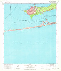
 1957 Pensacola1967 Print · USGSThe Florida Panhandle and Alabama coast are seen here at the height of the Cold War, showcasing a unique mix of military aviation and emerging beach tourism. Genealogists and local historians can trace legacy sites like Old Corry Field, the lumber town of Bagdad, and the coastal reaches of Santa Rosa Island.3 unique versions available
 - 1959 Map of Pensacola
 1959 Pensacola1959 Print · USGSThe Florida Panhandle and Alabama coast come alive in this late fifties survey of military aviation and maritime life. Genealogists can trace family roots in Bagdad, Loxley, and Milton while mapping the rails of the Louisville and Nashville.
 - 1960 Map of Pensacola
 1960 Pensacola1960 Print · USGSThe Florida Panhandle and Alabama's eastern shore are shown during a period of rapid military and coastal growth. Genealogists and historians can trace the mid-century footprints of Warrington, the Pensacola NAS (Chevalier), and the Blackwater River timber lands.
 - 1969 Map of Gulf Breeze, 1971 Print
 1969 Gulf Breeze1971 Print · USGSThe Florida Panhandle coast near Pensacola comes alive in this late-sixties study of a growing peninsula community. Researchers can trace the Andrew Jackson Trail, find the St Anna Ch, and explore the shoreline from Grassy Point to Fort Pickens State Park.3 unique versions available
 - 1978 Map of Pensacola, 1980 Print
 1978 Pensacola1980 Print · USGSThe Gulf Coast at the end of the 1970s reveals a landscape shaped by maritime industry and a heavy naval presence. Researchers can trace the development of Pensacola alongside quiet coastal hamlets like Magnolia Springs and the historic Fort Pickens State Park.3 unique versions available
 - 2012 Map of Gulf Breeze, 2012 Print
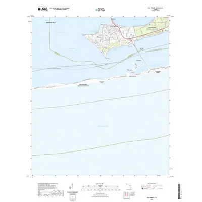
 2012 Gulf Breeze2012 Print · USGSCovers Villa Sabine, including Gulf Breeze, Pensacola Beach, and other nearby areas
 - 2015 Map of Gulf Breeze, 2015 Print
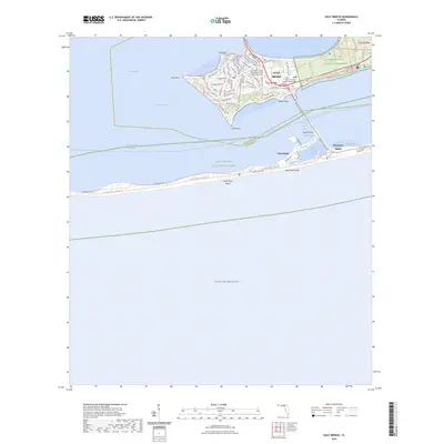
 2015 Gulf Breeze2015 Print · USGSCovers Villa Sabine, including Gulf Breeze, Pensacola Beach, and other nearby areas
 - 2018 Map of Gulf Breeze, 2018 Print
 2018 Gulf Breeze2018 Print · USGSCovers Villa Sabine, including Gulf Breeze, Pensacola Beach, and other nearby areas
 - 2021 Map of Gulf Breeze, 2021 Print
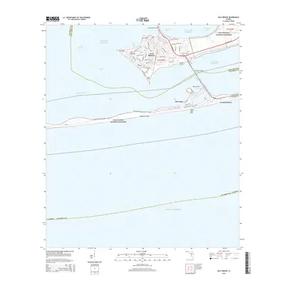
 2021 Gulf Breeze2021 Print · USGSCovers Villa Sabine, including Gulf Breeze, Pensacola Beach, and other nearby areas
 - 2024 Map of Gulf Breeze, 2024 Print
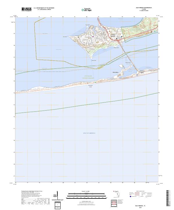
 2024 Gulf Breeze2024 Print · USGSCovers Villa Sabine, including Gulf Breeze, Pensacola Beach, and other nearby areas
 - 2025 Map of Gulf Breeze, 2025 Print
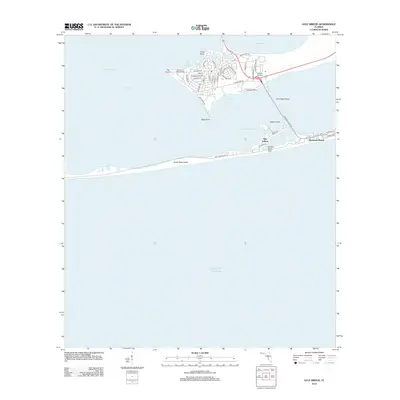
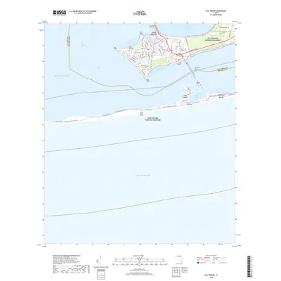
 2025 Gulf Breeze2025 Print · USGSThe Florida coast near Pensacola is shown here in its modern era, spanning the peninsula of Gulf Breeze to the barrier island shores. Genealogists and hikers can trace the Duncan Cem, find Villa Sabine, and follow the Nio Pine Scrub Trl.
End of results
Showing maps 1-15 of 15
Top cities near Villa Sabine
Frequently asked questions
- What are the different types of historical maps available for Villa Sabine?
- What is the oldest map of Villa Sabine?
- Where can I purchase historical maps of Villa Sabine for my home or office?
- Where can I download high-res historical maps of Villa Sabine?
- Are there historical topographic maps available for Villa Sabine?
- Is there historical aerial imagery available for Villa Sabine?
- Where are historical maps of Villa Sabine sourced from?