1970s Maps of Leon County, Florida
Explore 7 historic maps of Leon County from the 1970s. These maps offer a rare glimpse into what life looked like during the 1970s — showing old roads, neighborhoods, homes, and landmarks that have changed or disappeared over time.
Whether you're researching your family's past, planning a metal detecting trip, or studying how Leon County's landscape evolved across the 1970s, these high-resolution maps are a powerful tool for exploring the history of this region.
- Focus on a specific era: All maps on this page are from the 1970s, giving you a focused view of this time period.
- See what’s changed: Compare century-old streets, trails, and buildings to today's modern landscape using overlays and satellite layers.
- Research with precision: Use these maps for genealogy, historical research, land use analysis, or educational projects.
- View, download, or print: Maps are fully viewable online in high resolution, and can be downloaded or printed for your own records.
Start exploring Leon County's history through authentic maps from the 1970s. This is your window into the past.
Leon County, FL maps
(7)- 1970 Map of Tallahassee, 1972 Print
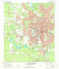 1970 Tallahassee1972 Print · USGSTallahassee is shown during a period of rapid expansion in the early seventies, balancing its role as a state capital and university hub. Genealogists can locate family landmarks from the Governor's Mansion to the Roselawn Cemetery and Bond Sch.4 unique versions available
 - 1972 Map of Lake Talquin SE, 1973 Print
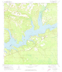
 1972 Lake Talquin SE1973 Print · USGSThe Florida panhandle forest was a wild landscape of wetlands and remote camps in the early 1970s. Trace old property lines from the Forbes Purchase and locate isolated landmarks like Otter Camp, Brown House, and the swampy reaches of Wolf Trap Bay.2 unique versions available
 - 1972 Map of Bloxham, 1973 Print
 1972 Bloxham1973 Print · USGSGadsden County and the northern reaches of the Apalachicola Forest are captured here in the early seventies, just as Lake Talquin became a focal point for local recreation. Researchers can trace the rural communities of Bloxham and Jackson Bluff, alongside family landmarks like Bear Creek Cem and Antioch Ch.2 unique versions available
 - 1972 Map of Lake Talquin, 1973 Print
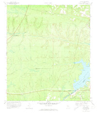
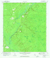
 1972 Lake Talquin1973 Print · USGSThe Lake Talquin reservoir region on the Leon and Gadsden county line appears here in the early seventies, showing a landscape shaped by water and public land. Local researchers can find family-named locations such as Williams Landing, Holland, and the Fort Braden Ch.
 - 1972 Map of Ward, 1974 Print
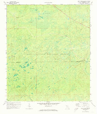
 1972 Ward1974 Print · USGSThe Florida Panhandle's riverine borderlands are captured here in the early 1970s, showing the meeting point of three counties within the national forest. Researchers can trace the rural communities of Ward and Stoutamire Landing alongside Blue Creek Ch (Cem).
 - 1978 Map of Bainbridge, 1980 Print
 1978 Bainbridge1980 Print · USGSIn the late seventies, this Georgia-Florida borderland was defined by the confluence of the Flint and Chattahoochee rivers. Trace the region's infrastructure via the Seaboard Coast Line Railroad and find sites like Bainbridge State Hospital.
 - 1979 Map of Tallahassee, 1980 Print
 1979 Tallahassee1980 Print · USGSFlorida's capital and the Gulf coast are captured here in the late seventies, showing the region's balance between urban growth and massive protected wetlands. Researchers can trace the routes of the Apalachicola Northern Railroad or locate small inland hubs like Sopchoppy, Panacea, and Hosford.
End of results
Showing maps 1-7 of 7
Top cities of Leon County
Frequently asked questions
- What are the different types of historical maps available for Leon County?
- What is the oldest map of Leon County?
- Where can I purchase historical maps of Leon County for my home or office?
- Where can I download high-res historical maps of Leon County?
- Are there historical topographic maps available for Leon County?
- Is there historical aerial imagery available for Leon County?
- Where are historical maps of Leon County sourced from?