1990s Maps of Saint Johns County, Florida
Explore 10 historic maps of Saint Johns County from the 1990s. These maps offer a rare glimpse into what life looked like during the 1990s — showing old roads, neighborhoods, homes, and landmarks that have changed or disappeared over time.
Whether you're researching your family's past, planning a metal detecting trip, or studying how Saint Johns County's landscape evolved across the 1990s, these high-resolution maps are a powerful tool for exploring the history of this region.
- Focus on a specific era: All maps on this page are from the 1990s, giving you a focused view of this time period.
- See what’s changed: Compare century-old streets, trails, and buildings to today's modern landscape using overlays and satellite layers.
- Research with precision: Use these maps for genealogy, historical research, land use analysis, or educational projects.
- View, download, or print: Maps are fully viewable online in high resolution, and can be downloaded or printed for your own records.
Start exploring Saint Johns County's history through authentic maps from the 1990s. This is your window into the past.
Saint Johns County, FL maps
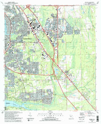
(10)- 1991 Map of Riverdale
 1991 Riverdale1991 Print · USGSThe St. Johns River corridor comes alive in the early nineties, documenting the riverside landings and crossings that shaped this region. Researchers can trace family sites near Riverdale, Federal Point, and St Johns Ch, or follow the Old Railroad Grade.
 - 1991 Map of Green Cove Springs
 1991 Green Cove Springs1991 Print · USGSGreen Cove Springs and the surrounding Clay County riverfront are captured here in the early 1990s as the landscape balanced small-town life with industrial growth. Researchers can locate several burial grounds and schools, from Hickory Grove Cemetery to Bennett School, and trace the route of the Old Railroad Grade.
 - 1991 Map of Picolata
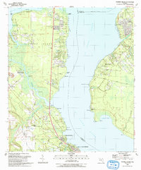
 1991 Picolata1991 Print · USGSThe eastern banks of the St. Johns River come into focus in the early 1990s, capturing a landscape of riverside landings and historic rural outposts. Genealogists can trace family landmarks like the Bakersville Cem, Mt Olive Ch, and the remnant Old Railroad Grade.
 - 1992 Map of Fleming Island, 1993 Print
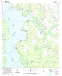
 1992 Fleming Island1993 Print · USGSFleming Island and the banks of the St. Johns River are shown here in the early nineties, a period of significant growth and suburban transition. Genealogists and local historians can trace family locations and old communities like Hibernia, Russell, and Switzerland Cem.
 - 1993 Map of Orangedale
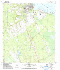
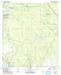 1993 Orangedale1993 Print · USGSCoastal St. Johns County comes into focus in the early nineties as residential growth began to press into the marshlands and hammocks. Local researchers can trace family landmarks and river crossings at Whites Ford, the Sampson Cem, and Orangedale.
 - 1993 Map of Orange Park
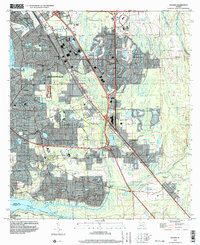
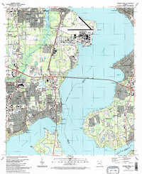 1993 Orange Park1993 Print · USGSThe riverfront communities of Clay and Duval counties were seeing significant suburban maturation in the early nineties. Genealogists and local historians can trace the development of Orange Park and Mandarin, locating landmarks like Magnolia Cem and the Jacksonville Naval Air Station.2 unique versions available
 - 1993 Map of Bayard
 1993 Bayard1993 Print · USGSSoutheast Jacksonville in the early nineties shows a landscape of rapid suburban growth between the St Johns River and Julington Creek. Researchers can trace the development of Mandarin, locate the Julington Cem, and follow the historical path of the Florida East Coast RR.2 unique versions available
 - 1994 Map of Orange Park, 2002 Print
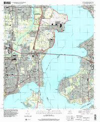 1994 Orange Park2002 Print · USGSThe riverfront communities of Orange Park and Mandarin are shown in the 1990s as they expanded around the St Johns River. Researchers can trace old family sites at Magnolia Cem and Mandarin Cem or locate the sprawling Jacksonville Naval Air Station.
 - 1994 Map of Jacksonville Beach, 2003 Print
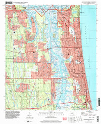 1994 Jacksonville Beach2003 Print · USGSCoastal Duval County underwent significant suburban expansion in the mid-nineties as beach communities became more integrated with the mainland. Genealogists and local historians can trace family plots at Rain Cem or explore the development of Manhattan Beach and Sans Pareil.
 - 1994 Map of Bayard, 2003 Print
 1994 Bayard2003 Print · USGSSouthern Duval County was undergoing rapid transformation in the mid-nineties as Jacksonville expanded toward the St. Johns River. Genealogists and local historians can trace established communities like Mandarin and Loretto alongside landmarks like Julington Cem and New Allen Chapel.
End of results
Showing maps 1-10 of 10
Top cities of Saint Johns County
- Fruit Cove historical maps
- Ponte Vedra Beach historical maps
- Saint Augustine historical maps
- Saint Augustine Beach historical maps
- Saint Augustine South historical maps
- Saint Augustine Shores historical maps
See more
Frequently asked questions
- What are the different types of historical maps available for Saint Johns County?
- What is the oldest map of Saint Johns County?
- Where can I purchase historical maps of Saint Johns County for my home or office?
- Where can I download high-res historical maps of Saint Johns County?
- Are there historical topographic maps available for Saint Johns County?
- Is there historical aerial imagery available for Saint Johns County?
- Where are historical maps of Saint Johns County sourced from?