1980s Maps of Wakulla County, Florida
Explore 11 historic maps of Wakulla County from the 1980s. These maps offer a rare glimpse into what life looked like during the 1980s — showing old roads, neighborhoods, homes, and landmarks that have changed or disappeared over time.
Whether you're researching your family's past, planning a metal detecting trip, or studying how Wakulla County's landscape evolved across the 1980s, these high-resolution maps are a powerful tool for exploring the history of this region.
- Focus on a specific era: All maps on this page are from the 1980s, giving you a focused view of this time period.
- See what’s changed: Compare century-old streets, trails, and buildings to today's modern landscape using overlays and satellite layers.
- Research with precision: Use these maps for genealogy, historical research, land use analysis, or educational projects.
- View, download, or print: Maps are fully viewable online in high resolution, and can be downloaded or printed for your own records.
Start exploring Wakulla County's history through authentic maps from the 1980s. This is your window into the past.
Wakulla County, FL maps
(11)- 1981 Map of Cody
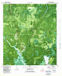
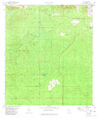 1981 Cody1981 Print · USGSJefferson and Leon Counties are captured here in the early eighties, showcasing a landscape of river swamps and small rural outposts. Local historians can trace the Old Railroad Grade and locate old landmarks like Cody, Fanlew, and Hardy Sink.
 - 1981 Map of Woodville, 1982 Print
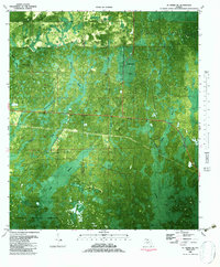
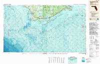
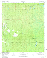 1981 Woodville1982 Print · USGSThe Leon and Wakulla county borderlands are shown here in the early eighties, centered on the historic site of the Natural Bridge Battlefield. Trace the path of the Seaboard Coast Line or locate family markers at Rhodes Cem and Godwin Cem.2 unique versions available
 - 1981 Map of St. Teresa, 1982 Print
 1981 St. Teresa1982 Print · USGSCoastal Franklin and Wakulla Counties are captured here in the early eighties, where the great river systems meet the Gulf of Mexico. Researchers can trace family sites like Nichols Cem or explore the shifting sands of Bay Mouth Bar and Peninsula Point.2 unique versions available
 - 1982 Map of Mc Intyre
 1982 Mc Intyre1982 Print · USGSCoastal Franklin County in the early eighties is a landscape of river-fed wetlands and forest. Researchers can trace river access points like Big Blackjack Landing, the local footprint of Lanark Village, and the St James Fire Tower.3 unique versions available
 - 1982 Map of Lighthouse Point
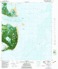 1982 Lighthouse Point1982 Print · USGSThe Florida coast near the Wakulla and Franklin county line appears here in the early eighties, showcasing a shifting landscape of tidal inlets and marshy islands. Discover the isolated interior of St James Island through its network of lakes and ponds, including Tucker Lake and Double Pond.2 unique versions available
 - 1982 Map of St. Marks NE, 1983 Print
 1982 St. Marks NE1983 Print · USGSThe Jefferson County coastland in the early eighties was a dense network of karst sinks and wetlands within the St Marks National Wildlife Refuge. Researchers can trace the water levels of Gum Swamp or locate named landmarks like Smoky Hammock, Jake Hole, and Pinhook Sinks.
 - 1982 Map of St Marks, 1983 Print
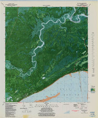
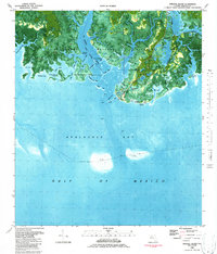
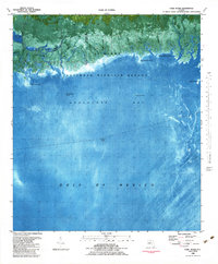
 1982 St Marks1983 Print · USGSCoastal Wakulla County in the early eighties is mapped here as a network of tidal rivers, marshes, and small historic settlements. Genealogists and historians can locate several rural cemeteries including Stewart Cem and Wakulla Cem, or trace the vicinity of Port Leon and the Old Railroad Grade.3 unique versions available
 - 1982 Map of Sprague Island, 1984 Print
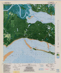
 1982 Sprague Island1984 Print · USGSThe Wakulla County coast in the early 1980s reveals a wild interface of salt marsh and maritime history within the St Marks National Wildlife Refuge. Researchers can locate the historic St Marks Lighthouse, the Forbes Purchase Line, and the Mounds Lookout Tower among the winding bayous.2 unique versions available
 - 1982 Map of Cobb Rocks, 1984 Print
 1982 Cobb Rocks1984 Print · USGSThe Jefferson County coastline during the early 1980s reveals a wild, tidal landscape within the St Marks National Wildlife Refuge. Boaters and coastal historians can trace the intricate network of Pinhook River and locate offshore hazards like Grey Mare Rock and Peters Rock.2 unique versions available
 - 1988 Map of Tallahassee
 1988 Tallahassee1988 Print · USGSThe Florida Panhandle and South Georgia are captured here in the late eighties, showing the expansion of the regional highway network and coastal growth. Genealogists and historians can trace rail lines like the Seaboard System Railroad or locate family roots in Blountstown, Graceville, or Crawfordville.2 unique versions available
 - 1988 Map of Apalachicola
 1988 Apalachicola1988 Print · USGSThe Florida Panhandle's Forgotten Coast comes to life in the late eighties, showing the delicate balance between wild marshlands and historic waterfront towns. Researchers can trace the shoreline from Cape San Blas to Bald Point, locating family-named landings like Hays Place and the historic grounds of Fort Gadsden.
End of results
Showing maps 1-11 of 11
Top cities of Wakulla County
Frequently asked questions
- What are the different types of historical maps available for Wakulla County?
- What is the oldest map of Wakulla County?
- Where can I purchase historical maps of Wakulla County for my home or office?
- Where can I download high-res historical maps of Wakulla County?
- Are there historical topographic maps available for Wakulla County?
- Is there historical aerial imagery available for Wakulla County?
- Where are historical maps of Wakulla County sourced from?