1990s Maps of Wakulla County, Florida
Explore 7 historic maps of Wakulla County from the 1990s. These maps offer a rare glimpse into what life looked like during the 1990s — showing old roads, neighborhoods, homes, and landmarks that have changed or disappeared over time.
Whether you're researching your family's past, planning a metal detecting trip, or studying how Wakulla County's landscape evolved across the 1990s, these high-resolution maps are a powerful tool for exploring the history of this region.
- Focus on a specific era: All maps on this page are from the 1990s, giving you a focused view of this time period.
- See what’s changed: Compare century-old streets, trails, and buildings to today's modern landscape using overlays and satellite layers.
- Research with precision: Use these maps for genealogy, historical research, land use analysis, or educational projects.
- View, download, or print: Maps are fully viewable online in high resolution, and can be downloaded or printed for your own records.
Start exploring Wakulla County's history through authentic maps from the 1990s. This is your window into the past.
Wakulla County, FL maps
(7)- 1990 Map of Smith Creek
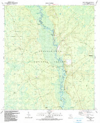 1990 Smith Creek1990 Print · USGSLiberty and Wakulla Counties are defined here by the winding Ochlockonee River during the late twentieth century. Researchers can trace historic river access at Blazed Pine Landing and Upper Langston Landing or locate the Mt Zion Ch community.
 - 1990 Map of Bradwell Bay
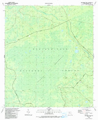 1990 Bradwell Bay1990 Print · USGSWakulla County's interior wetlands and timberlands are meticulously detailed in this late twentieth-century study of the Florida panhandle. Researchers can trace the path of the Florida National Scenic Trail as it skirts the Bradwell Bay swamp and the banks of the Sopchoppy River.
 - 1990 Map of Thousand Yard Bay
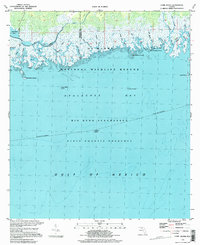
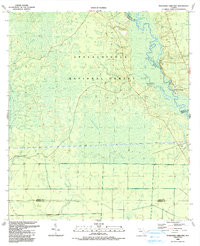 1990 Thousand Yard Bay1990 Print · USGSThe Florida Panhandle river country is documented here during the late twentieth century, showing a wilderness of interconnected basins and riverbanks. Researchers can locate family landmarks like Vause Cem or trace the winding course of the Ochlockonee River past Roberts Landing.
 - 1990 Map of Sanborn
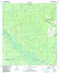 1990 Sanborn1990 Print · USGSThe Sopchoppy and Ochlockonee rivers converge in the Florida panhandle during the late twentieth century. Genealogists can trace family names at Revell Cemetery and McKenzie-Sanborn Cemetery or locate the settlements of Sopchoppy and Curtis Mill.
 - 1994 Map of Cobb Rocks, 1998 Print
 1994 Cobb Rocks1998 Print · USGSThe Jefferson County coastline during the late twentieth century is defined here by protected wetlands and tidal inlets. Marine researchers and local historians can trace the intricate flow of the Pinhook River into Apalachee Bay or locate Cobb Rocks.
 - 1999 Map of Woodville, 2003 Print
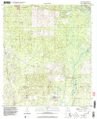 1999 Woodville2003 Print · USGSThe Leon County pine woods and springs are documented here at the close of the twentieth century. Researchers can trace the Forbes Purchase Line and locate local landmarks like Rhodes Cem and the Natural Bridge Battlefield State Historic Site.
 - 1999 Map of Lake Munson, 2003 Print
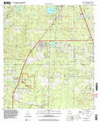 1999 Lake Munson2003 Print · USGSThe southern edge of the state capital meets the dense pines of the national forest in the late twentieth century. Researchers can trace historic property boundaries along the Forbes Purchase Line and locate rural landmarks like St Peters Ch or the community of Woodville.
End of results
Showing maps 1-7 of 7
Top cities of Wakulla County
Frequently asked questions
- What are the different types of historical maps available for Wakulla County?
- What is the oldest map of Wakulla County?
- Where can I purchase historical maps of Wakulla County for my home or office?
- Where can I download high-res historical maps of Wakulla County?
- Are there historical topographic maps available for Wakulla County?
- Is there historical aerial imagery available for Wakulla County?
- Where are historical maps of Wakulla County sourced from?