1970s Maps of Walton County, Florida
Explore 27 historic maps of Walton County from the 1970s. These maps offer a rare glimpse into what life looked like during the 1970s — showing old roads, neighborhoods, homes, and landmarks that have changed or disappeared over time.
Whether you're researching your family's past, planning a metal detecting trip, or studying how Walton County's landscape evolved across the 1970s, these high-resolution maps are a powerful tool for exploring the history of this region.
- Focus on a specific era: All maps on this page are from the 1970s, giving you a focused view of this time period.
- See what’s changed: Compare century-old streets, trails, and buildings to today's modern landscape using overlays and satellite layers.
- Research with precision: Use these maps for genealogy, historical research, land use analysis, or educational projects.
- View, download, or print: Maps are fully viewable online in high resolution, and can be downloaded or printed for your own records.
Start exploring Walton County's history through authentic maps from the 1970s. This is your window into the past.
Walton County, FL maps
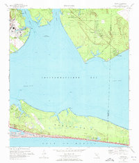
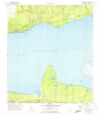
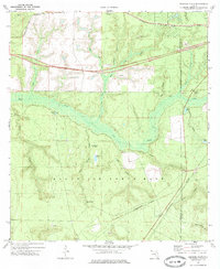
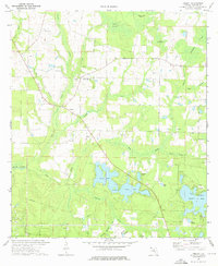
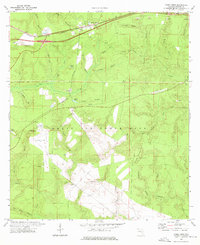
(27)- 1970 Map of Niceville, 1972 Print
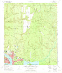 1970 Niceville1972 Print · USGSNiceville and Valparaiso are shown here at the start of the 1970s, shaped by the waters of Boggy Bayou and the expansion of Eglin Air Force Base. Trace local history through Rocky Cem, Pinecrest Community Ch, and the old Claypit sites.4 unique versions available
 - 1970 Map of Bunker, 1972 Print
 1970 Bunker1972 Print · USGSThe Walton County coastline in the early seventies shows the intricate delta where Black Creek meets the bay. Researchers can trace family roots at Black Creek Ch or explore the marsh islands of Bunker Island and Indian Island.2 unique versions available
 - 1970 Map of Portland, 1972 Print
 1970 Portland1972 Print · USGSCoastal Walton County in the early seventies shows a landscape where military activity meets rural tradition. Researchers can locate the New Home Cem, trace the waters of Alaqua Creek, and explore the southern outskirts of Portland.3 unique versions available
 - 1970 Map of Miramar Beach, 1972 Print
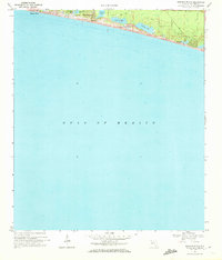 1970 Miramar Beach1972 Print · USGSThe Walton County coastline comes into focus in the early seventies, capturing a landscape of coastal dune lakes and nascent beach communities. Genealogists and locals can trace the early footprints of Miramar Beach, Four Mile Village, and Gulf Pines along the shore.2 unique versions available
 - 1970 Map of Destin, 1972 Print
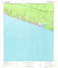
 1970 Destin1972 Print · USGSThe Florida Panhandle's Emerald Coast is captured here in the early seventies, showing a transitioning landscape of military installations and quiet fishing villages. Researchers can trace the layout of early Destin, the grounds of Eglin Air Force Base, and local landmarks like the Destin Sch.3 unique versions available
 - 1970 Map of Freeport, 1972 Print
 1970 Freeport1972 Print · USGSThe Walton County coast in the early seventies shows a landscape of tidal bayous and growing shoreline communities. Genealogists and historians can trace the early footprints of Freeport, Santa Rosa Beach, and the uniquely named Fluffy Landing.2 unique versions available
 - 1970 Map of Point Washington, 1972 Print
 1970 Point Washington1972 Print · USGSCoastal Walton County is seen here just as its beach communities began to take shape amidst the dune lakes and pine flatwoods. Trace the early footprints of Seagrove Beach and Inlet Beach, or follow the Intracoastal Waterway past Devils Swamp.3 unique versions available
 - 1970 Map of Rock Hill, 1972 Print
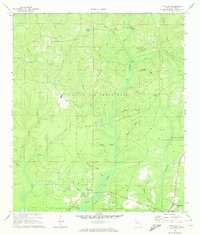
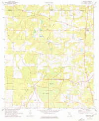
 1970 Rock Hill1972 Print · USGSWalton County as it appeared in the early 1970s shows the sprawling intersection of military training grounds and rural creek basins. Genealogists and historians can locate family landmarks near Owls Head or trace the drainage of Seven Runs and Lafayette Creek.3 unique versions available
 - 1970 Map of Choctaw Beach, 1972 Print
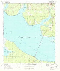
 1970 Choctaw Beach1972 Print · USGSChoctawhatchee Bay remains a quiet coastal frontier in the early seventies, dominated by military lands and small waterfront clusters. Researchers can map the early development of Choctaw Beach, locate the Fort Rucker Recreation Area, and trace the winding shores of Hogtown Bayou and Buck Bayou.2 unique versions available
 - 1970 Map of Niceville SE, 1972 Print
 1970 Niceville SE1972 Print · USGSWalton County's military and natural landscape is captured here in the early 1970s, showcasing the intersection of the Eglin Air Force Base interior with local creek basins. Researchers can trace land features like the Black Oak Cem, Wilson Pond, and the old Landing Strip.3 unique versions available
 - 1970 Map of Grayton Beach, 1972 Print
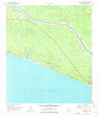
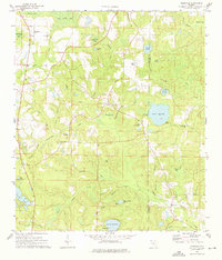
 1970 Grayton Beach1972 Print · USGSCoastal Walton County is documented here in the early seventies as small beach communities began to take shape along the Gulf. Researchers can trace the early layouts of Santa Rosa Beach and Grayton Beach or locate landmarks like Oyster Lake and a local cemetery.3 unique versions available
 - 1973 Map of Paxton, 1975 Print
 1973 Paxton1975 Print · USGSThe Florida-Alabama borderlands come to life in the early seventies, centered on the rail-side commerce of Paxton and Florala. Local historians can locate specific rural landmarks like St Marks Ch, the Childrens Home, and the Louisville and Nashville rail corridor.3 unique versions available
 - 1973 Map of Spencer Flats, 1975 Print
 1973 Spencer Flats1975 Print · USGSThe Florida panhandle comes into focus in the early seventies as military lands and railroad corridors intersect. Genealogists and researchers can trace the rail lines through Nashville and Deerland, or locate landmarks like the Ramer Lookout Tower and Spencer Flats.3 unique versions available
 - 1973 Map of Dorcas, 1975 Print
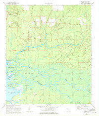
 1973 Dorcas1975 Print · USGSOkaloosa and Walton Counties are captured here in the early 1970s as the Shoal River valley sustained quiet rural communities and rail transport. Researchers can trace family history at Old Dorcas Cem, Welcome Ch, and the small settlement of Deerland.2 unique versions available
 - 1973 Map of Darlington, 1975 Print
 1973 Darlington1975 Print · USGSThe Florida-Alabama borderlands come into focus in the early 1970s, showing a landscape of timbered bays and quiet rural hamlets. Genealogists can trace family roots through several local landmarks like Oak Grove Ch, Limestone Cem, and Padgett Cem.2 unique versions available
 - 1973 Map of Laurel Hill, 1975 Print
 1973 Laurel Hill1975 Print · USGSLaurel Hill and the surrounding Okaloosa County pinelands are captured here in the early seventies as the railroad still anchored the local economy. Researchers can trace family roots at Travelers Rest Cemetery, Mt Zion Church, and the settlement of Svea.2 unique versions available
 - 1973 Map of Liberty, 1976 Print
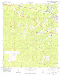
 1973 Liberty1976 Print · USGSMid-1970s Walton County is a landscape of springs and rural communities as they transitioned into a modern recreational hub. Genealogists and researchers can trace local family landmarks and sites such as Cluster Springs, Liberty, and the lakeside Campground near Juniper Lake.2 unique versions available
 - 1973 Map of Gaskin, 1976 Print
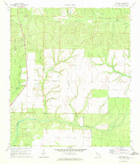
 1973 Gaskin1976 Print · USGSThe Florida-Alabama border in the 1970s is characterized by its creek systems and small rural outposts. Researchers can trace land use through features like the Natural Bridge, the Gaskin settlement, and several remote cemeteries scattered near Big Swamp.3 unique versions available
 - 1973 Map of Glendale, 1976 Print
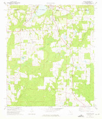
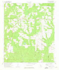
 1973 Glendale1976 Print · USGSThe Florida Panhandle interior during the early seventies is recorded here, showing the rural communities along the Walton and Holmes county border. Genealogists can locate family landmarks such as Gum Creek Ch, Pleasant Grove, and the State Fish Hatchery at Lake Cassidy.2 unique versions available
 - 1973 Map of De Funiak Springs West, 1976 Print
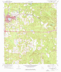
 1973 De Funiak Springs West1976 Print · USGSInland Walton County is shown during the early 1970s, as the growing community of De Funiak Springs expanded westward into the Florida pines. Genealogists and local historians can trace family locations near Oak Ridge Cem, early industrial sites like Cosson Mill, and rural centers such as Alaqua Ch.4 unique versions available
 - 1973 Map of Mossy Head, 1976 Print
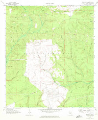
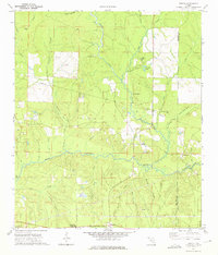
 1973 Mossy Head1976 Print · USGSWalton County's interior was a landscape of military aviation and railroad transit during the mid-seventies. Genealogists and historians can trace the development of Mossy Head and the expansive reach of Eglin Air Force Base near Mt Sinai and Auxiliary Field No 1.2 unique versions available
 - 1973 Map of De Funiak Springs East, 1976 Print
 1973 De Funiak Springs East1976 Print · USGSWalton County in the early seventies centers on the rail-driven growth of De Funiak Springs and the historic settlement of Eucheeanna. Genealogists and historians can trace local landmarks like Magnolia Cem, Euchee Valley Ch, and the Louisville and Nashville line.2 unique versions available
 - 1973 Map of New Harmony, 1976 Print
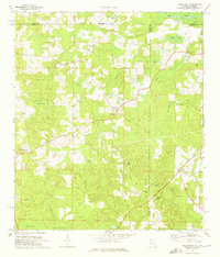
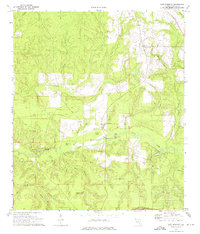 1973 New Harmony1976 Print · USGSWalton County in the early 1970s shows a landscape defined by the Shoal River and its many bays and branches. Genealogists and local historians can trace the vicinity of New Harmony, the Prosperity Ch, and the rail-side community of Mossy Head.2 unique versions available
 - 1974 Map of Point Washington
 1974 Point Washington1974 Print · USGSThe Florida Panhandle's Emerald Coast is captured in the mid-seventies, showing the growth of coastal communities between the Gulf and the bay. Genealogists and local historians can locate Black Creek Church, Santa Rosa Cemetery, and the early footprints of Grayton Beach and Point Washington.
 - 1978 Map of Fort Walton Beach, 1980 Print
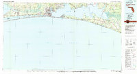 1978 Fort Walton Beach1980 Print · USGSThe Florida Panhandle in the late seventies reveals a landscape defined by the growth of Eglin Air Force Base and the shoreline of Choctawhatchee Bay. Genealogists and historians can trace the early footprints of Fort Walton Beach, Destin, and remote coastal outposts like Point Washington.2 unique versions available
Showing maps 1-25 of 27
Top cities of Walton County
- Santa Rosa Beach historical maps
- Miramar Beach historical maps
- DeFuniak Springs historical maps
- Freeport historical maps
- Paxton historical maps
Frequently asked questions
- What are the different types of historical maps available for Walton County?
- What is the oldest map of Walton County?
- Where can I purchase historical maps of Walton County for my home or office?
- Where can I download high-res historical maps of Walton County?
- Are there historical topographic maps available for Walton County?
- Is there historical aerial imagery available for Walton County?
- Where are historical maps of Walton County sourced from?