1950s Maps of Bryan County, Georgia
Explore 24 historic maps of Bryan County from the 1950s. These maps offer a rare glimpse into what life looked like during the 1950s — showing old roads, neighborhoods, homes, and landmarks that have changed or disappeared over time.
Whether you're researching your family's past, planning a metal detecting trip, or studying how Bryan County's landscape evolved across the 1950s, these high-resolution maps are a powerful tool for exploring the history of this region.
- Focus on a specific era: All maps on this page are from the 1950s, giving you a focused view of this time period.
- See what’s changed: Compare century-old streets, trails, and buildings to today's modern landscape using overlays and satellite layers.
- Research with precision: Use these maps for genealogy, historical research, land use analysis, or educational projects.
- View, download, or print: Maps are fully viewable online in high resolution, and can be downloaded or printed for your own records.
Start exploring Bryan County's history through authentic maps from the 1950s. This is your window into the past.
Bryan County, GA maps
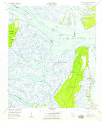
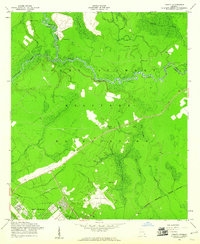
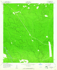
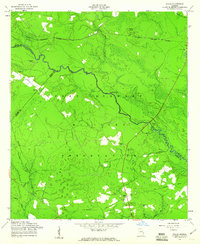
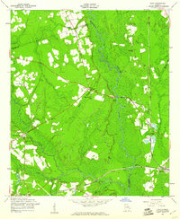
(24)- 1950 Map of Pembroke
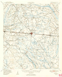 1950 Pembroke1950 Print · USGSCovers Bryan County, including Pembroke, Reka, and other nearby areas2 unique versions available
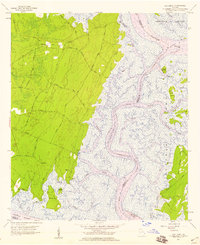
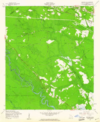
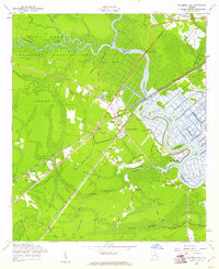
 - 1950 Map of Hinesville
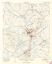 1950 Hinesville1950 Print · USGSCovers Bryan County, including Hinesville, Fort Stewart, and other nearby areas2 unique versions available
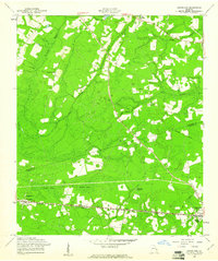
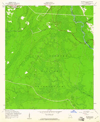
 - 1950 Map of Meldrim
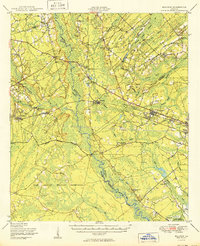 1950 Meldrim1950 Print · USGSCovers Bryan County, including Savannah, Pooler, and other nearby areas2 unique versions available
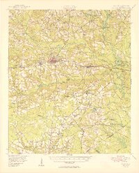
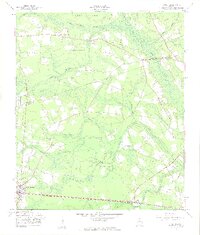
 - 1950 Map of Limerick
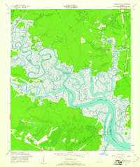
 1950 Limerick1950 Print · USGSCovers Bryan County, including Savannah, Richmond Hill, and other nearby areas2 unique versions available
 - 1950 Map of Claxton
 1950 Claxton1950 Print · USGSCovers Bryan County, including Claxton, Hagan, and other nearby areas2 unique versions available
 - 1954 Map of St Catherines Sound, 1958 Print
 1954 St Catherines Sound1958 Print · USGSCovers Bryan County, including Chatham County, Liberty County, and other nearby areas2 unique versions available
 - 1956 Map of Brunswick, 1968 Print
 1956 Brunswick1968 Print · USGSCovers Bryan County, including Savannah, Hinesville, and other nearby areas2 unique versions available
 - 1957 Map of Oak Level, 1959 Print
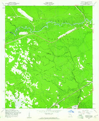
 1957 Oak Level1959 Print · USGSCovers Bryan County, including Sweet Hill, Buckhead, and other nearby areas2 unique versions available
 - 1957 Map of Burroughs, 1959 Print
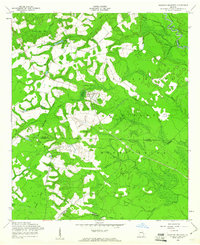
 1957 Burroughs1959 Print · USGSCovers Bryan County, including Savannah, Georgetown, and other nearby areas3 unique versions available
 - 1957 Map of Savannah, 1967 Print
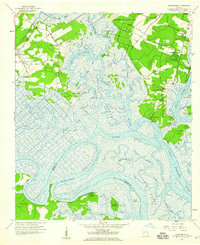
 1957 Savannah1967 Print · USGSCovers Bryan County, including Charleston, Savannah, and other nearby areas4 unique versions available
 - 1958 Map of Limerick NW, 1961 Print
 1958 Limerick NW1961 Print · USGSCovers Bryan County, including Fleming, Liberty County, and other nearby areas3 unique versions available
 - 1958 Map of Trinity, 1961 Print
 1958 Trinity1961 Print · USGSCovers Bryan County, including Flemington, Trinity, and other nearby areas3 unique versions available
 - 1958 Map of Meldrim SE, 1961 Print
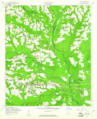
 1958 Meldrim SE1961 Print · USGSCovers Bryan County, including Savannah, Pooler, and other nearby areas4 unique versions available
 - 1958 Map of Groveland, 1961 Print
 1958 Groveland1961 Print · USGSCovers Bryan County, including Pembroke, Reka, and other nearby areas
 - 1958 Map of Lanier, 1961 Print
 1958 Lanier1961 Print · USGSCovers Bryan County, including Pembroke, Lanier, and other nearby areas3 unique versions available
 - 1958 Map of Letford, 1961 Print
 1958 Letford1961 Print · USGSCovers Bryan County, including Pembroke, Letford, and other nearby areas3 unique versions available
 - 1958 Map of Limerick SE, 1961 Print
 1958 Limerick SE1961 Print · USGSCovers Bryan County, including Richmond Hill, Midway, and other nearby areas2 unique versions available
 - 1958 Map of Glissons Millpond, 1961 Print
 1958 Glissons Millpond1961 Print · USGSCovers Bryan County, including Camp Olvier, Liberty County, and other nearby areas3 unique versions available
 - 1958 Map of Daisy, 1961 Print
 1958 Daisy1961 Print · USGSCovers Bryan County, including Daisy, Edna, and other nearby areas3 unique versions available
 - 1958 Map of Willie, 1961 Print
 1958 Willie1961 Print · USGSCovers Bryan County, including Pembroke, Willie, and other nearby areas3 unique versions available
 - 1958 Map of Dorchester, 1961 Print
 1958 Dorchester1961 Print · USGSCovers Bryan County, including Midway, Riceboro, and other nearby areas3 unique versions available
 - 1958 Map of Richmond Hill, 1961 Print
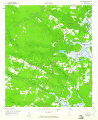
 1958 Richmond Hill1961 Print · USGSCovers Bryan County, including Savannah, Richmond Hill, and other nearby areas3 unique versions available
 - 1958 Map of Meldrim SW, 1961 Print
 1958 Meldrim SW1961 Print · USGSCovers Bryan County, including Ellabell, Chatham County, and other nearby areas3 unique versions available
 - 1958 Map of Eden, 1961 Print
 1958 Eden1961 Print · USGSCovers Bryan County, including Black Creek, Doswell, and other nearby areas2 unique versions available
End of results
Showing maps 1-24 of 24
Top cities of Bryan County
Frequently asked questions
- What are the different types of historical maps available for Bryan County?
- What is the oldest map of Bryan County?
- Where can I purchase historical maps of Bryan County for my home or office?
- Where can I download high-res historical maps of Bryan County?
- Are there historical topographic maps available for Bryan County?
- Is there historical aerial imagery available for Bryan County?
- Where are historical maps of Bryan County sourced from?