Old Maps of Bryan County, Georgia for Genealogy
Trace your family roots with 142 historic maps of Bryan County. These high-res maps reveal old neighborhoods, homesites, landmarks, and streets — helping you uncover where your ancestors lived and how the area evolved over time.
- Explore historic neighborhoods: Identify where your relatives may have lived in the 1800s or 1900s.
- Compare maps over time: Trace the changes in streets, buildings, and landmarks for multi-generational research.
- Perfect for genealogy & ancestry research: Used by family historians and researchers to map out lineage and migration.
These maps are an incredible resource for exploring your personal connection to Bryan County's past.
Bryan County, GA maps
(142)- 1918 Map of Hinesville
 1918 Hinesville1918 Print · USGSCoastal Liberty County is seen here during World War I, when a network of swamp-skirting roads connected small farming hubs and rail depots. Family historians can trace the exact locations of many rural institutions, including the Liberty Campmeeting Ground, New Jerusalem Church, and Ways Millpond.4 unique versions available
 - 1919 Map of Claxton
 1919 Claxton1919 Print · USGSSoutheast Georgia rail towns thrive along the Seaboard Air Line just after the Great War, showing a landscape shaped by timber and local agriculture. Genealogists can locate over twenty rural schools and crossings like Deans Crossing, Liberia School, and Hagan.3 unique versions available
 - 1920 Map of Pembroke
 1920 Pembroke1920 Print · USGSGeorgia's coastal plain emerges in the years after the Great War, showing a network of rail lines and river landings. Genealogists can trace old family roots through Stevens Grove School, Beulah Church, and the settlement at Pembroke.3 unique versions available
 - 1920 Map of Meldrim
 1920 Meldrim1920 Print · USGSCoastal Georgia during the early post-war period is defined here by the winding Ogeechee River and a busy intersection of rail lines. Genealogists and researchers can trace family roots near Clyde or locate rural landmarks like Zion Church and Miller Chapel.
 - 1920 Map of Limerick, 1928 Print
 1920 Limerick1928 Print · USGSThe Georgia coast at the end of the Great War reveals a landscape shaped by tidal rivers and burgeoning timber railroads. Genealogists and local historians can trace family roots through the settlements of Limerick, Sunbury, and Riceboro, or locate the historic Midway Ch. and the coastal defenses of Fort Morris.
 - 1928 Map of St Catherines Island
 1928 St Catherines Island1928 Print · USGSCoastal Georgia's intricate barrier islands and marshes are captured here in the early twentieth century. Genealogists and historians can locate specific sites like Bakers House & Chimney, the Quarantine Stack, and Harris.
 - 1942 Map of Meldrim
 1942 Meldrim1942 Print · USGSThe Ogeechee River corridor and its railway junctions are captured here in a series of surveys finalized just before the mid-century. Researchers can trace the layout of early settlements like Meldrim and Ellabel or locate ancestral sites at Miller Chapel and Zion Church.
 - 1943 Map of St Catherines Island, 1963 Print
 1943 St Catherines Island1963 Print · USGSCoastal Liberty County is seen here during the Second World War, showing the detailed shoreline from Ossabaw Island to Sapelo Island. Researchers can find landmark homesteads like Bakers House N Chimney and maritime sites including the Quarantine Flagstaff.2 unique versions available
 - 1944 Map of Claxton
 1944 Claxton1944 Print · USGSSoutheast Georgia was undergoing significant change in the 1940s as military expansion met established rail towns and rural school districts. Genealogists and historians can trace the footprint of Camp Stewart alongside family-named landmarks like Beasley Sch, Moodys Crossing, and Brewton Mill Sch.
 - 1944 Map of Hinesville, 1945 Print
 1944 Hinesville1945 Print · USGSLiberty County underwent a massive transition during the Second World War as military expansion met deep-rooted rural communities. Researchers can trace the layout of Camp Stewart alongside historic landmarks like the Liberty Campmeeting Ground and Providence Sch.
 - 1944 Map of Limerick, 1945 Print
 1944 Limerick1945 Print · USGSCoastal Georgia during the mid-forties reveals a landscape transitioning between established agricultural settlements and expanding military grounds. Genealogists and researchers can trace local families through many Art Well locations and historic community centers like Midway Ch, Limerick, and Riceboro.
 - 1944 Map of Ossabaw Island, 1963 Print
 1944 Ossabaw Island1963 Print · USGSCoastal Georgia's barrier islands and river networks come to life in this mid-century survey of the Ogeechee and Skidaway basins. Researchers can locate historical sites like Fort McAllister, the Kilkenny Club, and the vanished Cheves Mill Chimney among the tidal marshes.
 - 1945 Map of St. Catherine's Island
 1945 St. Catherine's Island1945 Print · USGSThe Georgia coast remained a wild expanse of tidal rivers and barrier islands in the years following the war. Genealogists and researchers can trace family landmarks like Bakers House N Chimney and the strategic maritime infrastructure on Black Beard Island.
 - 1945 Map of Ossabaw Island
 1945 Ossabaw Island1945 Print · USGSThe Georgia coast at the end of the war is a complex world of tidal rivers and historic fortifications. Genealogists and local historians can trace family-named sites and landmarks like Cheves Mill Chimney, Adams Chimney, and the Kilkenny Club among the winding creeks.
 - 1946 Map of Brunswick, 1948 Print
 1946 Brunswick1948 Print · USGSCoastal Georgia in the mid-forties reveals a landscape defined by the Camp Stewart Military Reservation and the sprawling barrier islands. Genealogists and historians can trace the rail-and-river network through inland towns like Ludowici and Jesup, or locate coastal landmarks like the St Simon Light.
 - 1947 Map of Savannah
 1947 Savannah1947 Print · USGSCoastal Georgia and South Carolina are captured here in the mid-forties, showing the rail-and-river networks of the Lowcountry. Genealogists and researchers can trace old crossroads and river towns from Statesboro to Beaufort, alongside military sites like Camp Stewart and Parris Island.
 - 1948 Map of Brunswick
 1948 Brunswick1948 Print · USGSCoastal Georgia in the late 1940s is defined here by its labyrinthine barrier islands and the massive footprint of Camp Stewart. Genealogists and historians can trace the rail-tied growth of Jesup and Hinesville or locate coastal landmarks like St Simon Light.
 - 1948 Map of Savannah
 1948 Savannah1948 Print · USGSThe Georgia and South Carolina Lowcountry comes alive in this post-war survey of the coast and its river-fed hinterlands. Genealogists and historians can trace rail lines like the Central of Georgia RR and find established settlements such as Isle of Hope and Sylvania.
 - 1948 Map of Limerick, 1964 Print
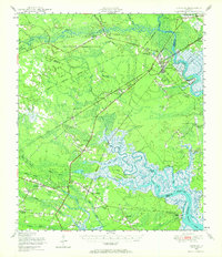 1948 Limerick1964 Print · USGSCoastal Georgia's river-fed landscapes are captured here just after the war, showing the deep-rooted settlements of Liberty and Bryan counties. Genealogists can locate family sites among numerous landmarks like Dorchester Academy, Fort Morris, and the Old Dorchester Cem.
 - 1948 Map of Pembroke, 1966 Print
 1948 Pembroke1966 Print · USGSPembroke and the surrounding Georgia pine lands are captured here just after the war, showing a landscape defined by the railroad and the military. Genealogists can trace family names at Beautiful Zion Cem, Ash Branch Church, and several rural schools like Midway Sch.
 - 1950 Map of Pembroke
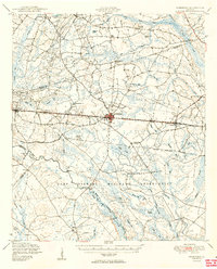 1950 Pembroke1950 Print · USGSIn mid-century Bryan County, the landscape around Pembroke was a mix of vital rail lines and expanding military boundaries. Genealogists and local historians can trace family locations near Beautiful Zion Cem, Ash Branch Church, and the rural Esla Sch.2 unique versions available
 - 1950 Map of Hinesville
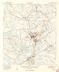 1950 Hinesville1950 Print · USGSLiberty County was undergoing a major transformation at mid-century as the military footprint grew around Hinesville. Genealogists and historians can trace the foundations of this change through landmarks like Terrells Millpond, Providence School, and the Cypress Slash Cem.2 unique versions available
 - 1950 Map of Meldrim
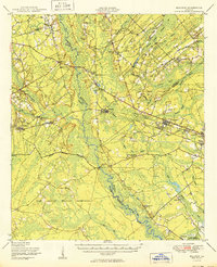 1950 Meldrim1950 Print · USGSCoastal Georgia in the late forties is defined by the rail lines and river swamps that connect inland towns like Meldrim and Blitchton. Genealogists can trace family landmarks and rural life at the Scaffletown School, Bethesda Ch, and Blitch Cem.2 unique versions available
 - 1950 Map of Limerick
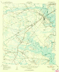 1950 Limerick1950 Print · USGSThe Georgia lowcountry at the mid-century mark shows a transition from coastal plantations to military and industrial expansion. Genealogists and historians can trace family roots through numerous sites like Dorchester Academy, Sunbury, and Scratchy Hall Cem.2 unique versions available
 - 1950 Map of Claxton
 1950 Claxton1950 Print · USGSMid-century Evans County centers on the thriving rail corridor connecting Claxton, Hagan, and Daisy during the height of the Seaboard Air Line era. Genealogists and historians can locate numerous rural landmarks like the Ennis Branch School, Sikes Chapel, and the vast Camp Stewart Military Reservation.2 unique versions available
Showing maps 1-25 of 142
Top cities of Bryan County
Frequently asked questions
- What are the different types of historical maps available for Bryan County?
- What is the oldest map of Bryan County?
- Where can I purchase historical maps of Bryan County for my home or office?
- Where can I download high-res historical maps of Bryan County?
- Are there historical topographic maps available for Bryan County?
- Is there historical aerial imagery available for Bryan County?
- Where are historical maps of Bryan County sourced from?