1920s Maps of Bulloch County, Georgia
Explore 6 historic maps of Bulloch County from the 1920s. These maps offer a rare glimpse into what life looked like during the 1920s — showing old roads, neighborhoods, homes, and landmarks that have changed or disappeared over time.
Whether you're researching your family's past, planning a metal detecting trip, or studying how Bulloch County's landscape evolved across the 1920s, these high-resolution maps are a powerful tool for exploring the history of this region.
- Focus on a specific era: All maps on this page are from the 1920s, giving you a focused view of this time period.
- See what’s changed: Compare century-old streets, trails, and buildings to today's modern landscape using overlays and satellite layers.
- Research with precision: Use these maps for genealogy, historical research, land use analysis, or educational projects.
- View, download, or print: Maps are fully viewable online in high resolution, and can be downloaded or printed for your own records.
Start exploring Bulloch County's history through authentic maps from the 1920s. This is your window into the past.
Bulloch County, GA maps
(6)- 1920 Map of Pembroke
 1920 Pembroke1920 Print · USGSGeorgia's coastal plain emerges in the years after the Great War, showing a network of rail lines and river landings. Genealogists can trace old family roots through Stevens Grove School, Beulah Church, and the settlement at Pembroke.3 unique versions available
 - 1920 Map of Statesboro
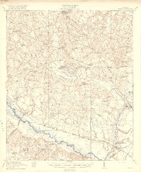
 1920 Statesboro1920 Print · USGSSoutheast Georgia was a bustling junction of regional railways just after the First World War. Researchers can trace family roots and land ownership across a network of rural schools like Smith Allen Deaf School, small settlements like Adabelle, and the prominent Central of Georgia Railway.4 unique versions available
 - 1920 Map of Meldrim
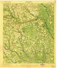
 1920 Meldrim1920 Print · USGSCoastal Georgia during the early post-war period is defined here by the winding Ogeechee River and a busy intersection of rail lines. Genealogists and researchers can trace family roots near Clyde or locate rural landmarks like Zion Church and Miller Chapel.
 - 1920 Map of Oliver
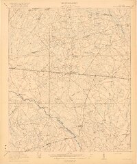
 1920 Oliver1920 Print · USGSScreven County agriculture and river commerce thrived in the years following the Great War. Genealogists can locate family landmarks across the Ogeechee basin, from Double Head Church and Middle Ground School to the bustling rail stops at Halcyondale and Oliver.2 unique versions available
 - 1921 Map of Brooklet
 1921 Brooklet1921 Print · USGSBulloch County's rural heartland is captured here during the 1920s, showing a landscape defined by small-town rail junctions and river fords. Genealogists can trace family footprints at vanished landmarks like Slabville School, Corinth Church, and Ebenezer Ford.2 unique versions available
 - 1921 Map of Rocky Ford
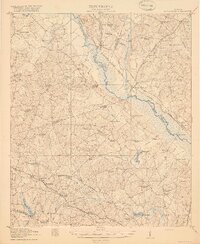 1921 Rocky Ford1921 Print · USGSSoutheast Georgia in the early twenties reveals a landscape of river-bottom swamps and decentralized farming communities. Genealogists can trace local roots through numerous family-named landmarks like Bradwell School, Akins Mill Creek, and Finchs Store.2 unique versions available
End of results
Showing maps 1-6 of 6
Top cities of Bulloch County
Frequently asked questions
- What are the different types of historical maps available for Bulloch County?
- What is the oldest map of Bulloch County?
- Where can I purchase historical maps of Bulloch County for my home or office?
- Where can I download high-res historical maps of Bulloch County?
- Are there historical topographic maps available for Bulloch County?
- Is there historical aerial imagery available for Bulloch County?
- Where are historical maps of Bulloch County sourced from?