1970s Maps of Folkston, Georgia
Explore 2 historic maps of Folkston from the 1970s. These maps offer a rare glimpse into what life looked like during the 1970s — showing old roads, neighborhoods, homes, and landmarks that have changed or disappeared over time.
Whether you're researching your family's past, planning a metal detecting trip, or studying how Folkston's landscape evolved across the 1970s, these high-resolution maps are a powerful tool for exploring the history of this region.
- Focus on a specific era: All maps on this page are from the 1970s, giving you a focused view of this time period.
- See what’s changed: Compare century-old streets, trails, and buildings to today's modern landscape using overlays and satellite layers.
- Research with precision: Use these maps for genealogy, historical research, land use analysis, or educational projects.
- View, download, or print: Maps are fully viewable online in high resolution, and can be downloaded or printed for your own records.
Start exploring Folkston's history through authentic maps from the 1970s. This is your window into the past.
Folkston, GA maps
(2)- 1970 Map of Boulogne, 1973 Print
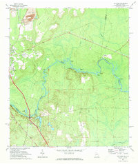 1970 Boulogne1973 Print · USGSThe Georgia-Florida border comes alive in the early seventies as the St Marys River winds through the wetlands of Camden and Nassau counties. Genealogists and local historians can trace the rail-side growth of Folkston and Boulogne, or locate the Camp Pinckney Ch and Bethune Middle Sch.3 unique versions available
 - 1978 Map of Burnt Fort
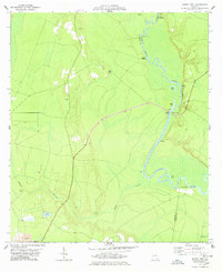 1978 Burnt Fort1978 Print · USGSCoastal Georgia's river-bottom lands are captured here in the late seventies as the river dictated the pace of local life. Researchers can trace historic river crossings and rural landmarks like Allens Ferry, Hopkins Bridge, and the Antioch Cem.2 unique versions available
End of results
Showing maps 1-2 of 2
Top cities near Folkston
Top neighborhoods of Folkston
Frequently asked questions
- What are the different types of historical maps available for Folkston?
- What is the oldest map of Folkston?
- Where can I purchase historical maps of Folkston for my home or office?
- Where can I download high-res historical maps of Folkston?
- Are there historical topographic maps available for Folkston?
- Is there historical aerial imagery available for Folkston?
- Where are historical maps of Folkston sourced from?