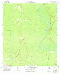
1978 Map of Burnt Fort
USGS Topo · Published 1978About this map
The Satilla River winds through the lowlands of Charlton and Camden counties, defining a landscape shaped by river transport and early settlement. At Burnt Fort, the river’s path is flanked by historic river access points like Allens Ferry and Hopkins Bridge, which historically served as vital connections across the swampy terrain. Small communities and family landmarks are scattered throughout the pine-heavy surroundings, including Buie and several rural burial grounds such as O'Berry Cem and Antioch Cem.
Find a feature on this map
27 named features on this map. Tap any name to fly to it.
Don’t see what you’re looking for? This feature index may not catch every label — zoom into the map to look around manually.
Map Details
Editions of this 1978 Burnt Fort Map
2 editions found
Other maps of this area

1917 · Nahunta
USGS Topo · 1:62,500

1917 · Boulogne
USGS Topo · 1:62,500

1918 · Folkston
USGS Topo · 1:62,500

1918 · Nahunta
USGS Topo · 1:62,500

1919 · Boulogne
USGS Topo · 1:62,500

1946 · Brunswick
USGS Topo · 1:250,000

1948 · Jacksonville
USGS Topo · 1:250,000

1948 · Brunswick
USGS Topo · 1:250,000

1953 · Waycross
USGS Topo · 1:250,000

1954 · Valdosta
USGS Topo · 1:250,000