Old Maps of Folkston, Georgia for Genealogy
Trace your family roots with 34 historic maps of Folkston. These high-res maps reveal old neighborhoods, homesites, landmarks, and streets — helping you uncover where your ancestors lived and how the area evolved over time.
- Explore historic neighborhoods: Identify where your relatives may have lived in the 1800s or 1900s.
- Compare maps over time: Trace the changes in streets, buildings, and landmarks for multi-generational research.
- Perfect for genealogy & ancestry research: Used by family historians and researchers to map out lineage and migration.
These maps are an incredible resource for exploring your personal connection to Folkston's past.
Folkston, GA maps
(34)- 1917 Map of Boulogne, 1966 Print
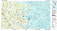
 1917 Boulogne1966 Print · USGSCoastal Georgia and Florida meet at the turn of the century along the winding banks of the Satilla and St Marys Rivers. Genealogists can trace family roots through numerous river landings like Gum Stump Landing and old community hubs such as Owens Ferry and Colerain.
 - 1918 Map of Folkston
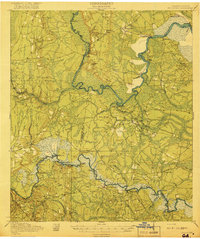
 1918 Folkston1918 Print · USGSSoutheast Georgia and the Florida borderlands are captured here during the height of the regional timber and rail era. Genealogists can trace family footprints at Traders Hill, old schools like Davis School, and the early rail stations at Uptonville and Mattox.3 unique versions available
 - 1919 Map of Boulogne
 1919 Boulogne1919 Print · USGSCoastal Georgia and Florida meet along the river-carved timberlands of the late nineteen-teens. Genealogists and historians can trace defunct river landings and rural landmarks like Owens Ferry, Germantown School, and the industrial site at Baileys Mills.3 unique versions available
 - 1948 Map of Jacksonville
 1948 Jacksonville1948 Print · USGSNortheast Florida and Southeast Georgia's coastal waterways and railroad towns are captured here in the years following the war. Genealogists can trace family connections through river towns like St Marys or identify long-standing military landmarks like Jacksonville NAS.
 - 1954 Map of Valdosta, 1967 Print
 1954 Valdosta1967 Print · USGSThe South Georgia and North Florida borderlands are captured here in the mid-fifties, showing the deep timber and wetland networks of the coastal plain. Researchers can trace the path of the Atlantic Coast Line through Valdosta or explore the interior of the Okefenokee Swamp.2 unique versions available
 - 1957 Map of Jacksonville, 1967 Print
 1957 Jacksonville1967 Print · USGSCoastal Florida and Georgia meet in the late fifties, showcasing a landscape of naval aviation, deep-water terminals, and barrier island communities. Researchers can trace the mid-century footprints of NAS Jacksonville, find small communities like Franklintown, and locate the historic Fort Clinch State Park.3 unique versions available
 - 1958 Map of Valdosta
 1958 Valdosta1958 Print · USGSSouth Georgia and North Florida are captured here in the mid-fifties, showing the vast Okefenokee Swamp and the vital timber and rail corridors connecting the two states. Researchers can locate the footprint of Moody Air Force Base, trace the Live Oak Perry and Gulf railroad, or find early community sites like Bakers Mill and Paradise Church.
 - 1959 Map of Valdosta
 1959 Valdosta1959 Print · USGSThe Georgia-Florida borderlands in the mid-fifties reveal a landscape of massive blackwater swamps and emerging military aviation hubs. Genealogists and historians can trace rail-stop towns like Fargo and Stockton or explore the interior reaches of the Okefenokee Swamp and Billys Island.
 - 1959 Map of Jacksonville
 1959 Jacksonville1959 Print · USGSNortheast Florida and Southeast Georgia are seen here in the late fifties, dominated by the maritime activity of the St Johns River and the Atlantic coast. Researchers can trace the mid-century layout of Jacksonville and identify sprawling military sites like Camp Blanding Military Reservation and Kings Bay Ammunition Terminal.
 - 1960 Map of Jacksonville
 1960 Jacksonville1960 Print · USGSCoastal Florida and Georgia meet in this mid-century portrait of a region shaped by naval power and the winding St Johns River. Researchers can trace the development of military sites like Cecil Field or locate historic rural landmarks such as Jerusalem Ch and Kings Ferry.
 - 1966 Map of Folkston, 1967 Print
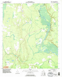
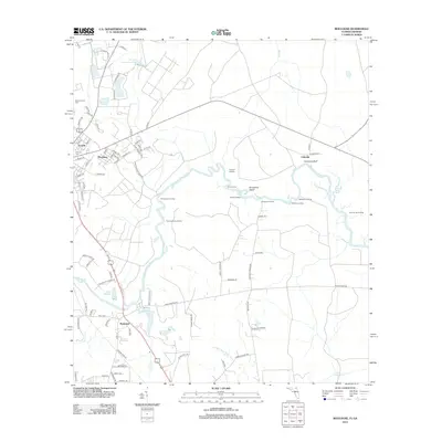
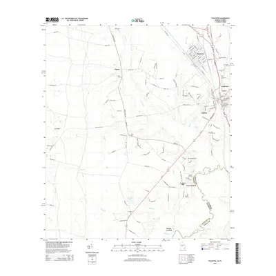
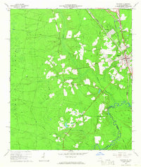 1966 Folkston1967 Print · USGSIn the mid-1960s, the Folkston area was defined by the intersection of the St Marys River and the Seaboard Coast Line Railroad. Genealogists and researchers can locate several rural landmarks including Traders Hill, Neeley Cem, and Philadelphia Ch.2 unique versions available
 - 1970 Map of Boulogne, 1973 Print
 1970 Boulogne1973 Print · USGSThe Georgia-Florida border comes alive in the early seventies as the St Marys River winds through the wetlands of Camden and Nassau counties. Genealogists and local historians can trace the rail-side growth of Folkston and Boulogne, or locate the Camp Pinckney Ch and Bethune Middle Sch.3 unique versions available
 - 1978 Map of Burnt Fort
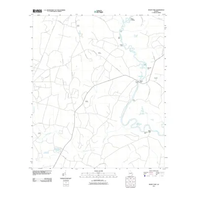
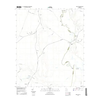
 1978 Burnt Fort1978 Print · USGSCoastal Georgia's river-bottom lands are captured here in the late seventies as the river dictated the pace of local life. Researchers can trace historic river crossings and rural landmarks like Allens Ferry, Hopkins Bridge, and the Antioch Cem.2 unique versions available
 - 1980 Map of Okefenokee Swamp, 1981 Print
 1980 Okefenokee Swamp1981 Print · USGSThe Georgia-Florida borderlands come to life in the early 1980s, centered on the immense wilderness of the Okefenokee Swamp. Genealogists and historians can trace rail-stop settlements like Fargo and Fruitland or explore the interior geography of Billys Island and Trail Ridge.
 - 1981 Map of Fernandina Beach, 1982 Print
 1981 Fernandina Beach1982 Print · USGSThe coastal borderlands of Georgia and Florida are captured here in the early eighties, from the barrier islands to the rail towns of the interior. Genealogists and historians can trace family-named bluffs and sites like Franklintown, Dungeness Wharf, and St Marys Historical Park.3 unique versions available
 - 1988 Map of Jacksonville
 1988 Jacksonville1988 Print · USGSCoastal Florida and Georgia are captured here during the late eighties, documenting the rapid growth of the First Coast and its vital military installations. Researchers can trace the development of beach communities like Fernandina Beach and Atlantic Beach or locate family landmarks near Mickler Landing and Orange Park.
 - 1993 Map of Burnt Fort, 1995 Print
 1993 Burnt Fort1995 Print · USGSThe Satilla River serves as the central artery for this Charlton and Camden County borderland in the 1990s. Researchers can trace riverfront heritage at Allens Ferry, Burnt Fort, and O'Berry Cem along the winding wetlands.
 - 1994 Map of Folkston
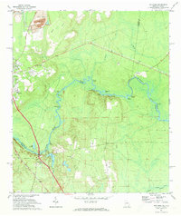
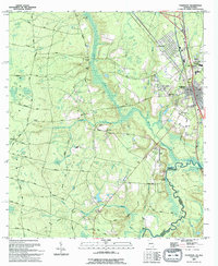 1994 Folkston1994 Print · USGSNear the Georgia-Florida line in the early 1990s, the riverfront settlement at Traders Hill remained a vital landmark. Genealogists and local historians can trace family roots through sites like Traders Hill Cem, Moody Landing Cem, and the rural Bethel Ch.
 - 2011 Map of Boulogne, 2011 Print
 2011 Boulogne2011 Print · USGSCovers Folkston, including Colerain, Pinehurst, and other nearby areas
 - 2011 Map of Burnt Fort, 2011 Print
 2011 Burnt Fort2011 Print · USGSCovers Folkston, including Mays Bluff, Rains Landing, and other nearby areas
 - 2011 Map of Folkston, 2011 Print
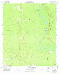
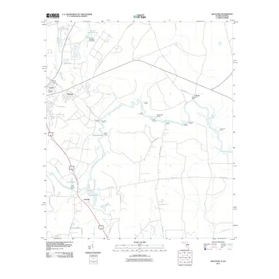
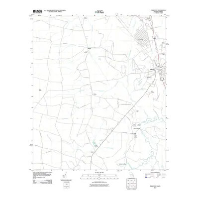 2011 Folkston2011 Print · USGSCovers Folkston, including Homeland, Paxton, and other nearby areas
 - 2012 Map of Boulogne, 2012 Print
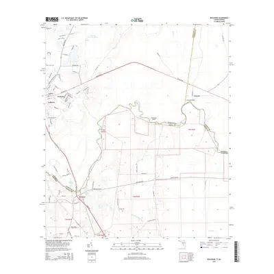
 2012 Boulogne2012 Print · USGSCovers Folkston, including Colerain, Pinehurst, and other nearby areas
 - 2014 Map of Burnt Fort, 2014 Print
 2014 Burnt Fort2014 Print · USGSCovers Folkston, including Mays Bluff, Rains Landing, and other nearby areas
 - 2014 Map of Folkston, 2014 Print
 2014 Folkston2014 Print · USGSCovers Folkston, including Homeland, Paxton, and other nearby areas
 - 2015 Map of Boulogne, 2015 Print
 2015 Boulogne2015 Print · USGSCovers Folkston, including Colerain, Pinehurst, and other nearby areas
Showing maps 1-25 of 34
Top cities near Folkston
Top neighborhoods of Folkston
Frequently asked questions
- What are the different types of historical maps available for Folkston?
- What is the oldest map of Folkston?
- Where can I purchase historical maps of Folkston for my home or office?
- Where can I download high-res historical maps of Folkston?
- Are there historical topographic maps available for Folkston?
- Is there historical aerial imagery available for Folkston?
- Where are historical maps of Folkston sourced from?