1940s Maps of Trenton, Georgia
Explore 7 historic maps of Trenton from the 1940s. These maps offer a rare glimpse into what life looked like during the 1940s — showing old roads, neighborhoods, homes, and landmarks that have changed or disappeared over time.
Whether you're researching your family's past, planning a metal detecting trip, or studying how Trenton's landscape evolved across the 1940s, these high-resolution maps are a powerful tool for exploring the history of this region.
- Focus on a specific era: All maps on this page are from the 1940s, giving you a focused view of this time period.
- See what’s changed: Compare century-old streets, trails, and buildings to today's modern landscape using overlays and satellite layers.
- Research with precision: Use these maps for genealogy, historical research, land use analysis, or educational projects.
- View, download, or print: Maps are fully viewable online in high resolution, and can be downloaded or printed for your own records.
Start exploring Trenton's history through authentic maps from the 1940s. This is your window into the past.
Trenton, GA maps
(7)- 1945 Map of Shellmound
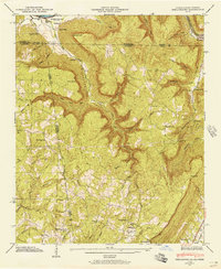 1945 Shellmound1945 Print · USGSThe tri-state border of Tennessee, Alabama, and Georgia was a landscape of remote hollows and mountain gaps at the close of the 1940s. Genealogists can trace family roots through Murphy Cem and Free Home Ch, or locate vanished crossroads at Cole City and Stephensville.2 unique versions available
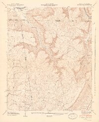
 - 1945 Map of Hooker, 1954 Print
 1945 Hooker1954 Print · USGSThe Georgia-Tennessee borderlands appear here in the mid-1940s, showing the intersection of heavy rail and mountain terrain. Genealogists can trace family landmarks like Sarah Chapel, West Brow Sch, and the Dickens Cem along the slopes of Lookout Mountain.2 unique versions available
 - 1946 Map of Shellmound, 1947 Print
 1946 Shellmound1947 Print · USGSSand Mountain and the Tennessee River valley meet in this post-war tri-state survey of the Georgia, Alabama, and Tennessee borders. Researchers can trace rural life and ancestry through sites like State Line Cem, Shanty Town Ch, and the Shellmound Sta along the rail line.2 unique versions available
 - 1946 Map of Hooker, 1947 Print
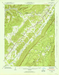
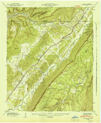 1946 Hooker1947 Print · USGSLookout Valley in the mid-1940s served as a vital rail corridor through the gaps of the Appalachians between Georgia and Tennessee. Genealogists can trace family footprints at Sarah Chapel, North Dade Sch, and Magill Cem along the winding course of Lookout Creek.2 unique versions available
 - 1946 Map of Trenton, 1947 Print
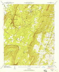
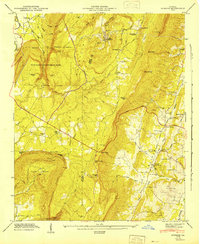
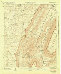 1946 Trenton1947 Print · USGSNorthwest Georgia and the Alabama borderlands are captured here in the mid-1940s, showing the ridge-and-valley landscape of Dade and DeKalb counties. Researchers can trace rural lineages through numerous landmarks like Countess Cem, Rising Fawn, and Byrds Chapel.5 unique versions available
 - 1946 Map of Durham, 1959 Print
 1946 Durham1959 Print · USGSNorthwest Georgia's high plateau and valley floor are captured here in the years following the war. Researchers can locate family landmarks such as Durham, Old Lookout Cem, and the Lookout Mtn Rural Sch.3 unique versions available
 - 1947 Map of Durham
 1947 Durham1947 Print · USGSNorthwest Georgia's mountain landscape was defined by coal and canyons in the years following World War II. Researchers can locate family landmarks such as Mc Kaig Cem and New Salem Ch, or trace the rail lines serving Durham.2 unique versions available
End of results
Showing maps 1-7 of 7
Top cities near Trenton
- Chattanooga historical maps
- LaFayette historical maps
- Rossville historical maps
- South Pittsburg historical maps
- Jasper historical maps
- Chickamauga historical maps
See more
Frequently asked questions
- What are the different types of historical maps available for Trenton?
- What is the oldest map of Trenton?
- Where can I purchase historical maps of Trenton for my home or office?
- Where can I download high-res historical maps of Trenton?
- Are there historical topographic maps available for Trenton?
- Is there historical aerial imagery available for Trenton?
- Where are historical maps of Trenton sourced from?