1900s (20th Century) Maps of Gilmer County, Georgia
Explore 38 historic maps of Gilmer County from the 1900s (20th Century). These maps offer a rare glimpse into what life looked like during the 1900s — showing old roads, neighborhoods, homes, and landmarks that have changed or disappeared over time.
Whether you're researching your family's past, planning a metal detecting trip, or studying how Gilmer County's landscape evolved across the 1900s, these high-resolution maps are a powerful tool for exploring the history of this region.
- Focus on a specific era: All maps on this page are from the 1900s, giving you a focused view of this time period.
- See what’s changed: Compare century-old streets, trails, and buildings to today's modern landscape using overlays and satellite layers.
- Research with precision: Use these maps for genealogy, historical research, land use analysis, or educational projects.
- View, download, or print: Maps are fully viewable online in high resolution, and can be downloaded or printed for your own records.
Start exploring Gilmer County's history through authentic maps from the 1900s. This is your window into the past.
Gilmer County, GA maps
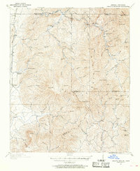
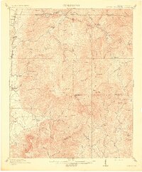
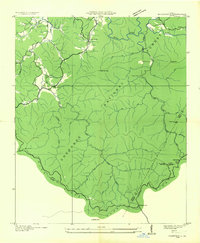
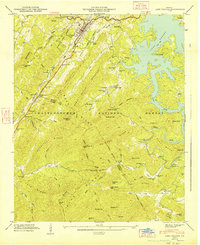
(38)- 1911 Map of Ellijay
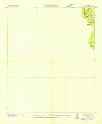
 1911 Ellijay1911 Print · USGSNorth Georgia and the Tennessee border are captured here at the turn of the century, showing a mountain landscape of river ferries and early rail. Genealogists can locate family landmarks like Higdons Store, the Pisgah church, or crossings at Bakers Ferry and Shallow Ford.4 unique versions available
 - 1911 Map of Cohutta Mtn
 1911 Cohutta Mtn1911 Print · USGSThe Georgia-Tennessee borderlands in the early twentieth century were defined by mountain rail and timber. Genealogists can trace family roots through settlements like Tennga and Crandall or locate historic operations like Hassler Mill along the rail line.2 unique versions available
 - 1913 Map of Cohutta Mtn.
 1913 Cohutta Mtn.1913 Print · USGSThe Georgia and Tennessee borderlands appear here in the years before the Great Depression, centered on the high peaks of the Blue Ridge. Researchers can trace early railroad life along the Louisville & Nashville RR or locate old sites like Cohutta Springs and Hassler Mill.3 unique versions available
 - 1914 Map of Talking Rock, 1960 Print
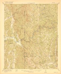
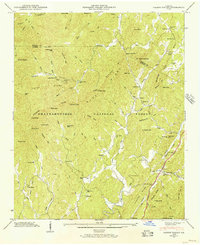
 1914 Talking Rock1960 Print · USGSThe foothills of North Georgia are captured here before the mid-century, showing the early communities of Talking Rock and Whitestone along the Louisville and Nashville rail line. Researchers can trace family sites at Ball Creek School, locate river crossings like McClouds Ford, and follow the historic FEDERAL ROAD.2 unique versions available
 - 1916 Map of Talking Rock
 1916 Talking Rock1916 Print · USGSNorth Georgia in the years before the Great War is defined by the winding Coosawattee River and the historic Federal Road. Genealogists can trace family landmarks like Cairns Mill, Clouds Ford, and the old Ball Creek School.2 unique versions available
 - 1935 Map of Noontootla
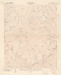
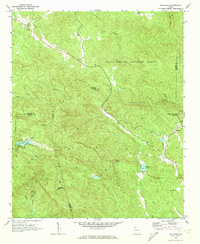
 1935 Noontootla1935 Print · USGSNorth Georgia's mountain ridges and valley settlements are captured here in the mid-1930s as the Tennessee Valley Authority and USGS surveyed the region. Researchers can trace the early APPALACHIAN TRAIL past the FIRE TOWER on Hawk Mtn and locate sites like Stock Hill Ch or the Rock Creek Cem.
 - 1935 Map of Cashes Valley
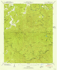
 1935 Cashes Valley1935 Print · USGSCashes Valley and the North Georgia mountains come alive in this mid-1930s survey of the Fannin and Gilmer borderlands. Genealogists can trace family footprints near Cashes Valley Ch, Madola Sch, and the isolated homesteads along Fightingtown Creek.
 - 1935 Map of Lake Toccoa
 1935 Lake Toccoa1935 Print · USGSNorth Georgia’s mountain and river life is preserved here during the mid-1930s transition into the hydroelectric era. Researchers can trace family roots through the numerous rural schools and churches, such as Stanley Creek Sch, Union Ch, and landmarks like Stanley Mill.
 - 1935 Map of Tickanetley
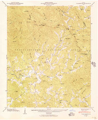
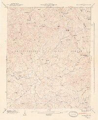
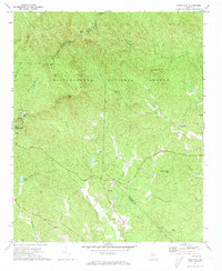
 1935 Tickanetley1935 Print · USGSHigh in the Blue Ridge mountains during the mid-1930s, this survey captures the rural crossroads of Gilmer and Fannin counties. Genealogists can trace early landmarks like Big Creek Ch, Stanley Mill, and the combined Mathis Chapel Sch.
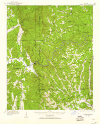
 - 1946 Map of Tickanetley, 1956 Print
 1946 Tickanetley1956 Print · USGSGilmer and Fannin counties in the mid-1940s reveal a landscape of mountain settlements and high-altitude lookouts. Genealogists can trace family roots through Scrougetown Cem, New Liberty Ch, and schools like Twiggs Sch or Salem Sch.2 unique versions available
 - 1946 Map of Cashes Valley, 1956 Print
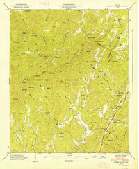
 1946 Cashes Valley1956 Print · USGSGilmer and Fannin counties are shown here just after the war, when mountain life followed the ridges and creek beds. Genealogists can trace family names at Johnson Cem, visit Higdon Mill, or follow the Louisville and Nashville tracks through Cherrylog.3 unique versions available
 - 1946 Map of Noontootla, 1956 Print
 1946 Noontootla1956 Print · USGSFannin County's high ridges and river headwaters are captured here just after the war, showing the mountain communities before modern development. Genealogists and hikers can trace the original Appalachian Trail route past Springer Mtn and locate old landmarks like Noontootla Ch and Bunker Hill Sch.2 unique versions available
 - 1946 Map of Blue Ridge, 1960 Print
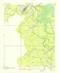
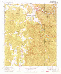
 1946 Blue Ridge1960 Print · USGSFannin and Gilmer Counties are captured here shortly after the war, showing the mountain communities of the Chattahoochee National Forest before modern expansion. Researchers can trace the roots of local families through the many rural landmarks like Cherrylog Church, Ballew Mill, and Snake Nation School.3 unique versions available
 - 1947 Map of Lake Toccoa
 1947 Lake Toccoa1947 Print · USGSFannin and Gilmer counties are captured here shortly after the war, showing the mountain communities and logging routes of North Georgia. Researchers can trace family sites like Antioch Cemetery, find old industrial locations including Greens Mill, or locate the historic Shallowford Bridge.2 unique versions available
 - 1947 Map of Tickanetley
 1947 Tickanetley1947 Print · USGSNorth Georgia’s high ridges and mountain hollows are captured here just after the war, showing a landscape of small schools and isolated churches. Genealogists can trace family roots through landmarks like Mathis Chapel School, the Pisgah (PO), and Stanley Mill.2 unique versions available
 - 1947 Map of Noontootla
 1947 Noontootla1947 Print · USGSFannin County's high ridges and quiet hollows are captured here in the late Forties, showing a landscape of small settlements and national forest land. Researchers can find ancestral sites like Noontootla Ch, Wilson Mill, and the Appalachian Trail as it crossed Big Stamp Gap.2 unique versions available
 - 1947 Map of Cashes Valley, 1948 Print
 1947 Cashes Valley1948 Print · USGSNorth Georgia mountain life is preserved here just after the war, showing a network of remote hollows and high ridges. Researchers can trace family history through the Johnson Cem, find old schoolhouses like Macedonia Sch, or follow the Tennessee and North Carolina Railroad.2 unique versions available
 - 1955 Map of Rome
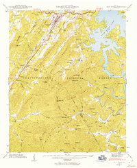
 1955 Rome1955 Print · USGSThe tri-state borderlands of Georgia, Alabama, and Tennessee appear in the mid-fifties as a landscape of ridge-and-valley industry and river navigation. Genealogists can trace family footprints near Chattanooga, the iron works of Gadsden, and textile towns like Trion or Summerville.
 - 1958 Map of Rome, 1966 Print
 1958 Rome1966 Print · USGSNorthwest Georgia and neighboring Tennessee and Alabama are captured here in the late fifties, showcasing a landscape of high ridges and river valleys. Researchers can trace historic rail lines like the Seaboard Air Line RR and explore the bounds of Cloudland Canyon State Park or Fort Oglethorpe.3 unique versions available
 - 1959 Map of Dyer Gap
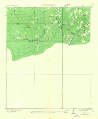
 1959 Dyer Gap1959 Print · USGSThe high ridges of Fannin and Gilmer counties are captured in the mid-twentieth century just as the forest service infrastructure was firmly established. Researchers can trace the old trail networks and mountain passes such as Dyer Gap and Newt Gap, or locate the Flat Top Fire Tower.3 unique versions available
 - 1961 Map of Rome
 1961 Rome1961 Print · USGSNorthwest Georgia and neighboring Tennessee and Alabama are shown here at a moment of significant mid-century growth. Researchers can trace the rail networks of the Central of Georgia or locate landmarks within Chickamauga and Chattanooga Nat Military Park.
 - 1963 Map of Rome
 1963 Rome1963 Print · USGSThe tri-state corner of Georgia, Alabama, and Tennessee is captured here during a period of massive reservoir expansion and post-war growth. Genealogists and historians can trace the rail corridors of the Southern Ry or locate landmarks like Fort Oglethorpe and Cloudland Canyon State Park.
 - 1971 Map of Amicalola, 1973 Print
 1971 Amicalola1973 Print · USGSNorth Georgia's high country is captured here in the early seventies as small mountain communities remained centered around local churches. Researchers can locate family sites near Little Ebenezer Cem, Antioch Ch, and the settlement of Amicalola.2 unique versions available
 - 1971 Map of Nimblewill, 1973 Print
 1971 Nimblewill1973 Print · USGSThe North Georgia highlands are captured here in the early seventies, centered on the community of Nimblewill and the Amicalola Mountain range. You can trace old mountain routes through Nimblewill Gap and locate historic rural gathering places like Wesley Chapel and Afton.4 unique versions available
 - 1971 Map of Oakman, 1973 Print
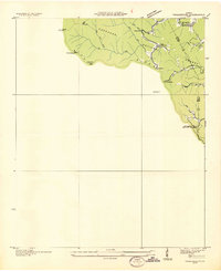
 1971 Oakman1973 Print · USGSNorth Georgia’s mountain landscape is captured here during the 1970s as new reservoirs began to reshape the river valleys. Researchers can locate several rural churches and rail-side communities like Oakman, Hopewell Ch, and Sweden near the Louisville and Nashville line.2 unique versions available
Showing maps 1-25 of 38
Top cities of Gilmer County
Frequently asked questions
- What are the different types of historical maps available for Gilmer County?
- What is the oldest map of Gilmer County?
- Where can I purchase historical maps of Gilmer County for my home or office?
- Where can I download high-res historical maps of Gilmer County?
- Are there historical topographic maps available for Gilmer County?
- Is there historical aerial imagery available for Gilmer County?
- Where are historical maps of Gilmer County sourced from?