1980s Maps of Lumpkin County, Georgia
Explore 7 historic maps of Lumpkin County from the 1980s. These maps offer a rare glimpse into what life looked like during the 1980s — showing old roads, neighborhoods, homes, and landmarks that have changed or disappeared over time.
Whether you're researching your family's past, planning a metal detecting trip, or studying how Lumpkin County's landscape evolved across the 1980s, these high-resolution maps are a powerful tool for exploring the history of this region.
- Focus on a specific era: All maps on this page are from the 1980s, giving you a focused view of this time period.
- See what’s changed: Compare century-old streets, trails, and buildings to today's modern landscape using overlays and satellite layers.
- Research with precision: Use these maps for genealogy, historical research, land use analysis, or educational projects.
- View, download, or print: Maps are fully viewable online in high resolution, and can be downloaded or printed for your own records.
Start exploring Lumpkin County's history through authentic maps from the 1980s. This is your window into the past.
Lumpkin County, GA maps
(7)- 1981 Map of Cartersville, 1982 Print
 1981 Cartersville1982 Print · USGSNorth Georgia at the start of the eighties shows a landscape defined by massive reservoirs and historic rail corridors. Researchers can trace the heritage of the Etowah Indian Mounds or locate old junctions along the Southern Railway and Seaboard Coast Line.2 unique versions available
 - 1981 Map of Dalton, 1982 Print
 1981 Dalton1982 Print · USGSNorth Georgia and the tristate borderlands are captured in the early eighties as the textile economy of Dalton thrived alongside the expanding Chattahoochee National Forest. Genealogists and hikers can trace the Appalachian Trail through the high country or locate family-named landmarks like Haskins Mill and Carters Mill.
 - 1981 Map of Toccoa, 1982 Print
 1981 Toccoa1982 Print · USGSThe tri-state mountain region where Georgia meets the Carolinas is shown here in the early eighties. Genealogists and historians can trace family-named locations and settlements from Dahlonega to Tallulah Falls, along with the Southern rail corridor.2 unique versions available
 - 1988 Map of Suches
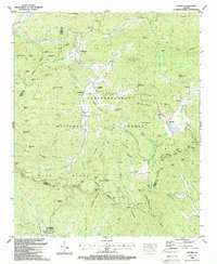 1988 Suches1988 Print · USGSUpper Georgia’s Blue Ridge highlands are shown in the late 1980s, revealing the intersection of mountain life and federal land management. Researchers can locate remote burial sites like Spriggs Cem and tracing the early footprint of Camp Merrill (U S Army).3 unique versions available
 - 1988 Map of Neels Gap
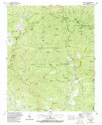 1988 Neels Gap1988 Print · USGSThe North Georgia mountains in the late eighties are seen here at the junction of Lumpkin and Union counties. Genealogists and hikers can trace the Appalachian Trail past Lake Winfield Scott, Mt Zion Ch, and the high peak of Blood Mountain.3 unique versions available
 - 1988 Map of Cowrock
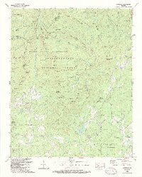 1988 Cowrock1988 Print · USGSThe North Georgia mountains near Loudsville are shown here in the late eighties as wilderness areas expanded. Genealogists and hikers can trace the Appalachian Trail and find family landmarks like Antioch Cem and Mt Pleasant Ch.2 unique versions available
 - 1988 Map of Noontootla
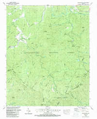 1988 Noontootla1988 Print · USGSThe mountain gaps and forest ridges of Fannin County are captured here in the late eighties, just as the trail networks were becoming established recreation corridors. Researchers can locate remote family landmarks like Stock Hill Cem or the Fellowship Primitive Ch and trace the winding course of Noontootla Creek.3 unique versions available
End of results
Showing maps 1-7 of 7
Top cities of Lumpkin County
Frequently asked questions
- What are the different types of historical maps available for Lumpkin County?
- What is the oldest map of Lumpkin County?
- Where can I purchase historical maps of Lumpkin County for my home or office?
- Where can I download high-res historical maps of Lumpkin County?
- Are there historical topographic maps available for Lumpkin County?
- Is there historical aerial imagery available for Lumpkin County?
- Where are historical maps of Lumpkin County sourced from?