Old Maps of Lumpkin County, Georgia for Hiking & Exploration
Hike through history with 109 historic maps of Lumpkin County. Explore old trails, ghost towns, and forgotten backroads — perfect for outdoor adventurers and local explorers.
- Rediscover forgotten places: Map out old mining camps, roads, and footpaths that no longer exist on modern maps.
- Layer with modern tools: Combine with LiDAR or satellite views to plan hikes through historical terrain.
- Made for exploration: Popular among hikers, overlanders, and local history lovers.
Use these maps to find adventure and explore the hidden past of Lumpkin County.
Lumpkin County, GA maps
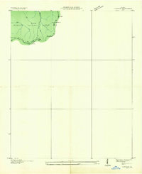
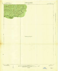
(109)- 1886 Map of Dahlonega
 1886 Dahlonega1886 Print · USGSThe North Georgia mountains in the mid-1880s reveal a landscape of mining camps and early settlements before the modern era. Genealogists and historians can trace family-named landmarks like Helton's Field and Osbornes, or locate the Findley Mine and the Indian Mound.
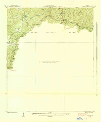
 - 1888 Map of Ellijay
 1888 Ellijay1888 Print · USGSNorth Georgia in the late 1880s was a land of high peaks and emerging rail lines as the mountains were first being methodically surveyed. You can trace the Marietta and North Georgia Railroad through Blue Ridge and locate vanished stops like Vanzants Store or the rural community of Cherry Log.
 - 1890 Map of Suwanee
 1890 Suwanee1890 Print · USGSNorth Georgia in the 1890s was a landscape of river-powered commerce and gold prospecting. Genealogists and historians can trace family-named river crossings like Jones Ferry and Pirkle's Ferry or locate the historic Kin Mori Gold Mine.
 - 1891 Map of Gainesville
 1891 Gainesville1891 Print · USGSNorth Georgia in the early 1890s appears as a landscape of rail-junction towns and river-powered industry centered on Hall and Jackson Counties. Researchers can trace historic river crossings like Browns Bridge and Keiths Fy, or locate nineteenth-century landmarks such as Oconee Mills and Flowery Branch.5 unique versions available
 - 1892 Map of Dahlonega
 1892 Dahlonega1892 Print · USGSThe North Georgia mountains come alive in the late nineteenth century, showing the rugged terrain around the mining hub of Dahlonega. Genealogists and historians can trace family-named sites like Osbornes, find the elusive Gold Mine, and locate the Indian Mound.2 unique versions available
 - 1892 Map of Ellijay
 1892 Ellijay1892 Print · USGSNorth Georgia's mountain communities were primarily connected by river valleys and the winding Marietta and North Georgia Railroad in the late nineteenth century. Genealogists can trace early homesteads and centers of trade like Vanzant's Store, Mineral Bluff, and Cherry Log.
 - 1894 Map of Suwanee
 1894 Suwanee1894 Print · USGSNorth Georgia in the late nineteenth century was a landscape of river ferries and rising industry, from marble quarries to gold mines. Genealogists can trace family landmarks like Fields Cross Roads, the Kin Mori Gold Mine, and Fort Buffington.6 unique versions available
 - 1896 Map of Dahlonega
 1896 Dahlonega1896 Print · USGSThe Blue Ridge and North Georgia gold belt are shown here in the 1890s, when mining and mountain gaps defined local travel. Genealogists can trace family roots in Dahlonega, Porter Springs, and the Findley Mine or locate early settlements like Nacoochee.
 - 1898 Map of Ellijay
 1898 Ellijay1898 Print · USGSNorth Georgia’s mountain country is captured here in the late nineteenth century, showing the early development of Gilmer and Fannin counties. Genealogists can trace family homesteads near old river crossings like Centers Ferry and settlements such as Mineral Bluff and Whitepath.2 unique versions available
 - 1903 Map of Dahlonega
 1903 Dahlonega1903 Print · USGSNorth Georgia and the Blue Ridge were defined by mountain settlements and early industry at the turn of the century. Genealogists and historians can trace family locations across the Nacoochee Valley, locate the Asbestos Mines, or find old sites like Loudsville and Porter Springs.5 unique versions available
 - 1911 Map of Ellijay
 1911 Ellijay1911 Print · USGSNorth Georgia and the Tennessee border are captured here at the turn of the century, showing a mountain landscape of river ferries and early rail. Genealogists can locate family landmarks like Higdons Store, the Pisgah church, or crossings at Bakers Ferry and Shallow Ford.4 unique versions available
 - 1935 Map of Cowrock
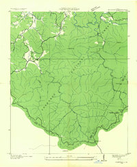
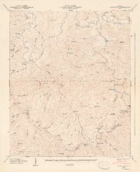
 1935 Cowrock1935 Print · USGSThe northern Georgia high country is captured here during the mid-1930s as federal agencies mapped the watershed for the Tennessee Valley Authority. Hikers and historians can trace the early route of the Appalachian Trail through Tesnatee Gap and past the summit of Cowrock Mtn.
 - 1935 Map of Noontootla
 1935 Noontootla1935 Print · USGSNorth Georgia's mountain ridges and valley settlements are captured here in the mid-1930s as the Tennessee Valley Authority and USGS surveyed the region. Researchers can trace the early APPALACHIAN TRAIL past the FIRE TOWER on Hawk Mtn and locate sites like Stock Hill Ch or the Rock Creek Cem.
 - 1935 Map of Suches
 1935 Suches1935 Print · USGSThe North Georgia mountains in the mid-1930s are captured here as federal forestry and New Deal projects began to reshape the Blue Ridge. Genealogists can trace early homesteads near Suches and Gaddistown or locate rural landmarks like Corinth Sch and Gilreath Mill.
 - 1935 Map of Neels Gap
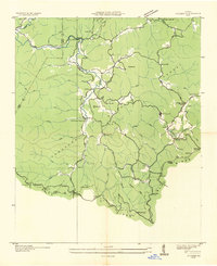
 1935 Neels Gap1935 Print · USGSThe high peaks of the Blue Ridge come into focus during the mid-1930s as early park infrastructure and mountain trails are established. Trace the original path of the Appalachian Trail past Blood Mtn, Zion Ch, and the heights of Neels Gap.
 - 1938 Map of Cowrock
 1938 Cowrock1938 Print · USGSHigh in the Blue Ridge during the late thirties, this survey shows the rugged intersection of White, Union, and Lumpkin counties. Hikers and historians can trace the early Appalachian Trail as it crosses through Tesnatee Gap and past Cowrock Mtn.
 - 1938 Map of Neels Gap
 1938 Neels Gap1938 Print · USGSThe high ridges of Lumpkin and Union counties are shown in the late 1930s, just as the region’s modern parks were taking shape. Researchers can trace the early Appalachian Trail, the grounds of Vogel State Park, and the community at Zion Church.
 - 1938 Map of Suches
 1938 Suches1938 Print · USGSUpper Union County and the Toccoa River valley are captured in the late 1930s, showing a landscape of high mountain gaps and isolated rural communities. Researchers can locate the CCC Camp F1, the Appalachian Trail, and schools like Peggy Hale Sch.
 - 1946 Map of Noontootla, 1956 Print
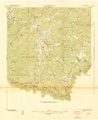
 1946 Noontootla1956 Print · USGSFannin County's high ridges and river headwaters are captured here just after the war, showing the mountain communities before modern development. Genealogists and hikers can trace the original Appalachian Trail route past Springer Mtn and locate old landmarks like Noontootla Ch and Bunker Hill Sch.2 unique versions available
 - 1947 Map of Noontootla
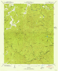
 1947 Noontootla1947 Print · USGSFannin County's high ridges and quiet hollows are captured here in the late Forties, showing a landscape of small settlements and national forest land. Researchers can find ancestral sites like Noontootla Ch, Wilson Mill, and the Appalachian Trail as it crossed Big Stamp Gap.2 unique versions available
 - 1950 Map of Neels Gap, 1952 Print
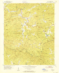
 1950 Neels Gap1952 Print · USGSNorth Georgia's high country is captured here at mid-century, as the Appalachian Trail wound through the peaks of the Chattahoochee National Forest. Local historians can trace old community landmarks like Mt Zion Ch, Mt Pisgah Sch, and the high waters of Lake Winfield Scott.4 unique versions available
 - 1950 Map of Suches, 1952 Print
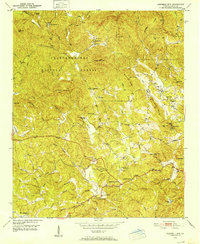
 1950 Suches1952 Print · USGSDeep in the Blue Ridge Mountains during the early fifties, this survey captures the rural character of Union and Lumpkin Counties. Genealogists can trace family roots through mountain settlements like Suches and Gaddistown, or locate remote landmarks like Mt Zion Ch and Woody Gap High Sch.4 unique versions available
 - 1950 Map of Campbell Mtn, 1952 Print
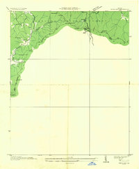
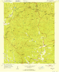
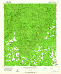
 1950 Campbell Mtn1952 Print · USGSLumpkin County in the early fifties shows a mountain landscape transitioning between its mining heritage and reforestation. Researchers can trace family sites like Davis Chapel Cem, locate the historic Buckhorn Tavern, and identify the Barlow Mine (Inactive).6 unique versions available
 - 1950 Map of Cowrock, 1962 Print
 1950 Cowrock1962 Print · USGSWhite County and the Blue Ridge high country are captured here at mid-century, before modern development reached the mountains. Genealogists and hikers can trace the original path of the Appalachian Trail past Corinth Ch and the remote Blue Ridge Sch.2 unique versions available
 - 1951 Map of Cleveland, 1952 Print
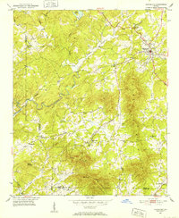 1951 Cleveland1952 Print · USGSNorth Georgia's mountain foothills come to life in the early fifties, centering on the growing community of Cleveland. Researchers can trace the rural landscape of White County through local landmarks like Mt View Ch, Grace Sch, and the waters of Tesnatee Creek.4 unique versions available
Showing maps 1-25 of 109
Top cities of Lumpkin County
Frequently asked questions
- What are the different types of historical maps available for Lumpkin County?
- What is the oldest map of Lumpkin County?
- Where can I purchase historical maps of Lumpkin County for my home or office?
- Where can I download high-res historical maps of Lumpkin County?
- Are there historical topographic maps available for Lumpkin County?
- Is there historical aerial imagery available for Lumpkin County?
- Where are historical maps of Lumpkin County sourced from?