Old Maps of Darien, Georgia for Genealogy
Trace your family roots with 31 historic maps of Darien. These high-res maps reveal old neighborhoods, homesites, landmarks, and streets — helping you uncover where your ancestors lived and how the area evolved over time.
- Explore historic neighborhoods: Identify where your relatives may have lived in the 1800s or 1900s.
- Compare maps over time: Trace the changes in streets, buildings, and landmarks for multi-generational research.
- Perfect for genealogy & ancestry research: Used by family historians and researchers to map out lineage and migration.
These maps are an incredible resource for exploring your personal connection to Darien's past.
Darien, GA maps
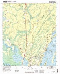
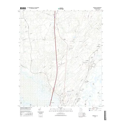
(31)- 1921 Map of Darien, 1937 Print
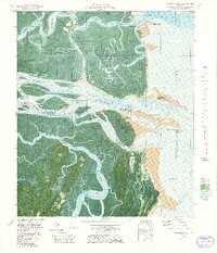
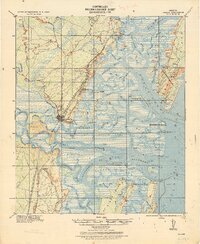 1921 Darien1937 Print · USGSThe Georgia coast near Darien is captured here in the years following the Great War, showing a landscape defined by rice milling and rail. Genealogists can locate family landmarks like Patterson and Meridian, or industrial sites such as the Butler Rice Mill Chimney.
 - 1946 Map of Brunswick, 1948 Print
 1946 Brunswick1948 Print · USGSCoastal Georgia in the mid-forties reveals a landscape defined by the Camp Stewart Military Reservation and the sprawling barrier islands. Genealogists and historians can trace the rail-and-river network through inland towns like Ludowici and Jesup, or locate coastal landmarks like the St Simon Light.
 - 1948 Map of Brunswick
 1948 Brunswick1948 Print · USGSCoastal Georgia in the late 1940s is defined here by its labyrinthine barrier islands and the massive footprint of Camp Stewart. Genealogists and historians can trace the rail-tied growth of Jesup and Hinesville or locate coastal landmarks like St Simon Light.
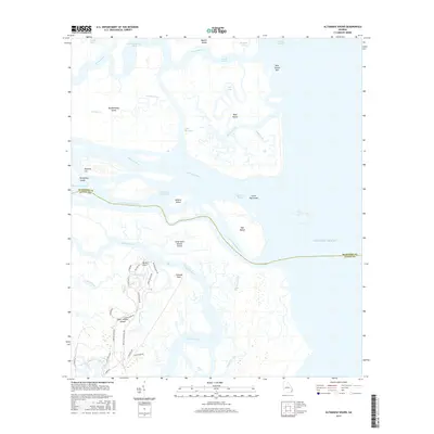
 - 1954 Map of Altamaha Sound, 1959 Print
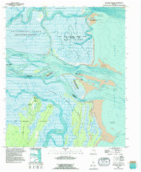
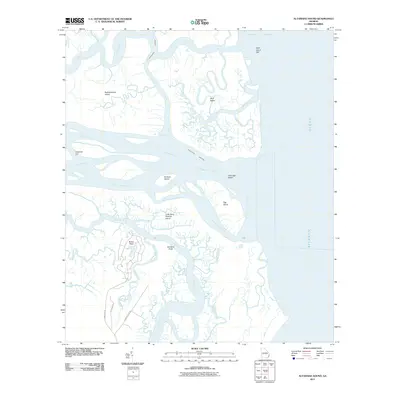
 1954 Altamaha Sound1959 Print · USGSThe Georgia coast at the edge of the Atlantic was a labyrinth of tidal marshes and remote island outposts in the mid-1950s. Genealogists and coastal historians can trace early landmarks like Butler Point, the winding Intracoastal Waterway, and the pristine stretches of the Wolf Island National Wildlife Refuge.2 unique versions available
 - 1954 Map of Ridgeville, 1959 Print
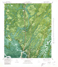
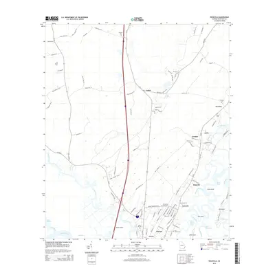
 1954 Ridgeville1959 Print · USGSCoastal Georgia in the mid-fifties is captured here during a time of river-based commerce and quiet marshland settlements. Genealogists and historians can trace family locations through St Andrews Cem, the Tolomato Spanish Mission Ruins, and small communities like Ardick and Ashintilly.2 unique versions available
 - 1956 Map of Darien, 1959 Print
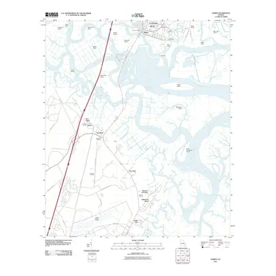
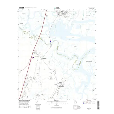
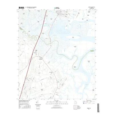
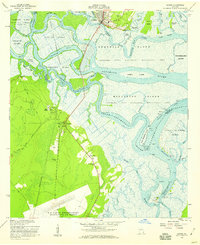 1956 Darien1959 Print · USGSCoastal Georgia's river delta and the historic port of Darien are captured here in the mid-fifties, showing a landscape defined by tidewater islands and colonial ruins. Genealogists and historians can trace the Brunswick-Altamaha Canal, family burial grounds like Butler Cem, and the Santo Domingo Mission Ruins.2 unique versions available
 - 1956 Map of Brunswick, 1968 Print
 1956 Brunswick1968 Print · USGSThe Georgia coast in the mid-twentieth century is a wild expanse of barrier islands and massive river deltas. You can trace the development of the maritime economy and military presence at Brunswick, or locate historic sites like Fort Frederica National Monument and Harris Neck National Wildlife Refuge.2 unique versions available
 - 1961 Map of Brunswick
 1961 Brunswick1961 Print · USGSThe Georgia coast at the start of the 1960s was a landscape of deep tidal marshes and growing military installations. Genealogists and historians can trace rail-linked towns like Limerick Station or explore coastal landmarks from Fort Frederica National Monument to Sapelo Island.
 - 1978 Map of Brunswick
 1978 Brunswick1978 Print · USGSThe Georgia coast and its barrier islands are captured in the late 1970s, as I-95 and the rail lines shaped the growth of coastal towns. Genealogists and historians can trace family locations across the islands or locate sites near Fort Stewart, Darien, and Ludowici.2 unique versions available
 - 1979 Map of Altamaha Sound
 1979 Altamaha Sound1979 Print · USGSThe Georgia coast in the mid-seventies is captured in this detailed orthophotomap of the Altamaha river delta and barrier islands. Researchers can trace historic boundaries at Cannons Point, navigate the Intracoastal Waterway, and explore the wetlands of Wolf Island.2 unique versions available
 - 1979 Map of Darien
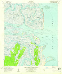
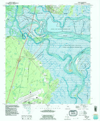
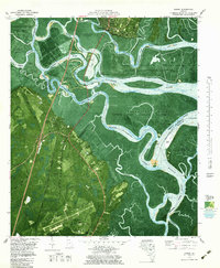 1979 Darien1979 Print · USGSCoastal Georgia in the late seventies reveals a landscape of tidal rivers and deep-rooted history. Genealogists and historians can trace old landmarks like the Old Slave Cem Evelyn, Old Fort King George, and the Hofwyl-Broadfield Plantation Historic Site.
 - 1980 Map of Ridgeville
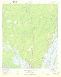
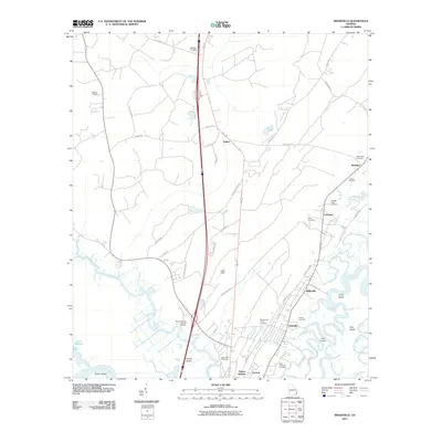
 1980 Ridgeville1980 Print · USGSCoastal McIntosh County is documented here during the late seventies, showing the intricate tidal marshes and river islands surrounding Darien. Genealogists and historians can trace family roots through sites like Oglethorpe Academy, Ashantilly, and numerous country burial grounds like Powell Cem.
 - 1981 Map of Brunswick, 1982 Print
 1981 Brunswick1982 Print · USGSThe Georgia coast at the start of the eighties reveals a complex landscape of tidal estuaries, deep-water sounds, and growing island communities. Trace local history through the protected grounds of Fort Frederica National Monument and the old rail stops at Thalmann and Nahunta.3 unique versions available
 - 1993 Map of Altamaha Sound, 1995 Print
 1993 Altamaha Sound1995 Print · USGSCoastal Georgia's barrier islands and river deltas are documented here in the early nineties, showing the meeting of fresh and salt water. Genealogists and historians can locate Hampton Plantation, the Cannons Point ruins, and the path of Lawrence Road.
 - 1993 Map of Ridgeville, 1995 Print
 1993 Ridgeville1995 Print · USGSCoastal McIntosh County is captured here in the early nineties, showing a landscape defined by tidal rivers and marshy islands. Genealogists can trace family names and local history through numerous landmarks like Ardoch Cem, Sams Memorial Ch, and Hutchison Cem.2 unique versions available
 - 1993 Map of Darien, 1995 Print
 1993 Darien1995 Print · USGSThe Altamaha River delta near the McIntosh and Glynn county line shows a landscape shaped by coastal history and conservation in the mid-1990s. Researchers can trace deep local roots at the Old Slave Cem, Needwood Ch, and the Hofwyl-Broadfield Plantation State Historic Site.
 - 2011 Map of Darien, 2011 Print
 2011 Darien2011 Print · USGSCovers Darien, including Bel-Air, Evelyn, and other nearby areas
 - 2011 Map of Ridgeville, 2011 Print
 2011 Ridgeville2011 Print · USGSCovers Darien, including Ashintilly, Carnigan, and other nearby areas
 - 2011 Map of Altamaha Sound, 2011 Print
 2011 Altamaha Sound2011 Print · USGSCovers Darien, including Glynn County, McIntosh County, and other nearby areas
 - 2014 Map of Altamaha Sound, 2014 Print
 2014 Altamaha Sound2014 Print · USGSCovers Darien, including Glynn County, McIntosh County, and other nearby areas
 - 2014 Map of Ridgeville, 2014 Print
 2014 Ridgeville2014 Print · USGSCovers Darien, including Ashintilly, Carnigan, and other nearby areas
 - 2014 Map of Darien, 2014 Print
 2014 Darien2014 Print · USGSCovers Darien, including Bel-Air, Evelyn, and other nearby areas
 - 2017 Map of Darien, 2017 Print
 2017 Darien2017 Print · USGSCovers Darien, including Bel-Air, Evelyn, and other nearby areas
 - 2017 Map of Ridgeville, 2017 Print
 2017 Ridgeville2017 Print · USGSCovers Darien, including Ashintilly, Carnigan, and other nearby areas
 - 2017 Map of Altamaha Sound, 2017 Print
 2017 Altamaha Sound2017 Print · USGSCovers Darien, including Glynn County, McIntosh County, and other nearby areas
Showing maps 1-25 of 31
Top cities near Darien
Top neighborhoods of Darien
Frequently asked questions
- What are the different types of historical maps available for Darien?
- What is the oldest map of Darien?
- Where can I purchase historical maps of Darien for my home or office?
- Where can I download high-res historical maps of Darien?
- Are there historical topographic maps available for Darien?
- Is there historical aerial imagery available for Darien?
- Where are historical maps of Darien sourced from?