1970s Maps of Monroe County, Georgia
Explore 15 historic maps of Monroe County from the 1970s. These maps offer a rare glimpse into what life looked like during the 1970s — showing old roads, neighborhoods, homes, and landmarks that have changed or disappeared over time.
Whether you're researching your family's past, planning a metal detecting trip, or studying how Monroe County's landscape evolved across the 1970s, these high-resolution maps are a powerful tool for exploring the history of this region.
- Focus on a specific era: All maps on this page are from the 1970s, giving you a focused view of this time period.
- See what’s changed: Compare century-old streets, trails, and buildings to today's modern landscape using overlays and satellite layers.
- Research with precision: Use these maps for genealogy, historical research, land use analysis, or educational projects.
- View, download, or print: Maps are fully viewable online in high resolution, and can be downloaded or printed for your own records.
Start exploring Monroe County's history through authentic maps from the 1970s. This is your window into the past.
Monroe County, GA maps
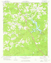
(15)- 1973 Map of East Juliette, 1975 Print
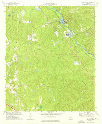 1973 East Juliette1975 Print · USGSThe riverfront communities of Juliette and East Juliette are shown during the 1970s at the junction of the Ocmulgee and Towaliga rivers. Researchers can trace rural life through numerous landmarks like Browns Chapel, Bethesda Ch, and Holly Grove Cem.
 - 1973 Map of Berner, 1975 Print
 1973 Berner1975 Print · USGSCentral Georgia's river-cut timberlands are captured here in the early seventies, showing the rural communities of Jasper and Butts counties. Genealogists and historians can trace the Southern railroad corridor through Berner and locate country congregations like Ward Ch.2 unique versions available
 - 1973 Map of Johnstonville, 1976 Print
 1973 Johnstonville1976 Print · USGSLamar and Monroe counties show their rural character in the early 1970s, as the railway still connected small local junctions. Genealogists can trace family footprints across dozens of sites like Goggins, Sappington Cem, and Bethany Ch.
 - 1973 Map of Forsyth, 1976 Print
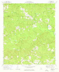
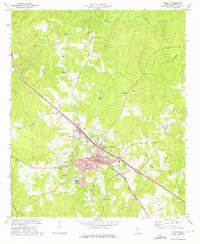 1973 Forsyth1976 Print · USGSMonroe County enters the mid-seventies with a balance of educational institutions and rural crossroads. Researchers can trace the grounds of Tift College and Hubbard High Sch, or locate family sites near Tessiehall Ch and the settlement of Box Ankle.2 unique versions available
 - 1973 Map of High Falls, 1976 Print
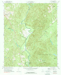
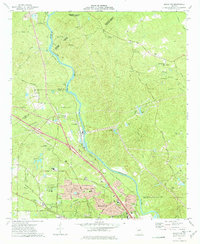
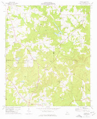
 1973 High Falls1976 Print · USGSThe Towaliga River corridor in the 1970s shows a landscape of transition between historic agricultural roots and modern recreation. Trace family history and land patterns through High Falls Lake, the Higgins Mill site, and local landmarks like Patillo and High Shoals Ch.2 unique versions available
 - 1973 Map of Indian Springs, 1976 Print
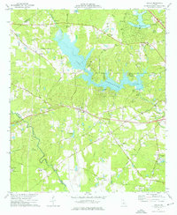
 1973 Indian Springs1976 Print · USGSThe rural Georgia landscape between Flovilla and Cabaniss is captured here in the mid-1970s as agricultural life centered around a dense network of country churches. Genealogists and local historians can trace family locations near Indian Springs, St Pauls Ch, and China Grove Cem.2 unique versions available
 - 1973 Map of Macon NW, 1977 Print
 1973 Macon NW1977 Print · USGSThe Ocmulgee River corridor north of Macon shows a landscape of river-bend settlements and expanding suburbs in the early seventies. Genealogists and local historians can trace family landmarks like Sardis Cem, the rural outpost at Popes Ferry, and Wesleyan College.2 unique versions available
 - 1974 Map of Lizella, 1976 Print
 1974 Lizella1976 Print · USGSBibb County west of Macon is captured here in the mid-1970s, as lakeside recreation and rural life intersected along the railroad. Researchers can trace family history at sites like Lizella, Fambro Chapel, and Parker Cem.2 unique versions available
 - 1974 Map of Bolingbroke, 1976 Print
 1974 Bolingbroke1976 Print · USGSCentral Georgia in the mid-1970s reveals a landscape of small rural settlements and traditional church congregations. Genealogists can trace family connections at Wadley Cem or explore the rail corridor near Bolingbroke and Lorane.3 unique versions available
 - 1974 Map of Culloden, 1976 Print
 1974 Culloden1976 Print · USGSMid-Georgia rural life is captured here in the mid-seventies as the Southern rail line and various pipelines cross the countryside. Genealogists can locate family landmarks like Taylor Cem, Johnson Cem, and the City of Refuge (Sanatorium).
 - 1974 Map of Moran, 1976 Print
 1974 Moran1976 Print · USGSCrawford County and the surrounding tri-county area are shown in the mid-1970s as a landscape of rural crossroads and wooded creek bottoms. Genealogists and historians can trace the foundations of local communities through landmarks like Tabernacle Campground, Sandy Point, and Little Rogers Ch.
 - 1974 Map of Strouds, 1976 Print
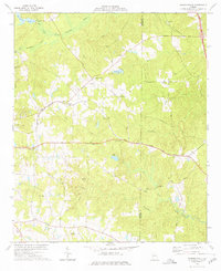
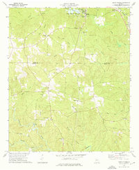
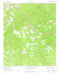
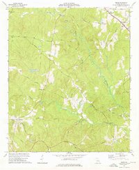
 1974 Strouds1976 Print · USGSMonroe County's rural landscape is captured here in the mid-seventies as traditional farming communities like Strouds and Brent persisted. Researchers can trace family history through sites like Sardis Cem and the Southern railroad corridor.
 - 1974 Map of Smarr, 1976 Print
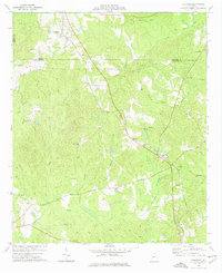
 1974 Smarr1976 Print · USGSMid-1970s Monroe County reveals a landscape of winding country roads and numerous rural congregations. Trace family histories at New Providence Ch or Mt Vernon Ch, and locate old crossings like the Maynard Mill Bridge.
 - 1978 Map of Macon, 1980 Print
 1978 Macon1980 Print · USGSCentral Georgia during the late seventies reveals a landscape shaped by military expansion and clay mining. Genealogists and local historians can trace the development of Warner Robins, the grounds of Wesleyan College, and the rural surroundings of Griswoldville.2 unique versions available
 - 1979 Map of Griffin, 1980 Print
 1979 Griffin1980 Print · USGSWest-central Georgia at the close of the seventies reveals a landscape of historic rail towns and growing suburbs between the major river systems. Trace the rail lines and early road networks connecting Griffin, Peachtree City, and Newnan, or locate smaller settlements like Senoia and Experiment.3 unique versions available
End of results
Showing maps 1-15 of 15
Top cities of Monroe County
Frequently asked questions
- What are the different types of historical maps available for Monroe County?
- What is the oldest map of Monroe County?
- Where can I purchase historical maps of Monroe County for my home or office?
- Where can I download high-res historical maps of Monroe County?
- Are there historical topographic maps available for Monroe County?
- Is there historical aerial imagery available for Monroe County?
- Where are historical maps of Monroe County sourced from?