Old Maps of Walker County, Georgia for Academic Research
Study the evolution of Walker County with 136 high-resolution historic maps. Whether you're teaching, researching, or modeling changes in land use, these maps provide essential visual documentation of urban, environmental, and geographic change.
- Analyze long-term change: Track patterns in development, transportation, and natural features.
- Ideal for environmental or urban studies: Support academic projects with primary historical map data.
- Use in the classroom or lab: Educators and researchers rely on these maps to bring historical context to life.
These maps are a powerful tool for teaching, research, and visualizing how Walker County has changed over the decades.
Walker County, GA maps
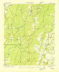
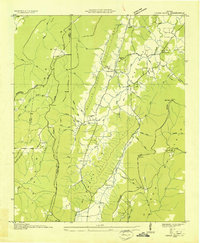
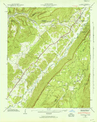
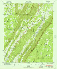
(136)- 1886 Map of Ringgold
 1886 Ringgold1886 Print · USGSNorthwest Georgia in the 1880s was a landscape of industrial river valleys and steep ridges defined by early rail lines. Local historians can trace family-named landmarks like Gilreath's Mill, the Trion Factory textile site, and the rural stop at Tap's Store.
 - 1886 Map of Stevenson
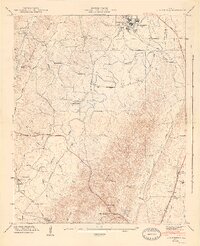
 1886 Stevenson1886 Print · USGSNortheast Alabama at the peak of the railroad era shows a landscape tied to the river and the rails. Genealogists can trace family landmarks like Coffey's Store or locate river crossings such as Caperton Ferry and Snodgrass Ferry.
 - 1892 Map of Ringgold
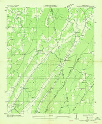
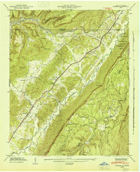
 1892 Ringgold1892 Print · USGSNorth Georgia and the Tennessee border are mapped here in the late nineteenth century as the region transitioned into a post-war rail and tourism hub. Researchers can trace the early National Park boundaries, industrial Coal Mines, and vanished stops like High Point or Lisbon Sta..9 unique versions available
 - 1892 Map of Stevenson
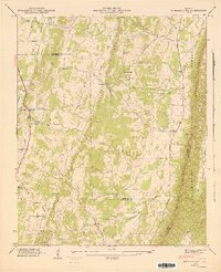
 1892 Stevenson1892 Print · USGSNortheast Alabama and the Tennessee border in the 1890s reveal a landscape of mountain coves and vital river crossings. Genealogists and historians can trace rail junctions at Stevenson, river landings like Coffey's Ferry, and landmarks like Nickajack Cave.
 - 1895 Map of Stevenson
 1895 Stevenson1895 Print · USGSThe Tennessee River valley and surrounding plateaus were a hub of rail and river commerce at the close of the century. Genealogists can trace family crossings at Island Creek Ferry or locate old communities like Bellefonte, Stevenson, and Valley Head.6 unique versions available
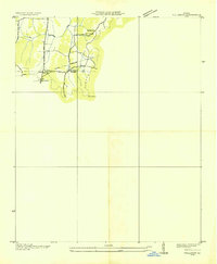
 - 1935 Map of Catlett
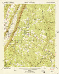
 1935 Catlett1935 Print · USGSThe Walker and Whitfield county line comes alive in the mid-1930s, showing a rural Georgia landscape of high ridges and valley farms. Researchers can trace family ties at Gladden Cem or locate the old Pine Grove Sch and Henderson Sch near the crossing of Catlett Creek.
 - 1935 Map of Durham
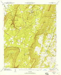
 1935 Durham1935 Print · USGSNorthwest Georgia's industrial and rural landscape is documented here during the mid-1930s as mining and rail commerce defined the region. Researchers can trace the heritage of Durham and Cassandra through sites like Coal Mines, Prospect Sch, and Fuggett Ch.
 - 1935 Map of Villanow
 1935 Villanow1935 Print · USGSThe borderlands of Whitfield and Walker Counties are captured here in the mid-1930s as the TVA began its regional work. Genealogists can locate rural landmarks like Friendship Ch, Fairview Sch, and the small settlement of Reo.
 - 1935 Map of Nickajack Gap
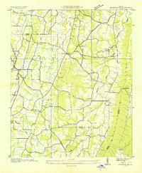 1935 Nickajack Gap1935 Print · USGSCatoosa and Walker Counties are captured in the mid-1930s as a landscape of ridges and rural settlements. Researchers can locate family landmarks like Mc Intyre Cem, Peavine Ch, and the school at Mt Pisgah Sch.
 - 1936 Map of Kensington
 1936 Kensington1936 Print · USGSWalker County during the mid-1930s shows a landscape of ridge-and-valley settlements connected by the Central of Georgia line. Genealogists and historians can trace family locations near Old Lookout Cem, Pond Spring, and the Gordon Lee Sch.
 - 1936 Map of Hooker
 1936 Hooker1936 Print · USGSNorthwest Georgia and neighboring Tennessee appear here in the mid-thirties, showing a landscape defined by mountain gaps and river valleys. Researchers can trace the path of Southern Railway through Morganville or locate family sites like Bethlehem Cem and Slygo Ch.
 - 1936 Map of Sulphur Springs
 1936 Sulphur Springs1936 Print · USGSLookout Mountain and the Alabama-Georgia borderlands are captured here in the mid-1930s. Researchers can trace families near Sulphur Springs or find landmarks like Amos Mill, Battelle, and the Lookout Chapel Sch.
 - 1936 Map of Estelle
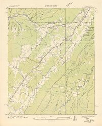
 1936 Estelle1936 Print · USGSWalker County during the mid-1930s shows a landscape of steep ridges and tucked-away hollows. Genealogists and historians can trace the Tenn Ala & Ga RR past Estelle or locate the Valley Head Ch near the dramatic slopes of Pigeon Mountain.
 - 1936 Map of Fort Oglethorpe
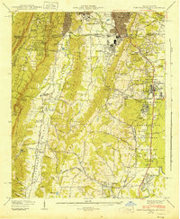
 1936 Fort Oglethorpe1936 Print · USGSThe Georgia-Tennessee borderlands appear here in the mid-1930s, featuring the extensive grounds of the Chickamauga battlefield and the early development of Lookout Mountain. Researchers can locate historic farmsteads and monuments such as the Snodgrass House, the Lee and Gordon Mill, and Rock City Gardens.
 - 1936 Map of Dougherty Gap
 1936 Dougherty Gap1936 Print · USGSNorthern Georgia mountain terrain comes into focus in the mid-1930s as federal agencies mapped the convergence of LOOKOUT MOUNTAIN and PIGEON MOUNTAIN. Genealogists and historians can trace the early road through Dougherty Gap and locate the site of a CCC Camp (Abandoned).
 - 1936 Map of Cedar Grove
 1936 Cedar Grove1936 Print · USGSWalker County's ridge-and-valley landscape is captured here in the mid-1930s as rural life centered on the fertile McLemore Cove. Genealogists can locate family landmarks such as Thurman Cem, Antioch Ch, and the settlement of Masseyville.
 - 1936 Map of Little Falls
 1936 Little Falls1936 Print · USGSDeKalb County, Alabama, is captured in the mid-1930s just as the Tennessee Valley Authority began modernizing the region. Researchers can trace rural life through the upland community of Violet Hill, its Violet Hill Ch, and the high ridges of Lookout Mountain.
 - 1942 Map of Fort Oglethorpe, 1946 Print
 1942 Fort Oglethorpe1946 Print · USGSThe Tennessee-Georgia borderlands are captured here during the early 1940s, highlighting the transition from historic battlefields to growing residential communities. Genealogists and historians can trace family-named sites like Snodgrass House, McCallie Lake, and Lee and Gordon Mill.3 unique versions available
 - 1945 Map of Hooker, 1954 Print
 1945 Hooker1954 Print · USGSThe Georgia-Tennessee borderlands appear here in the mid-1940s, showing the intersection of heavy rail and mountain terrain. Genealogists can trace family landmarks like Sarah Chapel, West Brow Sch, and the Dickens Cem along the slopes of Lookout Mountain.2 unique versions available
 - 1946 Map of Kensington, 1947 Print
 1946 Kensington1947 Print · USGSWalker County during the mid-forties is captured here as a landscape of ridge-top vistas and rail-connected valley towns. Genealogists and researchers can locate family sites like Owings Cem, the Gordon Lee School, and the old works at Hall Mill.6 unique versions available
 - 1946 Map of Hooker, 1947 Print
 1946 Hooker1947 Print · USGSLookout Valley in the mid-1940s served as a vital rail corridor through the gaps of the Appalachians between Georgia and Tennessee. Genealogists can trace family footprints at Sarah Chapel, North Dade Sch, and Magill Cem along the winding course of Lookout Creek.2 unique versions available
 - 1946 Map of Nickajack Gap, 1947 Print
 1946 Nickajack Gap1947 Print · USGSNorth Georgia’s ridge-and-valley corridor is captured here in the mid-1940s, showing a landscape of railway junctions and rural farmsteads. Genealogists can trace family connections through sites like Yates Cem, Rock Spring Sch, and the community of Wood Station.5 unique versions available
 - 1946 Map of Sulphur Springs, 1956 Print
 1946 Sulphur Springs1956 Print · USGSThe Alabama and Georgia state line meets along the spine of the mountains in this mid-century survey of the Little River Valley. Researchers can trace the path of the Southern Railroad through old stops like Sulphur Springs Station and find family landmarks like Pannell Cem and Amos Mill.3 unique versions available
 - 1946 Map of Valley Head, 1956 Print
 1946 Valley Head1956 Print · USGSThe Alabama-Georgia state line and the slopes of Lookout Mountain are captured here in the mid-1940s. Genealogists and researchers can locate the Southern Railroad corridor, rural schools like Moon Lake Sch, and local landmarks including Mentone and Valley Head.2 unique versions available
 - 1946 Map of Durham, 1959 Print
 1946 Durham1959 Print · USGSNorthwest Georgia's high plateau and valley floor are captured here in the years following the war. Researchers can locate family landmarks such as Durham, Old Lookout Cem, and the Lookout Mtn Rural Sch.3 unique versions available
Showing maps 1-25 of 136
Top cities of Walker County
- LaFayette historical maps
- Rossville historical maps
- Chickamauga historical maps
- Lookout Mountain historical maps
Frequently asked questions
- What are the different types of historical maps available for Walker County?
- What is the oldest map of Walker County?
- Where can I purchase historical maps of Walker County for my home or office?
- Where can I download high-res historical maps of Walker County?
- Are there historical topographic maps available for Walker County?
- Is there historical aerial imagery available for Walker County?
- Where are historical maps of Walker County sourced from?