Old Maps of Wilkes County, Georgia for Academic Research
Study the evolution of Wilkes County with 113 high-resolution historic maps. Whether you're teaching, researching, or modeling changes in land use, these maps provide essential visual documentation of urban, environmental, and geographic change.
- Analyze long-term change: Track patterns in development, transportation, and natural features.
- Ideal for environmental or urban studies: Support academic projects with primary historical map data.
- Use in the classroom or lab: Educators and researchers rely on these maps to bring historical context to life.
These maps are a powerful tool for teaching, research, and visualizing how Wilkes County has changed over the decades.
Wilkes County, GA maps
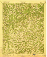
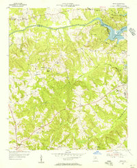
(113)- 1892 Map of Mc Cormick
 1892 Mc Cormick1892 Print · USGSThe Savannah River borderlands in the 1890s reveal a network of historic ferries and early mills connecting Georgia and South Carolina. Genealogists can trace family roots through landmarks like Dunn Chapel, Searle Mill, and the crossings at Barksdale Ferry.5 unique versions available
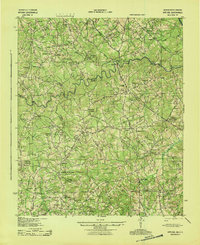
 - 1906 Map of Crawfordville
 1906 Crawfordville1906 Print · USGSUpper Georgia and the South Carolina border come alive in this early century survey, showing a landscape defined by river ferries and mining sites. Genealogists can trace family roots through old post offices like Triplett P.O. or find historic crossings like Fishdam Ferry and the Columbia Mines.3 unique versions available
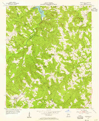
 - 1912 Map of Mc Cormick, 1913 Print
 1912 Mc Cormick1913 Print · USGSThe Georgia and South Carolina borderlands come alive in the 1890s, centered on the rail junction at Mc Cormick and the Savannah River. Genealogists can trace family footprints across numerous river crossings like Fury Ferry and through rural centers such as Appling and Sharon Church.
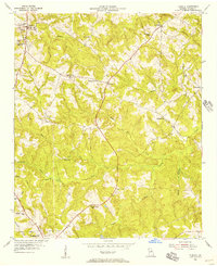
 - 1921 Map of Appling
 1921 Appling1921 Print · USGSColumbia County in the years following the Great War was a landscape of small agricultural communities and river crossings. Researchers can trace ancestral locations through dozens of named sites like Martins Academy, Lockhart Ferry, and the Whiteoak Camp Ground.3 unique versions available
 - 1943 Map of Appling
 1943 Appling1943 Print · USGSEastern Georgia and the Savannah River watershed are captured here during the early 1940s. Genealogists can trace family roots through numerous schools and churches, from Martins Academy to Hosea Chapel and Lockhart Ferry.
 - 1953 Map of Athens, 1966 Print
 1953 Athens1966 Print · USGSGeorgia's Piedmont and Savannah River borderlands come alive in this mid-century survey of the region surrounding Athens and Augusta. Trace the rail-and-river economy through the Georgia RR and landmarks like the Fort Gordon Military Reservation.3 unique versions available
 - 1954 Map of Metasville, 1955 Print
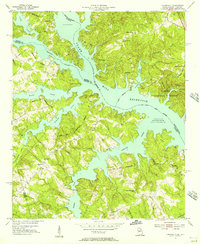
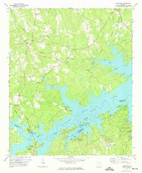
 1954 Metasville1955 Print · USGSWilkes and Lincoln Counties appear here in the mid-fifties, just as the landscape was being reshaped by the new Clark Hill Reservoir. Genealogists and historians can locate rural landmarks like Metasville High Sch, the Magruda Mines, and several country churches including St Lukes Ch.3 unique versions available
 - 1955 Map of Tignall, 1956 Print
 1955 Tignall1956 Print · USGSWilkes County during the mid-fifties reveals a landscape of rural schoolhouses and small crossroads settlements connected by the winding path of Georgia Highway 17. Genealogists and researchers can trace local landmarks like Rosenwald High Sch, Reeves Chapel Sch, and the community of Danburg.2 unique versions available
 - 1955 Map of Broad, 1956 Print
 1955 Broad1956 Print · USGSWilkes and Elbert counties meet along the Broad River in the mid-1950s as the rising waters of Clark Hill Reservoir begin to transform the landscape. Family historians can trace rural congregations and early schools like Popes Chapel, Tabor Ch, and Pole Branch Sch.2 unique versions available
 - 1955 Map of Chennault, 1956 Print
 1955 Chennault1956 Print · USGSThe Georgia-South Carolina border was undergoing a massive transformation in the mid-fifties as the Clark Hill Reservoir filled. Researchers can trace rural life in settlements like Chennault and Graball or locate family landmarks like Mt Pleasant Ch and New Tabernacle Sch.3 unique versions available
 - 1958 Map of Athens
 1958 Athens1958 Print · USGSNorth-central Georgia and the Savannah River valley are captured in the late fifties, showing the region as the new reservoirs were filling. Researchers can trace historic rail lines like the Georgia RR and locate rural landmarks such as Social Circle, Graves Mountain, and the Fort Gordon Military Reservation.
 - 1959 Map of Athens
 1959 Athens1959 Print · USGSNortheast Georgia and the South Carolina borderlands appear here in the mid-fifties, during a decade of infrastructure growth. Genealogists and historians can trace the rail-and-river geography of towns like Social Circle, the sprawl of Fort Gordon Military Reservation, and the newly formed Clark Hill Reservoir.
 - 1963 Map of Athens
 1963 Athens1963 Print · USGSGeorgia's Piedmont and the Savannah River valley are captured in the early sixties as major reservoirs and military installations reshaped the landscape. Researchers can trace the development of Clark Hill Reservoir, locate the Fort Gordon Military Reservation, and find historic towns like Social Circle and Eatonton.
 - 1966 Map of Philomath, 1967 Print
 1966 Philomath1967 Print · USGSWilkes and Taliaferro counties are shown in the mid-sixties, a period when rural Georgia was still dotted with small community centers and country chapels. Researchers can trace family roots at Philomath, Daniel Springs, or Thaxton Cem and locate many local landmarks like Victory Ch.2 unique versions available
 - 1966 Map of Crawfordville, 1967 Print
 1966 Crawfordville1967 Print · USGSTaliaferro County is captured in the mid-sixties, centered on the railroad town of Crawfordville and its surrounding agricultural land. Genealogists and local historians can locate rural landmarks like Stephens Chapel, the Stephens Institute, and the crossroads at Robinson.3 unique versions available
 - 1970 Map of Jacksons Crossroads, 1973 Print
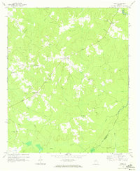
 1970 Jacksons Crossroads1973 Print · USGSWilkes County and its neighbors come alive in the early 1970s as the Broad River winds through a landscape of historic small settlements. Researchers can trace the Old Railroad Grade and locate ancestral sites like Mallorysville, Clark Station Ch, and St Johns Cem.
 - 1971 Map of Vesta, 1973 Print
 1971 Vesta1973 Print · USGSOglethorpe County in the early seventies was a landscape of granite extraction and rural congregations. Genealogists and historians can trace family locations near Saxon, Veribest, and numerous landmarks like Watkins Grove Ch or Fort Bethel Ch.2 unique versions available
 - 1971 Map of Celeste, 1973 Print
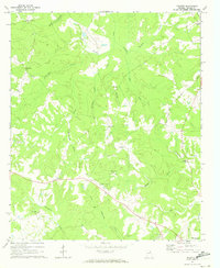 1971 Celeste1973 Print · USGSWilkes County at the start of the 1970s reveals a Piedmont landscape where historic rural settlements like Linesville and Celeste remained centered around their country churches. You can trace the Old Railroad Grade and locate family landmarks such as Jacksons Store and Hilliard Station Ch.
 - 1971 Map of Rayle, 1973 Print
 1971 Rayle1973 Print · USGSThe borderlands of Oglethorpe and Wilkes counties are captured here in the early seventies, showing a rural landscape tied to the land and local congregation. Genealogists can locate family landmarks like Chafin Cem, Stevens Grove Ch, and the settlement at Rayle.
 - 1971 Map of Woodlawn, 1974 Print
 1971 Woodlawn1974 Print · USGSLincoln County and its neighbors are seen here in the early seventies, as the sprawling waters of Clark Hill Lake redefined the local landscape. Genealogists can trace rural roots through landmarks like Loco Holiness Ch, Antioch Ch, and the settlement at Leathersville.
 - 1972 Map of Wrightsboro, 1974 Print
 1972 Wrightsboro1974 Print · USGSMcDuffie County in the early seventies shows the rural community of Wrightsboro as it balanced traditional church life with new development. Researchers can find family landmarks like Brinkley Chapel and Pine Grove Ch, or trace the shoreline of Clark Hill Lake.3 unique versions available
 - 1972 Map of Aonia, 1974 Print
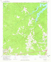
 1972 Aonia1974 Print · USGSWilkes County life in the early seventies centered on rural crossroads and the rising waters of the Little River. Genealogists can locate family landmarks like Hearns Chapel Cem, the Ship Mine, and the settlement of Aonia.2 unique versions available
 - 1972 Map of Sharon, 1974 Print
 1972 Sharon1974 Print · USGSTaliaferro County in the early seventies is characterized here by its quiet rural crossroads and winding creek networks. Genealogists can trace family roots through landmarks like Mt Olive Ch, Raytown, and the small community of Sharon.2 unique versions available
 - 1972 Map of Cadley, 1974 Print
 1972 Cadley1974 Print · USGSThe Georgia Piedmont at the start of the seventies is captured here as a landscape of rural congregations and family-named creeks. Genealogists can trace the location of South Liberty Church, Ebenezer Cem, and the Fountain Campground near Cadley.
 - 1972 Map of Washington East, 1975 Print
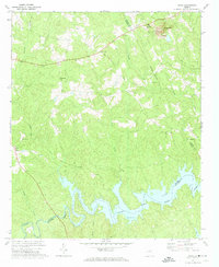
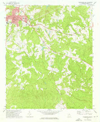 1972 Washington East1975 Print · USGSWilkes County life in the early 1970s centered on the town of Washington, where civic landmarks met a sprawling network of rural country churches. Researchers can trace family roots through several cemeteries and local landmarks like Clifford Grove Ch or Lundberg.2 unique versions available
Showing maps 1-25 of 113
Top cities of Wilkes County
Frequently asked questions
- What are the different types of historical maps available for Wilkes County?
- What is the oldest map of Wilkes County?
- Where can I purchase historical maps of Wilkes County for my home or office?
- Where can I download high-res historical maps of Wilkes County?
- Are there historical topographic maps available for Wilkes County?
- Is there historical aerial imagery available for Wilkes County?
- Where are historical maps of Wilkes County sourced from?