2020s Maps of Hawaiian Ocean View, Hawaii
Explore 4 historic maps of Hawaiian Ocean View from the 2020s. These maps offer a rare glimpse into what life looked like during the 2020s — showing old roads, neighborhoods, homes, and landmarks that have changed or disappeared over time.
Whether you're researching your family's past, planning a metal detecting trip, or studying how Hawaiian Ocean View's landscape evolved across the 2020s, these high-resolution maps are a powerful tool for exploring the history of this region.
- Focus on a specific era: All maps on this page are from the 2020s, giving you a focused view of this time period.
- See what’s changed: Compare century-old streets, trails, and buildings to today's modern landscape using overlays and satellite layers.
- Research with precision: Use these maps for genealogy, historical research, land use analysis, or educational projects.
- View, download, or print: Maps are fully viewable online in high resolution, and can be downloaded or printed for your own records.
Start exploring Hawaiian Ocean View's history through authentic maps from the 2020s. This is your window into the past.
Hawaiian Ocean View, HI maps
(4)- 2024 Map of Kahuku Ranch, 2024 Print
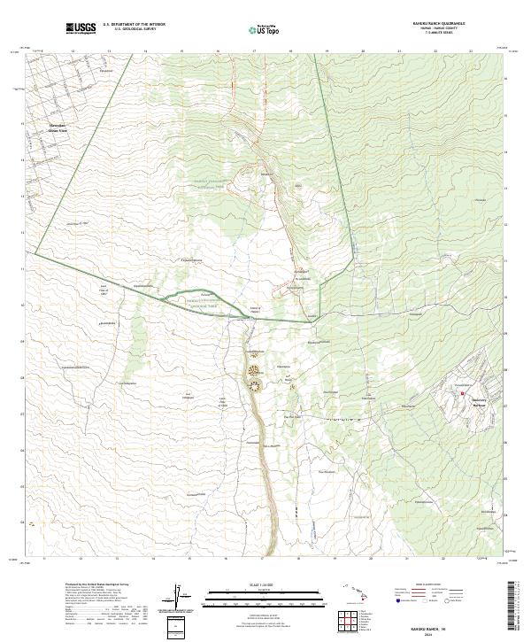 2024 Kahuku Ranch2024 Print · USGSThe southern volcanic slopes of Hawaii come alive in this modern survey, showing how residential growth meets historic lava fields. Trace the reach of the Lava Flow of 1868 and explore local landmarks like Discovery Harbour and Pali o Mamalu.
 - 2024 Map of Pohue Bay, 2024 Print
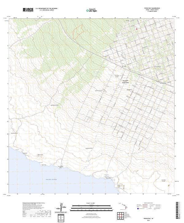 2024 Pohue Bay2024 Print · USGSThe Ka'ū District of Hawaii is shown here in the early twenty-first century, where modern residential grids meet massive historic volcanic flows. Trace the vast street layout of Hawaiian Ocean View as it navigates the Lava Flow of 1907 and the remote Pōhue Beach.
 - 2024 Map of Puuokeokeo, 2024 Print
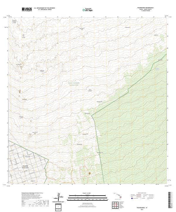 2024 Puuokeokeo2024 Print · USGSThe southwestern slopes of Mauna Loa appear here in the modern era as a landscape defined by sequential volcanic eruptions. Researchers can trace the massive Lava Flow of 1950 and the residential grid of Hawaiian Ocean View or the Kahuku Kona Trl.
 - 2024 Map of Papa, 2024 Print
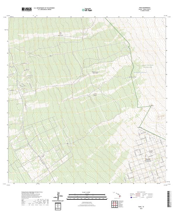 2024 Papa2024 Print · USGSThe leeward slopes of the Big Island are documented here in recent years, showing how volcanic history and modern settlement meet. Researchers can trace the paths of the 'Ālika Lava Flow of 1919 and locate landmarks like the One Hundred-Acre Waterhole.
End of results
Showing maps 1-4 of 4
Top cities near Hawaiian Ocean View
Top neighborhoods of Hawaiian Ocean View
- Country Garden Estates historical maps
- Hawaiian Ocean View historical maps
- Hawaiian Ocean View Estates historical maps
- Hawaiian Ranchos historical maps
- Kona South Estates historical maps
Frequently asked questions
- What are the different types of historical maps available for Hawaiian Ocean View?
- What is the oldest map of Hawaiian Ocean View?
- Where can I purchase historical maps of Hawaiian Ocean View for my home or office?
- Where can I download high-res historical maps of Hawaiian Ocean View?
- Are there historical topographic maps available for Hawaiian Ocean View?
- Is there historical aerial imagery available for Hawaiian Ocean View?
- Where are historical maps of Hawaiian Ocean View sourced from?