Old Maps of Māhukona, Hawaiʻi County for Genealogy
Trace your family roots with 13 historic maps of Māhukona. These high-res maps reveal old neighborhoods, homesites, landmarks, and streets — helping you uncover where your ancestors lived and how the area evolved over time.
- Explore historic neighborhoods: Identify where your relatives may have lived in the 1800s or 1900s.
- Compare maps over time: Trace the changes in streets, buildings, and landmarks for multi-generational research.
- Perfect for genealogy & ancestry research: Used by family historians and researchers to map out lineage and migration.
These maps are an incredible resource for exploring your personal connection to Māhukona's past.
Māhukona, Hawaiʻi County maps
(13)- 1913 Map of Kohala, 1954 Print
 1913 Kohala1954 Print · USGSThe Kohala coast thrived as a hub of sugar production and rail transport during the early territory days. Genealogists and historians can trace the industrial landscape of Union Mill, the Hawaii Railway line, and cultural landmarks like Puukohola Heiau.
 - 1916 Map of Kohala
 1916 Kohala1916 Print · USGSThe northern tip of Hawaii island comes into focus during the height of the sugar era. Researchers can trace the industrial landscape of the Hawaii Railway connecting Union Mill, Hawi, and Kohala Mill to the coastal landings.2 unique versions available
 - 1954 Map of Hawaii North
 1954 Hawaii North1954 Print · USGSThe Big Island in the mid-fifties shows a landscape of active volcanic history and a peak sugar-mill economy. Trace the route of the Hawaii Consolidated Railway, locate the Olaa Plantation Mill, and see the extent of the Lava flow of 1881 near Hilo.
 - 1957 Map of Mahukona, 1959 Print
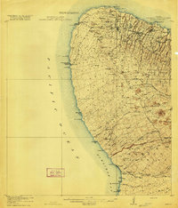
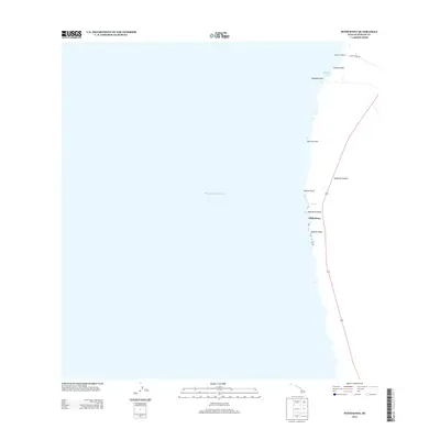
 1957 Mahukona1959 Print · USGSThe North Kohala coast in the late fifties is captured here through its ancient sites and modern maritime infrastructure. Researchers can trace land divisions from Upolu to Mahukona and locate landmarks like the Kamehameha I Birthplace and Mahukona Harbor.3 unique versions available
 - 1959 Map of Hawaii North
 1959 Hawaii North1959 Print · USGSThe northern half of Hawaii Island in the late fifties shows a landscape shaped by historic volcanic activity and a thriving sugar and ranching economy. Researchers can trace historic lava flows alongside local landmarks like Upolu Point Airport, Huehue Ranch, and the Pacific Sugar Mill.
 - 1961 Map of Hawaii North
 1961 Hawaii North1961 Print · USGSThe Big Island's northern reaches are shown here in the early sixties, during the peak of the sugar era and before modern resort development. Researchers can trace the Hawaii Consolidated railroad, locate the Ahu a Umi Heiau Ruins, and explore sugar industry landmarks like the Pacific Sugar Mill.2 unique versions available
 - 1975 Map of Hawaii, 1977 Print
 1975 Hawaii1977 Print · USGSThe Big Island in the mid-seventies is captured here as a landscape of volcanic giants and coastal sugar communities. Genealogists and historians can locate former plantation sites like Pepeekeo Mill or trace the routes of the Mamalahoa Highway through Kamuela.
 - 1980 Map of Hawaii County Sheet 1, 1984 Print
 1980 Hawaii County Sheet 11984 Print · USGSThe Big Island's diverse terrain and transition into the 1980s are shown here, from the northern coast to the high mountain saddles. Genealogists and historians can trace homesteads and local roads near Kailua, Kukuihaele, and the Ahualoa area.
 - 1982 Map of Mahukona
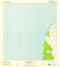
 1982 Mahukona1982 Print · USGSThe North Kohala coast comes alive in this early 1980s survey, showing the intersection of Hawaiian heritage and modern maritime history. Researchers can locate the Kamehameha I Birthplace, the ancient Mookini Heiau, and the former port at Mahukona.2 unique versions available
 - 1995 Map of Mahukona, 1998 Print
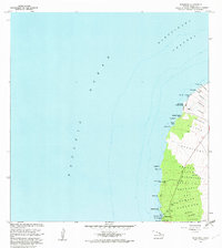
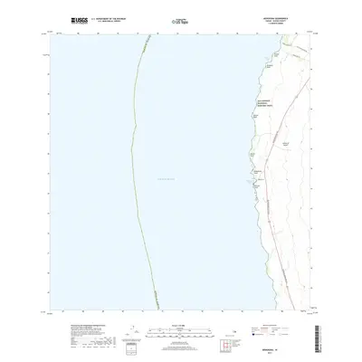
 1995 Mahukona1998 Print · USGSThe northwestern coast of Hawaii island appears here in the late twentieth century as a mix of ancient sites and modern maritime infrastructure. Genealogists and historians can locate former coastal settlements at Honoipu Landing or explore the vicinity of the Kahola Historical Sites State Monument.
 - 2013 Map of Mahukona, 2013 Print
 2013 Mahukona2013 Print · USGSCovers Māhukona, including Hawaiʻi County, United States, and other nearby areas
 - 2017 Map of Mahukona, 2017 Print
 2017 Mahukona2017 Print · USGSCovers Māhukona, including Hawaiʻi County, United States, and other nearby areas
 - 2024 Map of Mahukona, 2024 Print
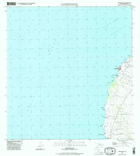
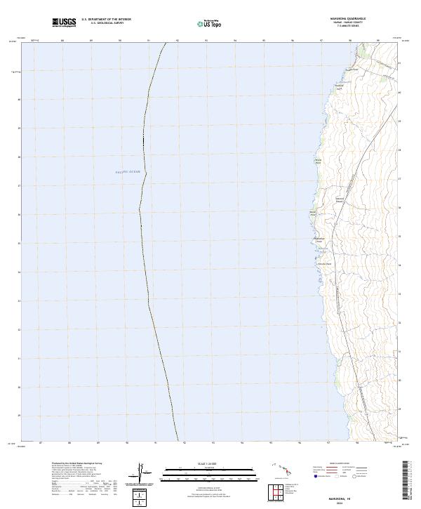 2024 Mahukona2024 Print · USGSThe leeward coast of the Island of Hawai‘i is documented here in the early twenty-first century, showing a landscape of rocky points and maritime access. Trace the historic coastal infrastructure near Māhukona Harbor and follow the paths of Coast Guard Rd and Upolu Rd.
End of results
Showing maps 1-13 of 13
Frequently asked questions
- What are the different types of historical maps available for Māhukona?
- What is the oldest map of Māhukona?
- Where can I purchase historical maps of Māhukona for my home or office?
- Where can I download high-res historical maps of Māhukona?
- Are there historical topographic maps available for Māhukona?
- Is there historical aerial imagery available for Māhukona?
- Where are historical maps of Māhukona sourced from?