2000s (21st Century) Maps of Honolulu, Hawaii
Explore 15 historic maps of Honolulu from the 2000s (21st Century). These maps offer a rare glimpse into what life looked like during the 2000s — showing old roads, neighborhoods, homes, and landmarks that have changed or disappeared over time.
Whether you're researching your family's past, planning a metal detecting trip, or studying how Honolulu's landscape evolved across the 2000s, these high-resolution maps are a powerful tool for exploring the history of this region.
- Focus on a specific era: All maps on this page are from the 2000s, giving you a focused view of this time period.
- See what’s changed: Compare century-old streets, trails, and buildings to today's modern landscape using overlays and satellite layers.
- Research with precision: Use these maps for genealogy, historical research, land use analysis, or educational projects.
- View, download, or print: Maps are fully viewable online in high resolution, and can be downloaded or printed for your own records.
Start exploring Honolulu's history through authentic maps from the 2000s. This is your window into the past.
Honolulu, HI maps
(15)- 2013 Map of Koko Head, 2013 Print
 2013 Koko Head2013 Print · USGSCovers Honolulu, including East Honolulu, Waimanalo, and other nearby areas
 - 2013 Map of Pearl Harbor, 2013 Print
 2013 Pearl Harbor2013 Print · USGSCovers Honolulu, including Ewa Beach, Pearl City, and other nearby areas
 - 2013 Map of Kaneohe, 2013 Print
 2013 Kaneohe2013 Print · USGSCovers Honolulu, including Kaneohe, Kahalu‘u, and other nearby areas
 - 2013 Map of Koko Head OE E, 2013 Print
 2013 Koko Head OE E2013 Print · USGSCovers Honolulu, including Honolulu County, United States, and other nearby areas
 - 2013 Map of Honolulu, 2013 Print
 2013 Honolulu2013 Print · USGSCovers Honolulu, including Honolulu County, United States, and other nearby areas
 - 2017 Map of Koko Head, 2017 Print
 2017 Koko Head2017 Print · USGSCovers Honolulu, including East Honolulu, Waimanalo, and other nearby areas
 - 2017 Map of Honolulu, 2017 Print
 2017 Honolulu2017 Print · USGSCovers Honolulu, including Honolulu County, United States, and other nearby areas
 - 2017 Map of Koko Head OE E, 2017 Print
 2017 Koko Head OE E2017 Print · USGSCovers Honolulu, including Honolulu County, United States, and other nearby areas
 - 2017 Map of Kaneohe, 2017 Print
 2017 Kaneohe2017 Print · USGSCovers Honolulu, including Kaneohe, Kahalu‘u, and other nearby areas
 - 2017 Map of Pearl Harbor, 2017 Print
 2017 Pearl Harbor2017 Print · USGSCovers Honolulu, including Ewa Beach, Pearl City, and other nearby areas
 - 2024 Map of Koko Head, 2024 Print
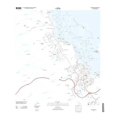
 2024 Koko Head2024 Print · USGSSoutheast O'ahu's modern shoreline and ridges appear here during a period of established residential development and preserved coastal landmarks. Researchers can trace local history from the Memorial Garden to the geological features of Hanauma Bay and Ka'au Crater.
 - 2024 Map of Honolulu, 2024 Print
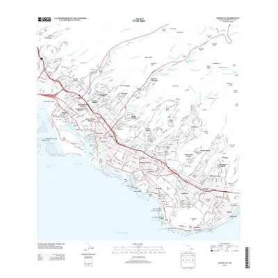
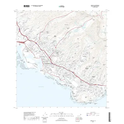
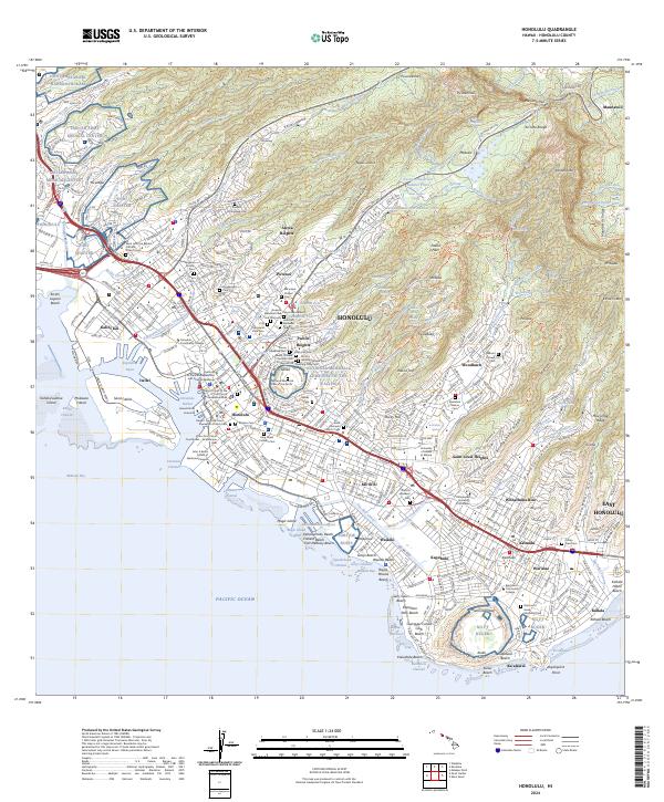 2024 Honolulu2024 Print · USGSModern Honolulu comes into sharp focus in this detailed survey, illustrating the city's expansion from the Pacific coast to the Ko'olau ridges. Genealogists and historians can trace institutional roots at the University of Hawaii at Manoa or locate ancestral sites like the Manoa Chinese Cem and the Royal Mausoleum State Monument.
 - 2024 Map of Koko Head OE E, 2024 Print
 2024 Koko Head OE E2024 Print · USGSThe eastern maritime reaches of Oahu are documented in this recent survey, capturing the coastal interface near the entrance to the Kaiwi Channel. Researchers can orient themselves along the shoreline at Makapu'u Point and trace the bathymetric expanse of the Pacific Ocean.
 - 2024 Map of Kaneohe, 2024 Print
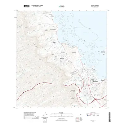
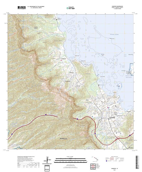 2024 Kaneohe2024 Print · USGSThe windward coast of Oahu comes alive in this contemporary record of its unique shorelines and mountain valleys. Researchers can trace the layout of Kaneohe, find family plots at Heeia Japanese Cem, and locate landmarks like He'eia Pond.
 - 2024 Map of Pearl Harbor, 2024 Print
 2024 Pearl Harbor2024 Print · USGSHonolulu's southern coast is a modern landscape of strategic military bases and urban growth in the twenty-first century. Researchers can trace the layout of Joint Base Pearl Harbor-Hickam and the USS Arizona Memorial alongside neighborhoods like Iroquois Point and Ewa Beach.
End of results
Showing maps 1-15 of 15
Top cities near Honolulu
- Waipahu historical maps
- East Honolulu historical maps
- Mililani historical maps
- Pearl City historical maps
- Kailua historical maps
- Kaneohe historical maps
See more
Top neighborhoods of Honolulu
- East Honolulu historical maps
- Kalihi Kai historical maps
- Sand Island historical maps
- Moanalua Gardens historical maps
- Āliamanu historical maps
- Kahala historical maps
See more
Frequently asked questions
- What are the different types of historical maps available for Honolulu?
- What is the oldest map of Honolulu?
- Where can I purchase historical maps of Honolulu for my home or office?
- Where can I download high-res historical maps of Honolulu?
- Are there historical topographic maps available for Honolulu?
- Is there historical aerial imagery available for Honolulu?
- Where are historical maps of Honolulu sourced from?