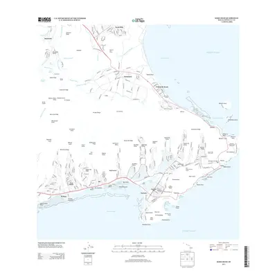
2013 Map of Koko Head
USGS Topo · Published 2013About this map
O'ahu's southeastern tip is defined by the sharp volcanic geometry of Koko Crater and the developed valleys of the Ko'olau Range. This 2013 survey details a landscape where ancient geography meets modern residential planning, from the coastal settlements of Waimānalo Beach and Hawai'i Kai to the inland ridges of Olomana Ridge and Wiliwilinui Ridge. The map documents the extensive water systems of the windward side, including the Maunawili Ditch, Killua Ditch, and the Korean Tunnel. Along the shoreline, maritime and scientific infrastructure appears via the Waimānalo Landing, Makai Pier, and the University of Hawaii Solar Observatory. Significant ecological and recreational sites like the Koko Crater Botanical Garden and the protected waters of Hanauma Bay highlight the region's focus on conservation and tourism in the early 21st century.
Find a feature on this map
288 named features on this map. Tap any name to fly to it.
Don’t see what you’re looking for? This feature index may not catch every label — zoom into the map to look around manually.
Map Details
Editions of this 2013 Koko Head Map
This is the sole edition of this map. No revisions or reprints were ever made.
Other maps of this area

1952 · Koko Head
USGS Topo · 1:24,000

1952 · Mokapu
USGS Topo · 1:24,000

1953 · Honolulu
USGS Topo · 1:24,000

1954 · Oahu
USGS Topo · 1:250,000

1954 · Kaneohe
USGS Topo · 1:24,000

1959 · Mokapu
USGS Topo · 1:24,000

1959 · Koko Head
USGS Topo · 1:24,000

1959 · Kaneohe
USGS Topo · 1:24,000

1959 · Honolulu
USGS Topo · 1:24,000

1961 · Oahu
USGS Topo · 1:250,000