Old Maps of Wainiha, Hawaii for Academic Research
Study the evolution of Wainiha with 8 high-resolution historic maps. Whether you're teaching, researching, or modeling changes in land use, these maps provide essential visual documentation of urban, environmental, and geographic change.
- Analyze long-term change: Track patterns in development, transportation, and natural features.
- Ideal for environmental or urban studies: Support academic projects with primary historical map data.
- Use in the classroom or lab: Educators and researchers rely on these maps to bring historical context to life.
These maps are a powerful tool for teaching, research, and visualizing how Wainiha has changed over the decades.
Wainiha, HI maps
(8)- 1954 Map of Kauai
 1954 Kauai1954 Print · USGSKauai and Niihau are shown during a period of transition in the early fifties as plantation-era infrastructure began to change. Researchers can trace the Kilauea Sugar Plantation Railroad, the Anahola Settlement, and remote sites on Niihau like Puuwai.
 - 1965 Map of Haena, 1967 Print
 1965 Haena1967 Print · USGSKauai's northern coast and deep interior forests are captured here in the mid-sixties, from the Kalalau Trail to the high Kokee State Park. Trace cultural landmarks like Ka Ulu a Paoa Heiau and the hidden Waikapalae Wet Cave.2 unique versions available
 - 1967 Map of Kauai
 1967 Kauai1967 Print · USGSThe Garden Isle and Niihau are shown here in the mid-sixties, capturing the island's transition from plantation roots to a more modern infrastructure. Genealogists can trace family connections in Moloaa Settlement or find coastal landmarks like Nonopapa and Kilauea Point Light.
 - 1970 Map of Kauai, 1974 Print
 1970 Kauai1974 Print · USGSThe islands of Kauai and Niihau are shown during the early 1970s, capturing the balance between military expansion and preserved wilderness. Researchers can trace the layout of Niihau's elusive villages like Puwai or explore Kauai's industrial landscape at Koloa Mill and Port Allen.2 unique versions available
 - 1983 Map of Haena
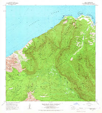
 1983 Haena1983 Print · USGSThe North Shore of Kauai is captured here in the early eighties, from the coastal caves of Haena to the high ALAKAI SWAMP. Trace cultural landmarks like the Ka Ulu a Paoa Heiau and the remote Kokee Air Force Station.
 - 2013 Map of Haena, 2013 Print
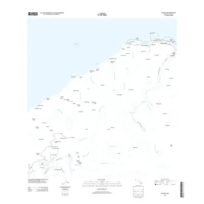 2013 Haena2013 Print · USGSCovers Wainiha, including Haena, Kauai County, and other nearby areas
 - 2017 Map of Haena, 2017 Print
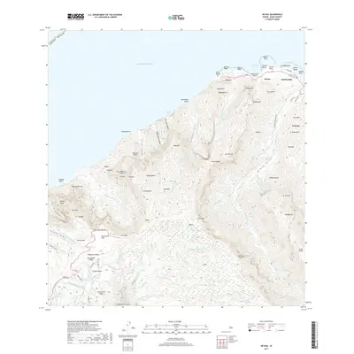 2017 Haena2017 Print · USGSCovers Wainiha, including Haena, Kauai County, and other nearby areas
 - 2024 Map of Haena, 2024 Print
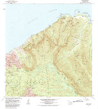
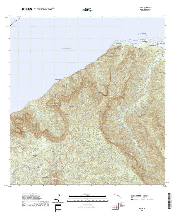 2024 Haena2024 Print · USGSThe northern coast of Kauai in 2024 reveals a landscape of isolated valleys and steep palis. Trace local roads like Wainiha Powerhouse Rd and find coastal landmarks from Tunnels Beach to the interior heights of Kokee State Park.
End of results
Showing maps 1-8 of 8
Frequently asked questions
- What are the different types of historical maps available for Wainiha?
- What is the oldest map of Wainiha?
- Where can I purchase historical maps of Wainiha for my home or office?
- Where can I download high-res historical maps of Wainiha?
- Are there historical topographic maps available for Wainiha?
- Is there historical aerial imagery available for Wainiha?
- Where are historical maps of Wainiha sourced from?