Old Maps of Mahana, Hawaii for Metal Detecting
Plan your next treasure hunt with 9 historic maps of Mahana. Find old homesites, ghost towns, trails, and gathering spots that may be lost to time — perfect for identifying promising metal detecting locations.
- Locate forgotten sites: Uncover places like long-lost settlements, abandoned rail lines, or gathering spots.
- Plan better hunts: Use map overlays combined with LiDAR or satellite views to narrow in on historically rich areas.
- Made for detectorists: Thousands of hobbyists use these maps to discover relics, coins, and hidden history.
Use these historic maps to boost your research and find new opportunities beneath the surface of Mahana.
Mahana, HI maps
(9)- 1952 Map of Molokai Airport, 1954 Print
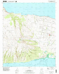
 1952 Molokai Airport1954 Print · USGSMolokai’s central plateau and southwestern slopes are captured here in the early fifties, featuring the transition from homesteaded grids to open volcanic terrain. Researchers can trace land divisions at Hoolehua Homesteads and find old landmarks like Kolo Wharf and Puu Nana.
 - 1954 Map of Maui
 1954 Maui1954 Print · USGSThe central Hawaiian Islands are shown during the mid-fifties, detailing the agricultural and coastal infrastructure of Maui, Lanai, and Molokai. Genealogists and researchers can trace plantation-era history at Haliimaile Camp, locate old harbors like Kaumalapau Harbor, or explore the early bounds of Haleakala National Park.
 - 1966 Map of Maui
 1966 Maui1966 Print · USGSThe central islands of Maui, Molokai, Lanai, and Kahoolawe are shown in detail during the mid-1960s as plantation life and early tourism coexisted. Genealogists and researchers can trace family locations in old plantation towns like Puunene, the harbor at Lahaina, and Hoolehua on Molokai.
 - 1968 Map of Molokai Airport, 1969 Print
 1968 Molokai Airport1969 Print · USGSCentral Molokai in the late sixties reveals a landscape of organized homesteads and deep coastal gulches. Genealogists and historians can trace the grid of Hoolehua Homesteads and find landmarks like Kolo Wharf and the Molokai Airport.
 - 1974 Map of Maui
 1974 Maui1974 Print · USGSMid-century Hawaii is captured here through the detailed landscapes of Maui, Molokai, Lanai, and Kahoolawe as they appeared in the 1970s. Researchers can trace the layout of island hubs like Lahaina and Lanai City alongside remote landmarks like Wainapanapa Cave.2 unique versions available
 - 1993 Map of Molokai Airport, 1999 Print
 1993 Molokai Airport1999 Print · USGSCentral Molokai in the early nineties reveals a landscape of aviation and agriculture, centered on the Molokai Airport. Genealogists and historians can trace the detailed layouts of Hoolehua Homesteads or locate the Pakanaka Fishpond and the Naval Reservation.2 unique versions available
 - 2013 Map of Molokai Airport, 2013 Print
 2013 Molokai Airport2013 Print · USGSCovers Mahana, including Maui County, United States, and other nearby areas
 - 2017 Map of Molokai Airport, 2017 Print
 2017 Molokai Airport2017 Print · USGSCovers Mahana, including Maui County, United States, and other nearby areas
 - 2024 Map of Molokai Airport, 2024 Print
 2024 Molokai Airport2024 Print · USGSThe central plains and coasts of Molokai are captured in this contemporary survey, showing the island's modern infrastructure and geography. Researchers can trace the layout of Kualapuu, locate Molokai Airport, and follow the deep ravines of Anahaki Gulch and Waiahewahewa Gulch.
End of results
Showing maps 1-9 of 9
Top cities near Mahana
- Kaunakakai historical maps
- Kualapuu historical maps
- Maunaloa historical maps
- Kalaupapa historical maps
- Kalawao historical maps
Frequently asked questions
- What are the different types of historical maps available for Mahana?
- What is the oldest map of Mahana?
- Where can I purchase historical maps of Mahana for my home or office?
- Where can I download high-res historical maps of Mahana?
- Are there historical topographic maps available for Mahana?
- Is there historical aerial imagery available for Mahana?
- Where are historical maps of Mahana sourced from?