Old Maps of Ada County, Idaho for Hiking & Exploration
Hike through history with 269 historic maps of Ada County. Explore old trails, ghost towns, and forgotten backroads — perfect for outdoor adventurers and local explorers.
- Rediscover forgotten places: Map out old mining camps, roads, and footpaths that no longer exist on modern maps.
- Layer with modern tools: Combine with LiDAR or satellite views to plan hikes through historical terrain.
- Made for exploration: Popular among hikers, overlanders, and local history lovers.
Use these maps to find adventure and explore the hidden past of Ada County.
Ada County, ID maps
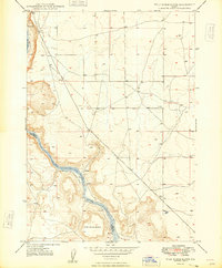
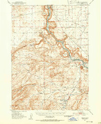
(269)- 1892 Map of Mountain Home
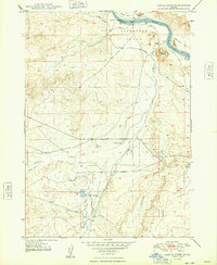
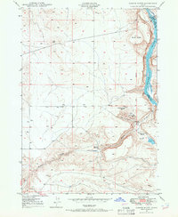
 1892 Mountain Home1892 Print · USGSElmore County's high desert and foothills are captured in the late nineteenth century as the railroad begins to reshape the Idaho territory. Genealogists and historians can trace early transit routes through Mountain Home and Cleft or follow the Boise River near Smith Prairie.
 - 1892 Map of Boise
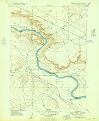
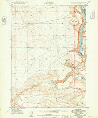
 1892 Boise1892 Print · USGSThe Boise Valley and surrounding highlands are shown here in the early 1890s as irrigation and railroads transformed the Idaho territory. Researchers can trace the early city grid near Boise Barracks and the paths of the Idaho Central Railroad and the Settlers Canal.
 - 1892 Map of Bisuka
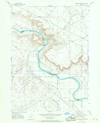
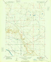
 1892 Bisuka1892 Print · USGSSouthern Idaho in the early 1890s was a land defined by the new Oregon Short Line Railroad and the deep cut of the canyon country. Researchers can trace early railroad stops at Bisuka and Kuna or locate the vital Boise Meridian reference at Initial Point.
 - 1892 Map of Silver City, 1962 Print
 1892 Silver City1962 Print · USGSOwyhee County was a center of industrial silver mining in the 1890s, with high-mountain camps and river crossings defining the local economy. Researchers can trace the layout of mining hubs like Silver City and De Lamar or locate the Warm Springs Ferry along the Snake River.2 unique versions available
 - 1893 Map of Mountain Home
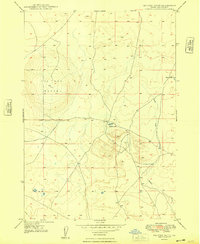
 1893 Mountain Home1893 Print · USGSElmore County during the frontier era of the late nineteenth century centers on the vital rail connection through the high desert. Genealogists and historians can trace the early layout of Mountain Home and Cleft along the Oregon Short Line Union Pacific Railroad.4 unique versions available
 - 1894 Map of Bisuka
 1894 Bisuka1894 Print · USGSSouthern Idaho in the 1890s was a landscape defined by the arrival of the rails and the deep canyon of the Snake River. Genealogists and historians can trace the early path of the Oregon Short Line Railroad through Kuna and locate the vital Initial Point survey marker.6 unique versions available
 - 1894 Map of Silver City
 1894 Silver City1894 Print · USGSThe Owyhee mining district and Snake River valley were in their industrial prime during the 1890s. Genealogists and historians can trace high-country settlements like Silver City and De Lamar or locate river crossings such as Warm Springs Ferry.
 - 1894 Map of Idaho Basin
 1894 Idaho Basin1894 Print · USGSThe Idaho Basin at the height of the mining era is revealed here through its network of camps and mountain trails. Genealogists and historians can trace early settlements like Pioneerville, Idaho City, and Placerville alongside landmarks like Halfway House.7 unique versions available
 - 1897 Map of Boise
 1897 Boise1897 Print · USGSBoise and the surrounding valley are captured here in the late nineteenth century as irrigation and rail networks began to reshape the high desert. Researchers can trace early water rights through the Settlers Canal or locate historic sites like the Boise Barracks and the Natatorium.4 unique versions available
 - 1898 Map of Nampa
 1898 Nampa1898 Print · USGSThe Treasure Valley's transformation is visible in the 1890s as railroads and massive irrigation projects began to reshape the high desert. Researchers can trace the development of early rail lines like the Boise Nampa & Owyhee R. R. and early canals such as the Riverside Canal and Newman Canal.4 unique versions available
 - 1898 Map of Silver City
 1898 Silver City1898 Print · USGSThe silver-mining heart of Owyhee County is captured here in the late nineteenth century during its industrial peak. Genealogists and historians can trace old mining camps like Silver City and De Lamar, or locate river crossings such as Warm Springs Ferry.3 unique versions available
 - 1947 Map of Jackass Butte, 1971 Print
 1947 Jackass Butte1971 Print · USGSThe Snake River canyon and the high desert bluffs of Owyhee County come alive in this late 1940s survey. Researchers can trace the path of the historic Emigrant Trail and locate local landmarks like Brooks Ranch, Birch Creek Sch, and Rabbit Springs.2 unique versions available
 - 1947 Map of Wild Horse Butte, 1973 Print
 1947 Wild Horse Butte1973 Print · USGSThe Snake River canyon near the Ada and Owyhee county line comes into focus in the late 1940s. Researchers can trace early river crossings at Swan Falls and the Ferry, or locate natural landmarks like Wild Horse Butte and Thomas Flats.
 - 1947 Map of Dorsey Butte, 1979 Print
 1947 Dorsey Butte1979 Print · USGSElmore County's high desert landscape is captured here in the late 1940s as irrigation projects transformed the arid basin. Researchers can trace the local water economy through the High Line Canal and locate the historic Hayland Sch near Chattin Hill.
 - 1948 Map of Castle Butte
 1948 Castle Butte1948 Print · USGSOwyhee County ranching and transit corridors are captured here in the late 1940s as the high plateau supported isolated homesteads and water projects. Researchers can trace the historic Emigrant Trail and locate local landmarks such as the Castle Creek Sch, Morgan Place, and the site of Clarks Ferry.2 unique versions available
 - 1948 Map of Big Foot Butte
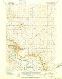
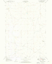
 1948 Big Foot Butte1948 Print · USGSAda County's high desert landscape was still a vast open range in the late 1940s, defined by volcanic landmarks and scarce water. Trace the primitive road network and survey benchmarks past Big Foot Butte to Tadpole Lake and Rabbit Creek.4 unique versions available
 - 1948 Map of Wild Horse Butte
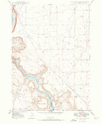
 1948 Wild Horse Butte1948 Print · USGSThe high desert canyon of the Snake River forms the divide between Ada and Owyhee counties in the late 1940s. Researchers can trace the river's path past Wild Horse Butte and Swan Falls to locate old water sources like Fossil Cr.
 - 1948 Map of Jackass Butte
 1948 Jackass Butte1948 Print · USGSThe Snake River canyon in Owyhee County was a critical corridor for both pioneers and post-war irrigators during the late 1940s. Researchers can trace the path of the Emigrant Trail or locate local landmarks like Brooks Ranch and Birch Creek Sch.
 - 1948 Map of Dorsey Butte
 1948 Dorsey Butte1948 Print · USGSElmore County during the late 1940s reveals a quiet landscape of high desert flats and river borders just as postwar ranching was modernizing. Researchers can locate the Hayland Sch, a private Landing Strip, and the rugged landmarks of Dorsey Butte and Chattin Hill.
 - 1948 Map of Big Foot Butte, 1952 Print
 1948 Big Foot Butte1952 Print · USGSIn the late 1940s, the Snake River canyon served as the heart of a transforming Idaho ranching and irrigation landscape. Researchers can trace the path of the Emigrant Trail or locate vanished landmarks like Birch Creek School and the Brooks Ranch.
 - 1948 Map of Sinker Butte, 1966 Print
 1948 Sinker Butte1966 Print · USGSOwyhee County's high desert reveals its frontier history in the late 1940s, marked by the intersection of early pioneer routes and the deep canyon of the Snake River. Historians can trace the Emigrant Trail past the Otter Massacre Site and locate remote outposts like Montini Ranch.2 unique versions available
 - 1948 Map of Little Joe Butte, 1976 Print
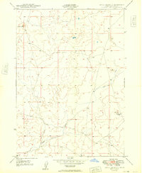
 1948 Little Joe Butte1976 Print · USGSAda County’s high desert landscape comes into focus during the late 1940s, a time when the region remained largely open rangeland. Researchers can trace early drainage patterns and land markers near Wind Butte, Little Joe Butte, and Corder Creek.
 - 1949 Map of Sinker Butte
 1949 Sinker Butte1949 Print · USGSThe Owyhee desert meets the canyon of the Snake River in the late 1940s, revealing a landscape defined by pioneer trails and ranching. Trace the path of the Emigrant Trail past the Otter Massacre Site and the remote Gabica Ranch.
 - 1949 Map of Little Joe Butte
 1949 Little Joe Butte1949 Print · USGSThe high desert of southwestern Idaho is captured here in the late 1940s, showing a landscape shaped by seasonal water and volcanic features. Genealogists and researchers can trace the drainage of Corder Creek and Rabbit Cr near landmarks like Wind Butte and Little Joe Butte.
 - 1949 Map of Oreana, 1952 Print
 1949 Oreana1952 Print · USGSOwyhee County ranching and the deep Snake River canyon are captured here in the post-war era. Researchers can trace the path of the Emigrant Road and locate historical landmarks like the Otter Massacre Site, Oreana, and local family ranch sites.2 unique versions available
Showing maps 1-25 of 269
Top cities of Ada County
- Boise historical maps
- Meridian historical maps
- Eagle historical maps
- Kuna historical maps
- Star historical maps
- Garden City historical maps
See more
Frequently asked questions
- What are the different types of historical maps available for Ada County?
- What is the oldest map of Ada County?
- Where can I purchase historical maps of Ada County for my home or office?
- Where can I download high-res historical maps of Ada County?
- Are there historical topographic maps available for Ada County?
- Is there historical aerial imagery available for Ada County?
- Where are historical maps of Ada County sourced from?