Old Maps of Idaho Falls, Idaho
Explore 20 old maps of Idaho Falls, spanning from 1924 to today. These high-resolution historic maps reveal how streets, neighborhoods, landmarks, and natural features evolved over time — perfect for genealogy, metal detecting, research, and local history exploration.
What you can do with these maps:
- See how Idaho Falls changed over time: Compare historical maps to modern-day views to trace roads, homesites, rail lines & more.
- View detailed metadata: Each map includes creators, publishers, year, scale, and archive source.
- Overlay maps with satellite & LiDAR: Visualize the past alongside modern tools to explore terrain & human change.
- Trusted historical sources: Maps sourced from the USGS, Library of Congress, and other archives.
- Access maps your way: View online, download high-res files, or order prints for personal or research use.
Start exploring old maps of Idaho Falls to uncover forgotten places, hidden landmarks, and the deep history beneath your feet.
Idaho Falls, ID maps
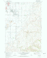
(20)- 1924 Map of Ammon, 1958 Print
 1924 Ammon1958 Print · USGSCovers Idaho Falls, including Ammon, Bone, and other nearby areas3 unique versions available
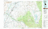
 - 1948 Map of Idaho Falls North, 1962 Print
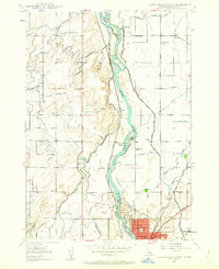 1948 Idaho Falls North1962 Print · USGSCovers Idaho Falls, including North Idaho Falls, Bonneville County, and other nearby areas4 unique versions available
 - 1948 Map of Idaho Falls South, 1965 Print
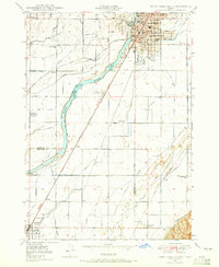 1948 Idaho Falls South1965 Print · USGSCovers Idaho Falls, including Taylorville, Gerrard, and other nearby areas3 unique versions available
 - 1948 Map of Ucon, 1973 Print
 1948 Ucon1973 Print · USGSCovers Idaho Falls, including Ammon, Iona, and other nearby areas3 unique versions available
 - 1949 Map of Ucon
 1949 Ucon1949 Print · USGSCovers Idaho Falls, including Ammon, Iona, and other nearby areas
 - 1949 Map of Idaho Falls North
 1949 Idaho Falls North1949 Print · USGSCovers Idaho Falls, including North Idaho Falls, Bonneville County, and other nearby areas
 - 1949 Map of Roberts, 1959 Print
 1949 Roberts1959 Print · USGSCovers Idaho Falls, including Menan, Roberts, and other nearby areas
 - 1950 Map of Idaho Falls South
 1950 Idaho Falls South1950 Print · USGSCovers Idaho Falls, including Taylorville, Gerrard, and other nearby areas
 - 1950 Map of Rigby, 1953 Print
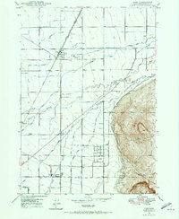
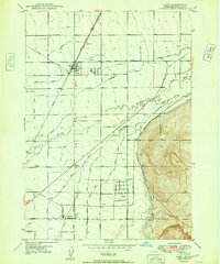
 1950 Rigby1953 Print · USGSCovers Idaho Falls, including Ammon, Rigby, and other nearby areas
 - 1955 Map of Idaho Falls, 1963 Print
 1955 Idaho Falls1963 Print · USGSCovers Idaho Falls, including Blackfoot, Arco, and other nearby areas5 unique versions available
 - 1955 Map of Driggs, 1967 Print
 1955 Driggs1967 Print · USGSCovers Idaho Falls, including Rexburg, Ammon, and other nearby areas3 unique versions available
 - 1958 Map of Driggs
 1958 Driggs1958 Print · USGSCovers Idaho Falls, including Rexburg, Ammon, and other nearby areas2 unique versions available
 - 1958 Map of Idaho Falls
 1958 Idaho Falls1958 Print · USGSCovers Idaho Falls, including Blackfoot, Arco, and other nearby areas2 unique versions available
 - 1962 Map of Driggs
 1962 Driggs1962 Print · USGSCovers Idaho Falls, including Rexburg, Ammon, and other nearby areas
 - 1976 Map of Idaho Falls South, 1981 Print
 1976 Idaho Falls South1981 Print · USGSCovers Idaho Falls, including Taylorville, Gerrard, and other nearby areas
 - 1978 Map of Blackfoot, 1997 Print
 1978 Blackfoot1997 Print · USGSCovers Idaho Falls, including Blackfoot, Firth, and other nearby areas
 - 1980 Map of Circular Butte
 1980 Circular Butte1980 Print · USGSCovers Idaho Falls, including Menan, Roberts, and other nearby areas
 - 1981 Map of Ammon
 1981 Ammon1981 Print · USGSCovers Idaho Falls, including Ammon, Blackhawk, and other nearby areas3 unique versions available
 - 1986 Map of Palisades, 1987 Print
 1986 Palisades1987 Print · USGSCovers Idaho Falls, including Ammon, Alpine, and other nearby areas2 unique versions available
 - 1988 Map of Rexburg, 1989 Print
 1988 Rexburg1989 Print · USGSCovers Idaho Falls, including Rexburg, Ammon, and other nearby areas
End of results
Showing maps 1-20 of 20
Top cities near Idaho Falls
- Ammon historical maps
- Rigby historical maps
- Iona historical maps
- Ucon historical maps
- Menan historical maps
- Roberts historical maps
See more
Top neighborhoods of Idaho Falls
- North Idaho Falls historical maps
- South Idaho Falls historical maps
- Downtown historical maps
- Snake River Landing historical maps
- West Idaho Falls historical maps
Frequently asked questions
- What are the different types of historical maps available for Idaho Falls?
- What is the oldest map of Idaho Falls?
- Where can I purchase historical maps of Idaho Falls for my home or office?
- Where can I download high-res historical maps of Idaho Falls?
- Are there historical topographic maps available for Idaho Falls?
- Is there historical aerial imagery available for Idaho Falls?
- Where are historical maps of Idaho Falls sourced from?