1970s Maps of Butte County, Idaho
Explore 31 historic maps of Butte County from the 1970s. These maps offer a rare glimpse into what life looked like during the 1970s — showing old roads, neighborhoods, homes, and landmarks that have changed or disappeared over time.
Whether you're researching your family's past, planning a metal detecting trip, or studying how Butte County's landscape evolved across the 1970s, these high-resolution maps are a powerful tool for exploring the history of this region.
- Focus on a specific era: All maps on this page are from the 1970s, giving you a focused view of this time period.
- See what’s changed: Compare century-old streets, trails, and buildings to today's modern landscape using overlays and satellite layers.
- Research with precision: Use these maps for genealogy, historical research, land use analysis, or educational projects.
- View, download, or print: Maps are fully viewable online in high resolution, and can be downloaded or printed for your own records.
Start exploring Butte County's history through authentic maps from the 1970s. This is your window into the past.
Butte County, ID maps
(31)- 1972 Map of Quaking Aspen Butte, 1975 Print
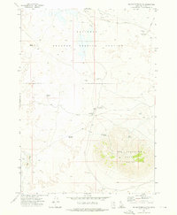
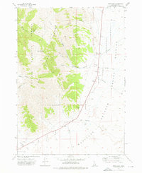
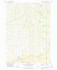
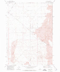
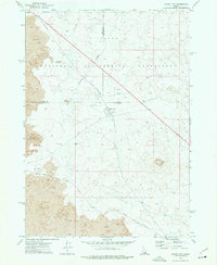
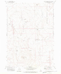 1972 Quaking Aspen Butte1975 Print · USGSButte County's high-desert landscape is captured here in the early seventies, dominated by the volcanic peaks and federal installations of the Snake River Plain. Trace remote landmarks like the Quaking Aspen Butte Landing Strip and the border of the National Reactor Testing Station.
 - 1972 Map of North Laidlaw Butte, 1975 Print
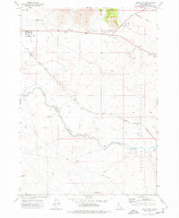
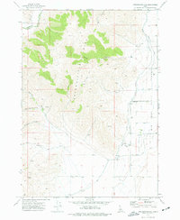
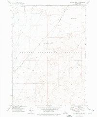
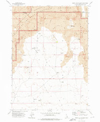 1972 North Laidlaw Butte1975 Print · USGSThe volcanic landscape of southern Idaho is captured in the early seventies, where lava flows meet high desert terrain. Researchers can trace remote infrastructure like the Hollow Top Landing Strip and isolated water sources such as Ellsworth Well and Snowdrift Reservoir.
 - 1972 Map of Arco North, 1976 Print
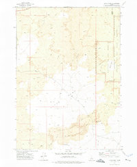
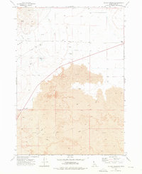
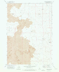
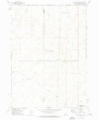
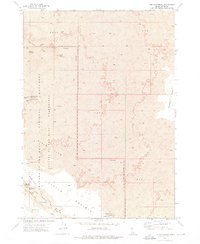
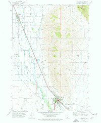 1972 Arco North1976 Print · USGSButte County ranching and irrigation are in focus during the early seventies as the desert valley meets the forest edge. Local historians can trace the Union Pacific rail corridor and find landmarks like the Butte Co High Sch, Hillcrest Cem, and the Natural Arch within the Challis National Forest.
 - 1972 Map of Arco Hills SE, 1976 Print
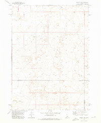
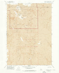
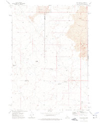
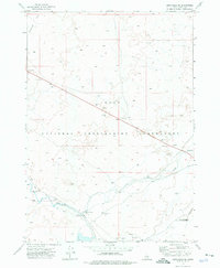 1972 Arco Hills SE1976 Print · USGSCentral Idaho in the early seventies shows a landscape transformed by nuclear research and desert infrastructure. You can trace the Big Lost River along the Union Pacific tracks or locate the Experimental Breeder Reactor No 1.
 - 1972 Map of Big Southern Butte, 1976 Print
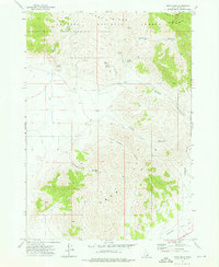
 1972 Big Southern Butte1976 Print · USGSThe Snake River Plain in the early seventies shows a unique overlap of frontier ranching and Cold War technology. Researchers can trace specialized sites like the Naval Ordnance Test Facility and Frenchmans Cabin near the massive Big Southern Butte.
 - 1972 Map of Little Park, 1976 Print
 1972 Little Park1976 Print · USGSBlaine County ranching and volcanic geology meet in the early 1970s at the edge of the Snake River Plain. Trace the historic monument boundary and find remote water sources like Indian Well and the Laidlaw Park Holding Corral.
 - 1972 Map of Pratt Butte, 1976 Print
 1972 Pratt Butte1976 Print · USGSThe volcanic Snake River Plain comes into sharp focus in the early 1970s, revealing a landscape defined by the Great Rift. Geologists and researchers can trace the extent of Lava flows, locate the Devils Caldron, and find isolated water sources like Heifer Reservoir.
 - 1972 Map of Arco South, 1976 Print
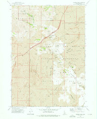
 1972 Arco South1976 Print · USGSThe high desert landscape of Idaho's Butte County was a study in water and volcanic rock in the early seventies. Trace the Union Pacific rail corridor near Arco or follow irrigation landmarks like the Big Lost River and the Siphon.
 - 1972 Map of Howe Peak, 1976 Print
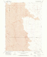
 1972 Howe Peak1976 Print · USGSThe high desert of Butte County meets the mountains in the early seventies, where the Lost River Range looms over federal research land. Researchers can trace the boundaries of the National Reactor Testing Station and locate landmarks like Howe Peak and Grafton.
 - 1972 Map of Butte City, 1976 Print
 1972 Butte City1976 Print · USGSButte City stands at the edge of the high desert in the 1970s, where the valley floor meets the restricted lands of the nuclear frontier. Researchers can trace the path of the Union Pacific rail line as it skirts Deadman Flat and the deep cut of Box Canyon.
 - 1972 Map of Nichols Reservoir, 1976 Print
 1972 Nichols Reservoir1976 Print · USGSThe volcanic Snake River Plain is captured here in the early seventies, showing a land defined by basalt flows and irrigation. Trace the intersection of ranching and geology through Soelberg Ranch, the Blaine Canal, and the extensive Lava Crack formations.
 - 1972 Map of Sunset Lake, 1976 Print
 1972 Sunset Lake1976 Print · USGSThe Idaho backcountry at the start of the 1970s reveals a vast, undeveloped landscape where Butte, Blaine, and Bingham counties converge. Researchers can trace the minimal paths of a Jeep Trail reaching out toward Sunset Lake and Rock Corral Butte.
 - 1972 Map of Arco Hills, 1976 Print
 1972 Arco Hills1976 Print · USGSThe Arco Hills and the southern Lost River Range are captured here in the early seventies, showing a landscape used primarily for ranching. Researchers can trace land use through named features like Walker Spring, Combe Reservoir, and Deadman Flat.
 - 1972 Map of Fingers Butte, 1976 Print
 1972 Fingers Butte1976 Print · USGSButte County, Idaho, is defined by its volcanic geology and high-desert terrain during the early 1970s. Researchers can trace the layout of remote water sources and landmarks like Sage Brush Reservoir, Huddles Hole, and the prominent Fingers Butte.
 - 1972 Map of Serviceberry Butte, 1976 Print
 1972 Serviceberry Butte1976 Print · USGSHigh-desert ranching and volcanic terrain define this corner of Idaho in the 1970s. Researchers can trace remote water improvements and livestock sites like Smith Corrals, Coxs Well, and Rattlesnake Water Hole No 1.
 - 1972 Map of Inferno Cone, 1976 Print
 1972 Inferno Cone1976 Print · USGSThe volcanic high desert of Butte County is captured here in the early seventies, detailing the stark volcanic landscape of Craters of the Moon. Geologists and explorers can trace the extent of the Blue Dragon Flow or locate features like the Martin Mine and Buffalo Caves.
 - 1972 Map of Blizzard Mtn South, 1976 Print
 1972 Blizzard Mtn South1976 Print · USGSHigh in the Pioneer Mountains during the early 1970s, this area shows the intersection of mining history and volcanic geology. Trace the remote Paymaster Mine, the volcanic basin of Lava Lake, and old jeep trails through Barn Canyon.
 - 1972 Map of Appendicitis Hill, 1977 Print
 1972 Appendicitis Hill1977 Print · USGSThe high desert of Butte County during the early 1970s shows a landscape of mountain canyons meeting the irrigated valley floor. Trace local genealogy and ranching history through the Lost River Cem, the Corral, and Sorensen Spring along the river.
 - 1973 Map of Little Butte NW, 1976 Print
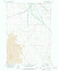
 1973 Little Butte NW1976 Print · USGSThe Snake River Plain in the early seventies reveals the technical landscape of the Idaho National Engineering Laboratory. Researchers can trace the path of Lincoln Boulevard and locate specific sites like a Borrow Pit and a remote Well.
 - 1973 Map of Fissure Butte, 1976 Print
 1973 Fissure Butte1976 Print · USGSBlaine and Butte counties meet in this volcanic landscape during the early 1970s, showcasing the expansion of federal protected lands. Geologists and local historians can trace the Sheep Trail past isolated features like Split Butte and the natural Bridge of the Moon.
 - 1973 Map of Scoville, 1976 Print
 1973 Scoville1976 Print · USGSThe high-desert research landscape of Butte County is shown here in the early seventies, dominated by federal infrastructure. Map collectors and researchers can trace the Government Railroad serving Scoville and the Idaho National Engineering Laboratory.
 - 1973 Map of Circular Butte 3 NE, 1976 Print
 1973 Circular Butte 3 NE1976 Print · USGSThe high desert of Butte County is seen here during the early 1970s, focused on the highly controlled Idaho National Engineering Laboratory. Researchers can trace the path of the Big Lost River and the isolated route of Lincoln Boulevard across the lava plains.2 unique versions available
 - 1973 Map of The Watchman, 1976 Print
 1973 The Watchman1976 Print · USGSThe volcanic expanse of Butte County comes into focus in the early 1970s, detailing the complex subterranean world of the high desert. Researchers and explorers can trace the locations of the Lava River Cave, Tom Thumb Tunnel, and the remote Surprise Waterhole.
 - 1973 Map of Rock Butte, 1976 Print
 1973 Rock Butte1976 Print · USGSSoutheast Idaho in the early seventies is recorded here as a landscape of basalt and survival along the Butte County line. Researchers can trace the remote network of a Jeep Trail connecting isolated water sites like Moose Res and Rock Butte.
 - 1973 Map of Atomic City, 1976 Print
 1973 Atomic City1976 Print · USGSThe high desert plains of Bingham County were undergoing unique development in the early 1970s at the height of the atomic age. Researchers can trace the infrastructure of the Idaho National Engineering Laboratory and the small settlement of Atomic City near landmarks like Table Legs Butte.
Showing maps 1-25 of 31
Top cities of Butte County
Frequently asked questions
- What are the different types of historical maps available for Butte County?
- What is the oldest map of Butte County?
- Where can I purchase historical maps of Butte County for my home or office?
- Where can I download high-res historical maps of Butte County?
- Are there historical topographic maps available for Butte County?
- Is there historical aerial imagery available for Butte County?
- Where are historical maps of Butte County sourced from?