Old Maps of Butte County, Idaho for Hiking & Exploration
Hike through history with 369 historic maps of Butte County. Explore old trails, ghost towns, and forgotten backroads — perfect for outdoor adventurers and local explorers.
- Rediscover forgotten places: Map out old mining camps, roads, and footpaths that no longer exist on modern maps.
- Layer with modern tools: Combine with LiDAR or satellite views to plan hikes through historical terrain.
- Made for exploration: Popular among hikers, overlanders, and local history lovers.
Use these maps to find adventure and explore the hidden past of Butte County.
Butte County, ID maps
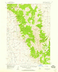
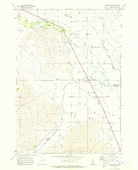
(369)- 1935 Map of MacKay
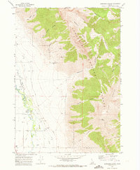
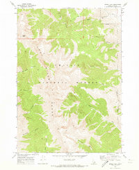
 1935 MacKay1935 Print · USGSCuster County was a rugged center of mining and irrigation in the mid-1930s. Genealogists and historians can trace high-altitude homesteads and industry through Mackay, the Star O Hope Mine, and rural schools like Franklin Sch.
 - 1955 Map of Dubois
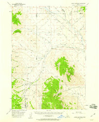
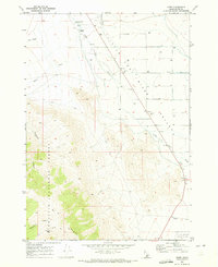
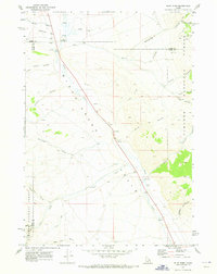
 1955 Dubois1955 Print · USGSThe high desert and mountain passes of eastern Idaho and western Montana are captured here during the mid-fifties. Researchers can trace the Union Pacific rail line through Dubois or locate the National Reactor Testing Station.4 unique versions available
 - 1955 Map of Idaho Falls, 1963 Print
 1955 Idaho Falls1963 Print · USGSThe Snake River Plain and its surrounding volcanic peaks are captured in the late fifties, showing the region's unique mix of nuclear research and high-desert ranching. Trace the industrial footprint of the National Reactor Testing Station or find old mining sites like Empire Mine.5 unique versions available
 - 1957 Map of Diamond Peak, 1958 Print
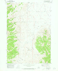
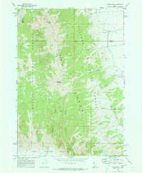
 1957 Diamond Peak1958 Print · USGSThe high Lemhi Range of the late fifties reveals a landscape defined by mining prospects and mountain hydrology. Genealogists and historians can trace early activity at Clyde, locate the Badger Mine, or identify family-named landmarks like Foss Mountain.3 unique versions available
 - 1957 Map of Hawley Mountain, 1959 Print
 1957 Hawley Mountain1959 Print · USGSHigh mountain peaks and arid valley basins define this Idaho backcountry in the late fifties. Genealogists and historians can trace high-altitude routes like Pass Creek Road through the Challis National Forest and locate seasonal landmarks such as Magpie Springs and Mulkey Bar.2 unique versions available
 - 1958 Map of Dubois
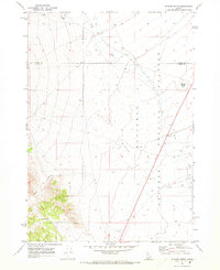
 1958 Dubois1958 Print · USGSThe high divide between Idaho and Montana comes alive in this mid-century survey, from the mining camps of the Lemhi Range to the ranchlands of Centennial Valley. Trace historic operations at the Copper Queen Mine, the route of the Union Pacific RR, and the scientific work at the Sheep experimental station.2 unique versions available
 - 1958 Map of Idaho Falls
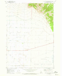
 1958 Idaho Falls1958 Print · USGSEastern Idaho in the late fifties showcases the rapid expansion of agricultural and scientific outposts across its volcanic plains. Researchers can locate remote sites like Atomic City, mineral interests at White Knob Mine, and the cultural grounds of St Marys Mission.2 unique versions available
 - 1960 Map of Muldoon Canyon, 1961 Print
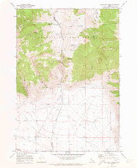
 1960 Muldoon Canyon1961 Print · USGSThe Pioneer Mountains during the early sixties were a landscape defined by high-altitude mining and national forest management. Trace the legacy of extraction at the Muldoon site, the Idaho Muldoon Mine, and the Eagle Bird Mine.3 unique versions available
 - 1960 Map of Grouse, 1961 Print
 1960 Grouse1961 Print · USGSAntelope Valley in the early 1960s was a landscape of remote mountain ranches and fading mining camps. Researchers can trace the heritage of vanished settlements at Martin (Site) or locate family landmarks like the Brockie Ranch and Antelope Cem.2 unique versions available
 - 1969 Map of Darlington, 1973 Print
 1969 Darlington1973 Print · USGSThe Big Lost River Valley in the late sixties reveals a landscape defined by complex irrigation and small rail-side settlements. Genealogists and historians can trace water rights and local landmarks like the Darlington Cem, the Union Ditch, and the aptly named Appendicitis Hill.2 unique versions available
 - 1969 Map of Arco Pass, 1973 Print
 1969 Arco Pass1973 Print · USGSButte County high country is documented here during the late sixties, showcasing the intersection of the Lost River Range and the Challis National Forest. Researchers can trace remote transit routes via the Jeep Trail and locate seasonal water sources like Hurst Creek and Arco Pass.2 unique versions available
 - 1969 Map of Little Lost River Sinks, 1973 Print
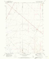
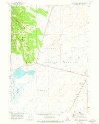
 1969 Little Lost River Sinks1973 Print · USGSThe Idaho desert in the late sixties shows the point where the mountains meet the subterranean. Researchers can trace the National Reactor Testing Station boundary and the former Berenice near the Little Lost River Sinks.
 - 1969 Map of Circular Butte, 1973 Print
 1969 Circular Butte1973 Print · USGSThe high Idaho desert in the late sixties reveals a unique landscape of atomic research and geological formations. Trace the boundaries of the National Reactor Testing Station alongside features like Circular Butte and the Birch Creek Sinks.
 - 1969 Map of Circular Butte NW, 1973 Print
 1969 Circular Butte NW1973 Print · USGSThe high desert of eastern Idaho was undergoing a period of specialized development in the late sixties as scientific testing expanded. Researchers can trace the boundaries of the National Reactor Testing Station and locate early infrastructure like Birch Creek and the Gravel Pit.
 - 1969 Map of Eightmile Canyon, 1973 Print
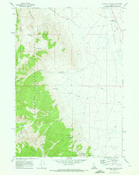 1969 Eightmile Canyon1973 Print · USGSThe eastern front of the Lemhi Range meets the Birch Creek Valley in this late-sixties Idaho survey. Local historians and researchers can locate the Indian Massacre Historical Monument and trace the historic route of the Mormon Trail.
 - 1969 Map of Richard Butte, 1973 Print
 1969 Richard Butte1973 Print · USGSThe high desert of Butte County during the late sixties shows the intersection of federal research and the volcanic landscape. Trace family history at Goddard Cem or explore the boundaries of the National Reactor Testing Station near Richard Butte.
 - 1969 Map of Tyler Peak, 1973 Print
 1969 Tyler Peak1973 Print · USGSThe high ridges of the Lemhi Range are captured here in the late sixties, marking the intersection of Butte and Clark counties. Hikers and historians can trace the high-mountain topography around Tyler Peak, locating isolated points like Kyle Spring and the winding Jeep Tr.2 unique versions available
 - 1969 Map of Ramshorn Canyon, 1973 Print
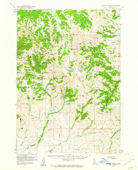
 1969 Ramshorn Canyon1973 Print · USGSThe Big Lost River Valley and the foothills of the Lost River Range are captured here in the late sixties, showcasing the area's irrigation and early ranching history. Researchers can locate the Pioneer Cem and trace water routes like the Moore Diversion or the Beck and Evan Ditch Road.2 unique versions available
 - 1969 Map of Howe, 1973 Print
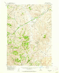
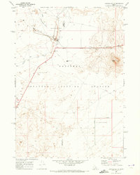
 1969 Howe1973 Print · USGSButte County, Idaho, during the late sixties reveals the intersection of mountain wilderness and modern research. Researchers can trace the water-management network of the Little Lost River or locate the boundaries of the National Reactor Testing Station near Jumpoff Peak.2 unique versions available
 - 1969 Map of Howe NW, 1973 Print
 1969 Howe NW1973 Print · USGSThe high desert of Butte County is documented here during the late sixties, where the mountains meet the Little Lost River Valley. Researchers can trace old fence lines and isolated water sources like Big Spring Creek and Uncle Ike Creek.2 unique versions available
 - 1969 Map of Howe NE, 1973 Print
 1969 Howe NE1973 Print · USGSThe Little Lost River Valley in the late sixties reveals a landscape shaped by mining and water management. Researchers can trace land use through the Diversion Dam, a remote Mine, and an isolated Grave located near the Challis National Forest boundary.
 - 1969 Map of Big Lost River Sinks, 1973 Print
 1969 Big Lost River Sinks1973 Print · USGSIdaho's high desert during the late sixties reveals the unique intersection of natural sinks and nuclear research. Researchers can trace the Big Lost River as it disappears into the Big Lost River Sinks near Lincoln Boulevard.
 - 1969 Map of Sunset Peak, 1973 Print
 1969 Sunset Peak1973 Print · USGSThe high ridge lines of the Lost River Range take center stage in this late-sixties study of the Idaho backcountry. Genealogists and historians can trace the network of Jeep Trails connecting remote landmarks like Sunset Peak, Cedarville Canyon, and Jepson Canyon.
 - 1969 Map of Blue Dome, 1973 Print
 1969 Blue Dome1973 Print · USGSBirch Creek Valley at the end of the sixties was a landscape of remote outposts and high-country canyon drainages. Researchers can locate the John Day Grave, identify old forest service sites like Kaufman Guard Station, and trace trails through Skull Canyon.
 - 1969 Map of Methodist Creek, 1973 Print
 1969 Methodist Creek1973 Print · USGSThe high peaks of the Challis National Forest meet the irrigated ranch lands of the Big Lost River Valley in the late 1960s. Researchers can locate remote landmarks like the Mtn View Guard Sta or trace the essential water routes of Hanson Ditch and Burnett Ditch.
Showing maps 1-25 of 369
Top cities of Butte County
Frequently asked questions
- What are the different types of historical maps available for Butte County?
- What is the oldest map of Butte County?
- Where can I purchase historical maps of Butte County for my home or office?
- Where can I download high-res historical maps of Butte County?
- Are there historical topographic maps available for Butte County?
- Is there historical aerial imagery available for Butte County?
- Where are historical maps of Butte County sourced from?