1990s Maps of Canyon County, Idaho
Explore 7 historic maps of Canyon County from the 1990s. These maps offer a rare glimpse into what life looked like during the 1990s — showing old roads, neighborhoods, homes, and landmarks that have changed or disappeared over time.
Whether you're researching your family's past, planning a metal detecting trip, or studying how Canyon County's landscape evolved across the 1990s, these high-resolution maps are a powerful tool for exploring the history of this region.
- Focus on a specific era: All maps on this page are from the 1990s, giving you a focused view of this time period.
- See what’s changed: Compare century-old streets, trails, and buildings to today's modern landscape using overlays and satellite layers.
- Research with precision: Use these maps for genealogy, historical research, land use analysis, or educational projects.
- View, download, or print: Maps are fully viewable online in high resolution, and can be downloaded or printed for your own records.
Start exploring Canyon County's history through authentic maps from the 1990s. This is your window into the past.
Canyon County, ID maps
(7)- 1992 Map of Walters Butte
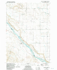
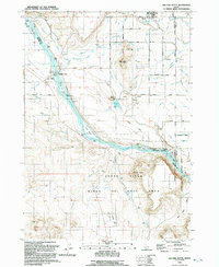 1992 Walters Butte1992 Print · USGSThe Snake River corridor in the early nineties reveals a landscape where ancient history meets modern irrigation. Trace the path of the river past Walters Ferry to find Petroglyphs, the Guffey Railroad Bridge, and the community of Melba.
 - 1992 Map of Opalene Gulch
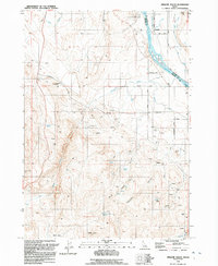 1992 Opalene Gulch1992 Print · USGSOwyhee County's rugged mineral and agricultural corridor is captured here in the early nineties, centered on the Snake River crossing at Riverside. Researchers can locate numerous Open Pit Mines and trace irrigation through the Deer Flat Canal.
 - 1992 Map of Wilson Peak
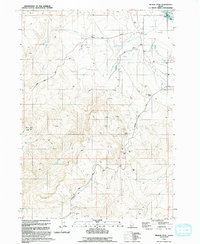 1992 Wilson Peak1992 Print · USGSOwyhee County ranching and mining lands are recorded here just after the turn of the nineties. Genealogists can trace family names at the Wilson Cemetery and Wilson Community Hall while researchers locate an Open Pit Mine or Prospect sites.
 - 1992 Map of Melba
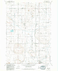 1992 Melba1992 Print · USGSCanyon County agriculture and irrigation come into focus in the early nineties, centered on the communities of Melba and Bowmont. Genealogists and local historians can trace family landmarks like the Scism School or the various water features including the Mora Canal and McElroy Butte.
 - 1992 Map of Givens Hot Springs
 1992 Givens Hot Springs1992 Print · USGSThe Snake River corridor comes alive in the early 1990s, showcasing the intricate balance of irrigation and river life. Researchers can trace the Bernard Ferry (Site), the ancient Map Rock, and the waters of Givens Hot Springs.
 - 1992 Map of Kuna
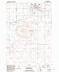 1992 Kuna1992 Print · USGSKuna and the surrounding High Desert are captured here in the early nineties as irrigation transformed the sagebrush steppe. Researchers can trace the path of the New York Canal and locate landmarks like Kuna Cave and Hubbard Sch.
 - 1993 Map of Vale
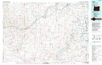 1993 Vale1993 Print · USGSEastern Oregon's river valleys and high desert plateaus are captured here in the early nineties, centered on the irrigation-rich lands of Malheur County. Researchers can locate the Miller Memorial Airpark, follow the Union Pacific rails, and trace the Owyhee River past Mitchell Butte.2 unique versions available
End of results
Showing maps 1-7 of 7
Top cities of Canyon County
- Nampa historical maps
- Caldwell historical maps
- Middleton historical maps
- Parma historical maps
- Wilder historical maps
- Greenleaf historical maps
See more
Frequently asked questions
- What are the different types of historical maps available for Canyon County?
- What is the oldest map of Canyon County?
- Where can I purchase historical maps of Canyon County for my home or office?
- Where can I download high-res historical maps of Canyon County?
- Are there historical topographic maps available for Canyon County?
- Is there historical aerial imagery available for Canyon County?
- Where are historical maps of Canyon County sourced from?