Old Maps of Canyon County, Idaho for Hiking & Exploration
Hike through history with 161 historic maps of Canyon County. Explore old trails, ghost towns, and forgotten backroads — perfect for outdoor adventurers and local explorers.
- Rediscover forgotten places: Map out old mining camps, roads, and footpaths that no longer exist on modern maps.
- Layer with modern tools: Combine with LiDAR or satellite views to plan hikes through historical terrain.
- Made for exploration: Popular among hikers, overlanders, and local history lovers.
Use these maps to find adventure and explore the hidden past of Canyon County.
Canyon County, ID maps
(161)- 1892 Map of Boise
 1892 Boise1892 Print · USGSThe Boise Valley and surrounding highlands are shown here in the early 1890s as irrigation and railroads transformed the Idaho territory. Researchers can trace the early city grid near Boise Barracks and the paths of the Idaho Central Railroad and the Settlers Canal.
 - 1892 Map of Bisuka
 1892 Bisuka1892 Print · USGSSouthern Idaho in the early 1890s was a land defined by the new Oregon Short Line Railroad and the deep cut of the canyon country. Researchers can trace early railroad stops at Bisuka and Kuna or locate the vital Boise Meridian reference at Initial Point.
 - 1892 Map of Silver City, 1962 Print
 1892 Silver City1962 Print · USGSOwyhee County was a center of industrial silver mining in the 1890s, with high-mountain camps and river crossings defining the local economy. Researchers can trace the layout of mining hubs like Silver City and De Lamar or locate the Warm Springs Ferry along the Snake River.2 unique versions available
 - 1894 Map of Bisuka
 1894 Bisuka1894 Print · USGSSouthern Idaho in the 1890s was a landscape defined by the arrival of the rails and the deep canyon of the Snake River. Genealogists and historians can trace the early path of the Oregon Short Line Railroad through Kuna and locate the vital Initial Point survey marker.6 unique versions available
 - 1894 Map of Silver City
 1894 Silver City1894 Print · USGSThe Owyhee mining district and Snake River valley were in their industrial prime during the 1890s. Genealogists and historians can trace high-country settlements like Silver City and De Lamar or locate river crossings such as Warm Springs Ferry.
 - 1897 Map of Boise
 1897 Boise1897 Print · USGSBoise and the surrounding valley are captured here in the late nineteenth century as irrigation and rail networks began to reshape the high desert. Researchers can trace early water rights through the Settlers Canal or locate historic sites like the Boise Barracks and the Natatorium.4 unique versions available
 - 1898 Map of Nampa
 1898 Nampa1898 Print · USGSThe Treasure Valley's transformation is visible in the 1890s as railroads and massive irrigation projects began to reshape the high desert. Researchers can trace the development of early rail lines like the Boise Nampa & Owyhee R. R. and early canals such as the Riverside Canal and Newman Canal.4 unique versions available
 - 1898 Map of Silver City
 1898 Silver City1898 Print · USGSThe silver-mining heart of Owyhee County is captured here in the late nineteenth century during its industrial peak. Genealogists and historians can trace old mining camps like Silver City and De Lamar, or locate river crossings such as Warm Springs Ferry.3 unique versions available
 - 1906 Map of Mitchell Butte
 1906 Mitchell Butte1906 Print · USGSEastern Oregon's high desert was being redefined by irrigation and ranching at the turn of the century. Genealogists and historians can trace early water rights through the Farmers Ditch network or locate remote family outposts like Isaacs Ranch and Prices Ranch.3 unique versions available
 - 1953 Map of Meridian, 1955 Print
 1953 Meridian1955 Print · USGSThe town of Meridian serves as a hub for the Boise Valley's irrigation network in the early fifties. Local historians can trace the development of rural education and industry through landmarks like Columbia School, Amity Sch, and the Union Pacific Railroad.4 unique versions available
 - 1953 Map of Star, 1955 Print
 1953 Star1955 Print · USGSNear the border of Ada and Canyon Counties in the early fifties, this map captures the intense irrigation culture of the Boise Valley. Genealogists can locate several rural schools and burial grounds including the Home of the Peace Cem and Lower Fairview School.3 unique versions available
 - 1955 Map of Boise, 1977 Print
 1955 Boise1977 Print · USGSThe Treasure Valley and Owyhee uplands are shown in detail during the mid-fifties, capturing the region's transition into a major agricultural and urban hub. Researchers can trace the Union Pacific line through Nampa, explore the volcanic Jordan Craters, or locate the historic mining district of Silver City.
 - 1957 Map of Walters Butte, 1958 Print
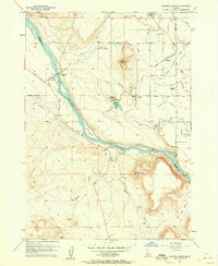 1957 Walters Butte1958 Print · USGSIn the Snake River canyon during the late 1950s, this area shows a sharp transition from high desert buttes to irrigated farmland. Genealogists and historians can trace the foundations of Melba, the location of the Glendale School, and the historic crossing at Walters Ferry.3 unique versions available
 - 1957 Map of Opalene Gulch, 1958 Print
 1957 Opalene Gulch1958 Print · USGSOwyhee County's high desert meets the river's edge in the late fifties, showcasing a complex irrigation landscape of canals and siphons. Genealogists and historians can locate the Opalene School, the Boy Scout Camp, and remote outposts like Upper Rats Nest Spring.2 unique versions available
 - 1957 Map of Wilson Peak, 1958 Print
 1957 Wilson Peak1958 Print · USGSOwyhee County at the end of the fifties is a landscape of high peaks and vital irrigation systems along the southern banks of the Snake River. Genealogists and historians can trace local landmarks like Wilson Cemetery, the Wilson Community Hall, and several remote mining Prospect sites.2 unique versions available
 - 1957 Map of Wilder, 1959 Print
 1957 Wilder1959 Print · USGSIn the late 1950s, the western Idaho borderlands near Homedale were defined by a complex irrigation network of canals and laterals. Researchers can trace the Union Pacific line through Wilder or locate the Arena Valley School and Fargo Cemetery.3 unique versions available
 - 1957 Map of Sands Basin, 1959 Print
 1957 Sands Basin1959 Print · USGSThe Owyhee backcountry in the late fifties shows a landscape of remote ranches and vital water sources before modern development changed the range. Genealogists and local historians can trace family sites like Bush Ranch and French John Hill, or find the old Opalene School and Boy Scout Camp.
 - 1957 Map of Notus, 1960 Print
 1957 Notus1960 Print · USGSIn the late fifties, the Boise River valley near Notus was a landscape defined by industrial rail and intensive irrigation. Researchers can trace rural school districts and family landmarks like Greenleaf Academy, Bowman Ranch, and Pleasant Ridge Cemetery.3 unique versions available
 - 1958 Map of Boise
 1958 Boise1958 Print · USGSThe Treasure Valley and Snake River Plain come alive in the mid-fifties as the rail-and-river economy transitions into a modern agricultural hub. Trace the Union Pacific lines through Nampa or locate remote landmarks like Initial Point and the Rockville settlement.2 unique versions available
 - 1958 Map of Kuna, 1959 Print
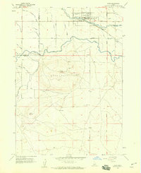 1958 Kuna1959 Print · USGSAgricultural expansion in southern Ada County is documented here during the late fifties as irrigation transformed the high desert. Researchers can trace the path of the Oregon Short Line Railroad and find local landmarks like Kuna Cave, the town Cem, and Kuna Butte.3 unique versions available
 - 1958 Map of Givens Hot Springs, 1959 Print
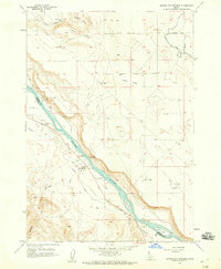 1958 Givens Hot Springs1959 Print · USGSThe Snake River valley in Southwest Idaho is captured here in the late fifties, showing the vital irrigation systems and historic river crossings. Genealogists and researchers can locate Givens Hot Springs and trace former river access at the Bernard Ferry (Site) or find the ancient Map Rock (Petroglyphs).2 unique versions available
 - 1958 Map of Middleton, 1959 Print
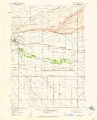 1958 Middleton1959 Print · USGSMiddleton and the surrounding Idaho countryside are mapped here in the late fifties, showing a valley shaped by the Boise River and the Union Pacific. Genealogists and researchers can locate several rural schoolhouses like Lone Tree School and trace the complex irrigation network of the Phyllis Canal and Mason Slough.3 unique versions available
 - 1958 Map of Lake Lowell, 1959 Print
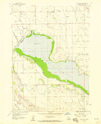 1958 Lake Lowell1959 Print · USGSCanyon County in the late fifties shows a landscape reshaped by irrigation, centered on the expansive Lake Lowell. Genealogists and historians can trace local landmarks like Lakeview School, Sage Acres Race Track, and the Deer Flat National Wildlife Refuge.3 unique versions available
 - 1958 Map of Nampa, 1960 Print
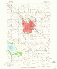 1958 Nampa1960 Print · USGSNampa and the Boise Valley are shown in detail during the late fifties, as the city expanded around its irrigation canals and railroad lines. Genealogists and historians can locate numerous local institutions, from Northwest Nazarene College to the Sugar Factory and many rural schools like Midway School.4 unique versions available
 - 1958 Map of Caldwell, 1960 Print
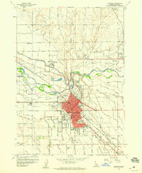 1958 Caldwell1960 Print · USGSCaldwell and its surrounding irrigation colonies are captured here in the late fifties as the regional agricultural economy reached its peak. Researchers can locate specific family-named landmarks and institutions like the College of Idaho, Gem State Academy, and the Caldwell Labor Camp.3 unique versions available
Showing maps 1-25 of 161
Top cities of Canyon County
- Nampa historical maps
- Caldwell historical maps
- Middleton historical maps
- Parma historical maps
- Wilder historical maps
- Greenleaf historical maps
See more
Frequently asked questions
- What are the different types of historical maps available for Canyon County?
- What is the oldest map of Canyon County?
- Where can I purchase historical maps of Canyon County for my home or office?
- Where can I download high-res historical maps of Canyon County?
- Are there historical topographic maps available for Canyon County?
- Is there historical aerial imagery available for Canyon County?
- Where are historical maps of Canyon County sourced from?