Old Maps of Fort Hall, Idaho for Metal Detecting
Plan your next treasure hunt with 37 historic maps of Fort Hall. Find old homesites, ghost towns, trails, and gathering spots that may be lost to time — perfect for identifying promising metal detecting locations.
- Locate forgotten sites: Uncover places like long-lost settlements, abandoned rail lines, or gathering spots.
- Plan better hunts: Use map overlays combined with LiDAR or satellite views to narrow in on historically rich areas.
- Made for detectorists: Thousands of hobbyists use these maps to discover relics, coins, and hidden history.
Use these historic maps to boost your research and find new opportunities beneath the surface of Fort Hall.
Fort Hall, ID maps
(37)- 1934 Map of Michaud, 1957 Print
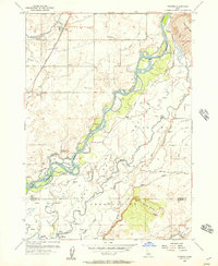
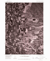
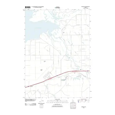
 1934 Michaud1957 Print · USGSThe Fort Hall Indian Reservation was undergoing significant changes in the 1930s as the American Falls Reservoir reshaped the valley. Genealogists and historians can trace the paths of the Oregon Trail, locate the Indian Cem, and find old rail stops at Schiller and Michaud.
 - 1937 Map of Pocatello
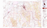
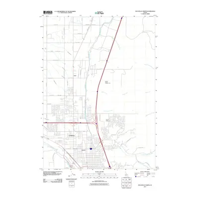
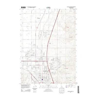
 1937 Pocatello1937 Print · USGSBannock County is captured in the late 1930s as a burgeoning rail and highway crossroads along the Portneuf River. Genealogists can locate family landmarks in old Alameda, trace the Fort Hall Mine, or find rural school sites like Blackrock Sch.3 unique versions available
 - 1937 Map of Michaud
 1937 Michaud1937 Print · USGSThe Fort Hall Indian Reservation and its mid-century transportation networks are documented here just as the aviation age was taking flight. Genealogists and historians can trace family-named sites and early infrastructure like the Indian School, Indian Cem, and the path of the Old Oregon Trail.
 - 1940 Map of Blackfoot, 1958 Print
 1940 Blackfoot1958 Print · USGSBingham County at the dawn of the 1940s reveals a landscape defined by the Snake River and a vast irrigation network. Genealogists and historians can trace the Fort Hall Indian Reservation boundaries, find School No 12, and locate the Indian Agency and Ross Fork Indian Sch.
 - 1943 Map of Blackfoot
 1943 Blackfoot1943 Print · USGSSoutheastern Idaho's river valleys and irrigation networks are on full display in the early 1940s, centered on the confluence of the Snake River and Blackfoot River. Genealogists and historians can trace family-named waterworks like Wearyrick Ditch and explore the historic layout of the Fort Hall Indian Reservation and Blackfoot.2 unique versions available
 - 1944 Map of Pocatello
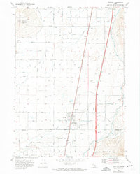
 1944 Pocatello1944 Print · USGSBannock County and the Fort Hall Indian Reservation are captured here in the years leading up to the second World War. Researchers can trace the early streets of Pocatello and Alameda, or locate rural landmarks like the Portneuf Sch and the Fort Hall Mine.
 - 1954 Map of Pocatello, 1963 Print
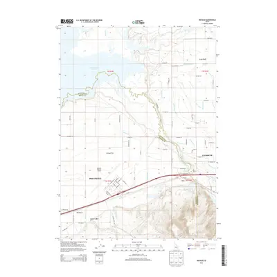
 1954 Pocatello1963 Print · USGSSoutheast Idaho in the mid-1950s reveals a landscape shaped by massive water reclamation and mountain forests. Researchers can trace the development of the Fort Hall Indian Reservation or locate specific landmarks like the Arbon P O and Emerson School.4 unique versions available
 - 1955 Map of Pingree, 1957 Print
 1955 Pingree1957 Print · USGSThe Snake River plain in the mid-fifties shows a landscape of deep historical layers, where the Route of Old Oregon Trail crosses the Fort Hall Indian Reservation. Trace early transit and water rights through the Union Pacific tracks, local cemeteries, and the Aberdeen Springfield Canal.4 unique versions available
 - 1955 Map of Idaho Falls, 1963 Print
 1955 Idaho Falls1963 Print · USGSThe Snake River Plain and its surrounding volcanic peaks are captured in the late fifties, showing the region's unique mix of nuclear research and high-desert ranching. Trace the industrial footprint of the National Reactor Testing Station or find old mining sites like Empire Mine.5 unique versions available
 - 1958 Map of Idaho Falls
 1958 Idaho Falls1958 Print · USGSEastern Idaho in the late fifties showcases the rapid expansion of agricultural and scientific outposts across its volcanic plains. Researchers can locate remote sites like Atomic City, mineral interests at White Knob Mine, and the cultural grounds of St Marys Mission.2 unique versions available
 - 1958 Map of Pocatello
 1958 Pocatello1958 Print · USGSSoutheastern Idaho in the late fifties was a landscape of expanding reservoirs and historic trails. Genealogists and historians can trace the Old Oregon Trail, locate the Bannock Creek Indian Day School, and study the many Union Pacific rail sidings.2 unique versions available
 - 1971 Map of Fort Hall, 1974 Print
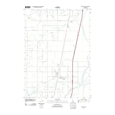
 1971 Fort Hall1974 Print · USGSThe Fort Hall Indian Reservation in the early seventies shows a complex landscape of irrigation and rail. Genealogists and historians can trace local landmarks like Fort Hall Indian Agency, Good Shepherd Cem, and the prominent Ferry Butte.
 - 1971 Map of Pocatello North, 1974 Print
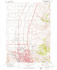 1971 Pocatello North1974 Print · USGSNorth of Pocatello during the early seventies, the landscape shows a transition from the Fort Hall Indian Reservation Boundary to growing suburban tracts. Local historians can trace development through labels for the Drive-in Theater, Chubbuck School, and the Union Pacific line.2 unique versions available
 - 1971 Map of Michaud, 1974 Print
 1971 Michaud1974 Print · USGSPower County and the Fort Hall Indian Reservation meet here in the early seventies as the Portneuf River feeds the reservoir. Genealogists and historians can trace family-named roads and sites like Reider Cemetery, Indian Cem, and the settlement of Michaud.4 unique versions available
 - 1974 Map of Pocatello North, 1975 Print
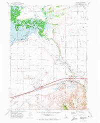
 1974 Pocatello North1975 Print · USGSSoutheastern Idaho's urban-rural boundary is captured in the mid-1970s as the northern expansion of Pocatello meets the surrounding farmland. Genealogists and local historians can trace the development of Chubbuck and the rural outpost of Tyhee along the Portneuf River valley.
 - 1978 Map of Blackfoot, 1997 Print
 1978 Blackfoot1997 Print · USGSThe Snake River Valley in the late 1970s shows a landscape of volcanic lava flows meeting intensive irrigation. Genealogists and local historians can trace the irrigation canals and rail towns from Atomic City to the Fort Hall Indian Reservation and Gay Mine.
 - 1984 Map of Pocatello
 1984 Pocatello1984 Print · USGSSoutheast Idaho in the early eighties centers on the industrial and rail corridor between Pocatello and the Snake River. Genealogists and historians can trace routes through the Fort Hall Indian Reservation or locate family sites near American Falls and Lava Hot Springs.2 unique versions available
 - 2010 Map of Fort Hall, 2010 Print
 2010 Fort Hall2010 Print · USGSCovers Fort Hall, including Gibson, Bannock County, and other nearby areas
 - 2010 Map of Pingree, 2010 Print
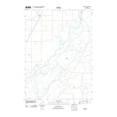 2010 Pingree2010 Print · USGSCovers Fort Hall, including Pingree, Bannock County, and other nearby areas
 - 2010 Map of Pocatello North, 2010 Print
 2010 Pocatello North2010 Print · USGSCovers Fort Hall, including Pocatello, Tyhee, and other nearby areas
 - 2010 Map of Michaud, 2010 Print
 2010 Michaud2010 Print · USGSCovers Fort Hall, including Pocatello, Arbon Valley, and other nearby areas
 - 2013 Map of Pingree, 2013 Print
 2013 Pingree2013 Print · USGSCovers Fort Hall, including Pingree, Bannock County, and other nearby areas
 - 2013 Map of Fort Hall, 2013 Print
 2013 Fort Hall2013 Print · USGSCovers Fort Hall, including Gibson, Bannock County, and other nearby areas
 - 2013 Map of Pocatello North, 2013 Print
 2013 Pocatello North2013 Print · USGSCovers Fort Hall, including Pocatello, Tyhee, and other nearby areas
 - 2013 Map of Michaud, 2013 Print
 2013 Michaud2013 Print · USGSCovers Fort Hall, including Pocatello, Arbon Valley, and other nearby areas
Showing maps 1-25 of 37
Top cities near Fort Hall
Frequently asked questions
- What are the different types of historical maps available for Fort Hall?
- What is the oldest map of Fort Hall?
- Where can I purchase historical maps of Fort Hall for my home or office?
- Where can I download high-res historical maps of Fort Hall?
- Are there historical topographic maps available for Fort Hall?
- Is there historical aerial imagery available for Fort Hall?
- Where are historical maps of Fort Hall sourced from?