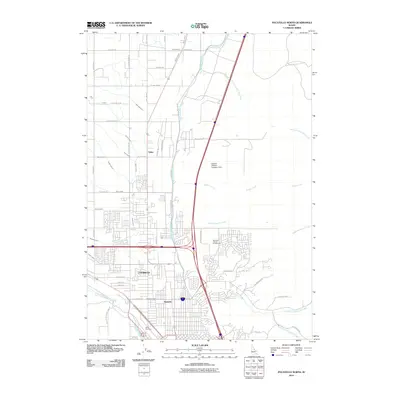
2010 Map of Pocatello North
USGS Topo · Published 2010About this map
Chubbuck and the surrounding northern reaches of the Pocatello urban area are defined by a complex grid of residential expansion and agricultural water management at the start of the 2010s. The landscape is heavily marked by its irrigation infrastructure, featuring an extensive network of laterals such as the Tyhee Lateral and Baker Lateral, alongside the prominent Fort Hall Main Canal. This intricate system supports the valley's transition from rural acreage to suburban development. Cultural landmarks like the Bannock County Fairgrounds sit near the major highway intersection, while the Simplot Effluent Irrigation Dam reflects the region's industrial and agricultural utility. To the south, the Portneuf River and Pocatello Creek weave through the growing neighborhoods of Alameda and North Pocatello, providing a clear view of how the city's modern footprint has followed the natural topography of the river valley.
Find a feature on this map
55 named features on this map. Tap any name to fly to it.
Don’t see what you’re looking for? This feature index may not catch every label — zoom into the map to look around manually.
Map Details
Editions of this 2010 Pocatello North Map
This is the sole edition of this map. No revisions or reprints were ever made.
Other maps of this area

1934 · Michaud
USGS Topo · 1:62,500

1937 · Pocatello
USGS Topo · 1:48,000

1937 · Michaud
USGS Topo · 1:62,500

1940 · Blackfoot
USGS Topo · 1:62,500

1943 · Blackfoot
USGS Topo · 1:62,500

1944 · Pocatello
USGS Topo · 1:62,500

1954 · Pocatello
USGS Topo · 1:250,000

1955 · Pingree
USGS Topo · 1:24,000

1955 · Idaho Falls
USGS Topo · 1:250,000

1958 · Idaho Falls
USGS Topo · 1:250,000