Old Maps of Dayton, Idaho for Genealogy
Trace your family roots with 34 historic maps of Dayton. These high-res maps reveal old neighborhoods, homesites, landmarks, and streets — helping you uncover where your ancestors lived and how the area evolved over time.
- Explore historic neighborhoods: Identify where your relatives may have lived in the 1800s or 1900s.
- Compare maps over time: Trace the changes in streets, buildings, and landmarks for multi-generational research.
- Perfect for genealogy & ancestry research: Used by family historians and researchers to map out lineage and migration.
These maps are an incredible resource for exploring your personal connection to Dayton's past.
Dayton, ID maps
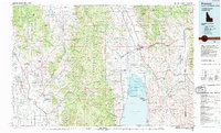
(34)- 1915 Map of Preston
 1915 Preston1915 Print · USGSSoutheastern Idaho and northern Utah are defined by their river valleys and early irrigation networks during the mid-1910s. Genealogists can locate family landmarks like the Thatcher Meetinghouse, Egypt School, and the path of the Oregon Short Line.2 unique versions available
 - 1918 Map of Preston
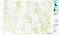
 1918 Preston1918 Print · USGSSouthern Idaho and northern Utah are captured just before the close of the Great War, showing a landscape of burgeoning farm towns and irrigation canals. Researchers can trace the Oregon Short Line to early settlements like Preston or locate rural landmarks like the Thatcher Meetinghouse and Egypt School.2 unique versions available
 - 1954 Map of Pocatello, 1963 Print
 1954 Pocatello1963 Print · USGSSoutheast Idaho in the mid-1950s reveals a landscape shaped by massive water reclamation and mountain forests. Researchers can trace the development of the Fort Hall Indian Reservation or locate specific landmarks like the Arbon P O and Emerson School.4 unique versions available
 - 1955 Map of Preston, 1968 Print
 1955 Preston1968 Print · USGSSoutheast Idaho and western Wyoming are shown in detail during the mid-fifties, from the high Bear River Range to the Green River Basin. Genealogists and collectors can trace the Union Pacific RR through historic towns like Preston, Montpelier, and Afton.3 unique versions available
 - 1958 Map of Pocatello
 1958 Pocatello1958 Print · USGSSoutheastern Idaho in the late fifties was a landscape of expanding reservoirs and historic trails. Genealogists and historians can trace the Old Oregon Trail, locate the Bannock Creek Indian Day School, and study the many Union Pacific rail sidings.2 unique versions available
 - 1958 Map of Preston
 1958 Preston1958 Print · USGSThe high valleys of the Idaho and Wyoming borderlands are captured here in the late fifties, showcasing a landscape of mountain ranching and phosphate mining. Genealogists and historians can locate early settlements like Chesterfield and Bedford or trace the Union Pacific rail lines serving Cokeville.2 unique versions available
 - 1962 Map of Preston
 1962 Preston1962 Print · USGSSoutheast Idaho and the Wyoming borderlands are captured here in the early sixties, a time of thriving agricultural valleys and mountain ranching. Researchers can trace the Union Pacific rail lines and find legacy settlements like Montpelier, Afton, and Preston.
 - 1968 Map of Clifton, 1971 Print
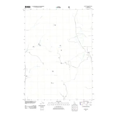
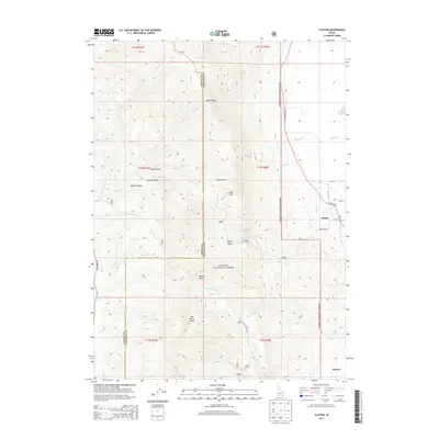
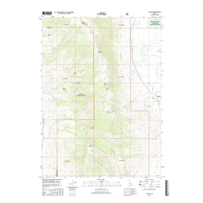
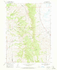 1968 Clifton1971 Print · USGSIn the late sixties, the ranching country near Clifton remained a world of mountain basins and complex water rights. Genealogists and local historians can trace the paths of the Pack Trail through North Fork Mine Hollow or locate high-elevation landmarks like Weston Peak and Davis Basin.3 unique versions available
 - 1968 Map of Weston Canyon, 1971 Print
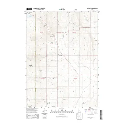
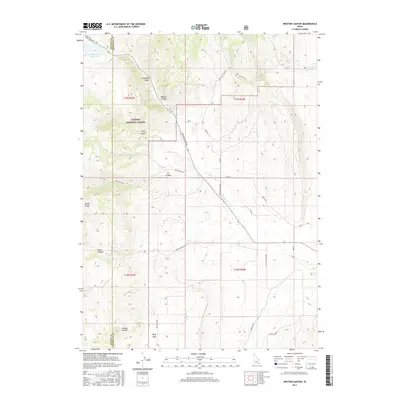
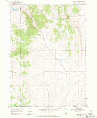 1968 Weston Canyon1971 Print · USGSFranklin and Oneida counties meet in this late-1960s survey of the Idaho-Utah borderlands, where mountain canyons give way to high-desert flats. Genealogists and historians can locate remote landmarks like Standing Rock, Weston Creek Reservoir, and the Washboards.2 unique versions available
 - 1969 Map of Weston, 1973 Print
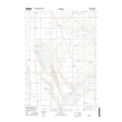
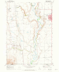 1969 Weston1973 Print · USGSFranklin County's irrigation and rail network are on full display in the late 1960s, centered on the growing hubs of Preston and Weston. Researchers can trace the Union Pacific line past local landmarks like the Little Santa Anita Racetrack and the Historical Monument near Dayton.2 unique versions available
 - 1969 Map of Banida, 1973 Print
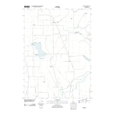
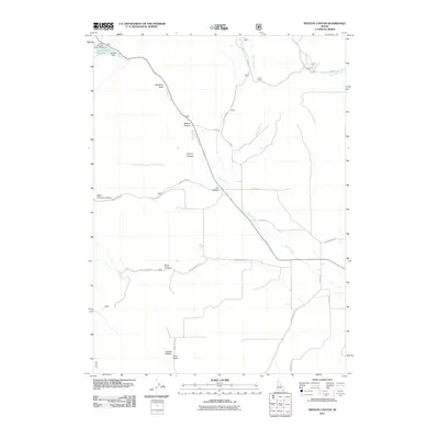
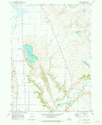 1969 Banida1973 Print · USGSFranklin County's irrigation and rail landscape is captured here in the late sixties as agricultural development shaped the valley. Genealogists and local historians can trace family roots through small settlements like Banida and Dayton or locate the Pioneer Women Historical Monument and Wayland Hot Springs.
 - 1983 Map of Preston
 1983 Preston1983 Print · USGSSoutheast Idaho and the tri-state border region thrived on a mix of mountain agriculture and rail transport in the early eighties. Genealogists and historians can trace the Union Pacific corridor through Preston or locate family landmarks in Mound Valley and Paris.
 - 1984 Map of Malad City
 1984 Malad City1984 Print · USGSSoutheastern Idaho in the mid-eighties shows a landscape of high valleys and prominent ranges between the Malad and Curlew basins. Genealogists and historians can trace the foundations of local ranching communities like Samaria, Holbrook, and Arbon, or locate the Black Pine Bird Sanctuary.2 unique versions available
 - 2010 Map of Banida, 2010 Print
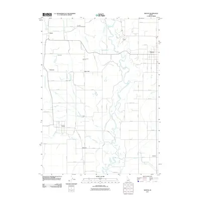
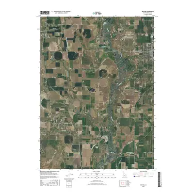
 2010 Banida2010 Print · USGSCovers Dayton, including Preston, Clifton, and other nearby areas
 - 2011 Map of Clifton, 2011 Print
 2011 Clifton2011 Print · USGSCovers Dayton, including Clifton, Franklin County, and other nearby areas
 - 2011 Map of Weston Canyon, 2011 Print
 2011 Weston Canyon2011 Print · USGSCovers Dayton, including Franklin County, Oneida County, and other nearby areas
 - 2011 Map of Weston, 2011 Print
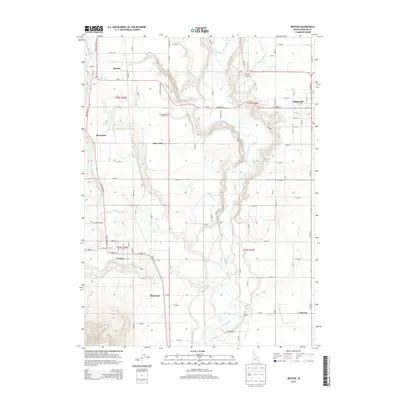
 2011 Weston2011 Print · USGSCovers Dayton, including Preston, Weston, and other nearby areas
 - 2013 Map of Weston, 2013 Print
 2013 Weston2013 Print · USGSCovers Dayton, including Preston, Weston, and other nearby areas
 - 2013 Map of Banida, 2013 Print
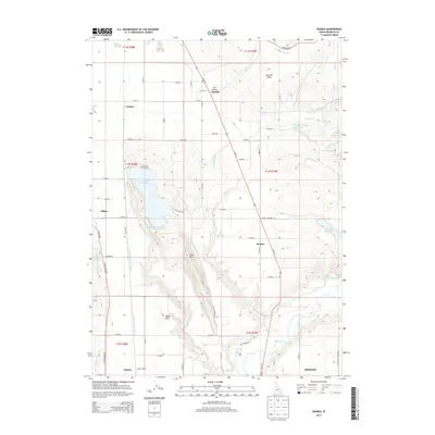 2013 Banida2013 Print · USGSCovers Dayton, including Preston, Clifton, and other nearby areas
 - 2013 Map of Weston Canyon, 2013 Print
 2013 Weston Canyon2013 Print · USGSCovers Dayton, including Franklin County, Oneida County, and other nearby areas
 - 2013 Map of Clifton, 2013 Print
 2013 Clifton2013 Print · USGSCovers Dayton, including Clifton, Franklin County, and other nearby areas
 - 2017 Map of Weston Canyon, 2017 Print
 2017 Weston Canyon2017 Print · USGSCovers Dayton, including Franklin County, Oneida County, and other nearby areas
 - 2017 Map of Banida, 2017 Print
 2017 Banida2017 Print · USGSCovers Dayton, including Preston, Clifton, and other nearby areas
 - 2017 Map of Weston, 2017 Print
 2017 Weston2017 Print · USGSCovers Dayton, including Preston, Weston, and other nearby areas
 - 2017 Map of Clifton, 2017 Print
 2017 Clifton2017 Print · USGSCovers Dayton, including Clifton, Franklin County, and other nearby areas
Showing maps 1-25 of 34
Top cities near Dayton
- Preston historical maps
- Richmond historical maps
- Lewiston historical maps
- Franklin historical maps
- Clarkston historical maps
- Weston historical maps
See more
Frequently asked questions
- What are the different types of historical maps available for Dayton?
- What is the oldest map of Dayton?
- Where can I purchase historical maps of Dayton for my home or office?
- Where can I download high-res historical maps of Dayton?
- Are there historical topographic maps available for Dayton?
- Is there historical aerial imagery available for Dayton?
- Where are historical maps of Dayton sourced from?