1970s Maps of Gooding County, Idaho
Explore 6 historic maps of Gooding County from the 1970s. These maps offer a rare glimpse into what life looked like during the 1970s — showing old roads, neighborhoods, homes, and landmarks that have changed or disappeared over time.
Whether you're researching your family's past, planning a metal detecting trip, or studying how Gooding County's landscape evolved across the 1970s, these high-resolution maps are a powerful tool for exploring the history of this region.
- Focus on a specific era: All maps on this page are from the 1970s, giving you a focused view of this time period.
- See what’s changed: Compare century-old streets, trails, and buildings to today's modern landscape using overlays and satellite layers.
- Research with precision: Use these maps for genealogy, historical research, land use analysis, or educational projects.
- View, download, or print: Maps are fully viewable online in high resolution, and can be downloaded or printed for your own records.
Start exploring Gooding County's history through authentic maps from the 1970s. This is your window into the past.
Gooding County, ID maps
(6)- 1971 Map of Wendell, 1974 Print
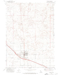 1971 Wendell1974 Print · USGSThe agricultural hub of Wendell is documented here in the early 1970s, showcasing its role as a regional rail center. Genealogists can trace town life through the Cem, local HS, and the prominent Grain Elevator along the Union Pacific Railroad.2 unique versions available
 - 1971 Map of Tunupa, 1974 Print
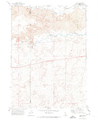 1971 Tunupa1974 Print · USGSSouthern Idaho's volcanic plains are captured here in the early 1970s at the intersection of Gooding and Lincoln counties. Genealogists and researchers can trace the path of the Union Pacific through the settlement of Tunupa and the vital South Gooding Main Canal.2 unique versions available
 - 1971 Map of Gooding SE, 1974 Print
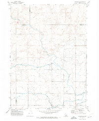 1971 Gooding SE1974 Print · USGSThe intersection of Gooding, Jerome, and Lincoln Counties is shown in the early 1970s as a landscape of irrigation and desert tracks. Researchers can trace the water-management network through the Diversion Dam and Siphon, or follow remote Jeep Trails across the flats.2 unique versions available
 - 1971 Map of Gooding, 1974 Print
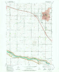
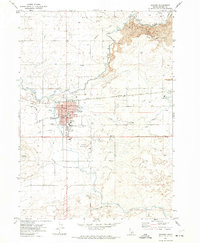 1971 Gooding1974 Print · USGSGooding at the start of the 1970s reveals a community deeply integrated with its irrigation and rail networks. Researchers can trace family history at Elmwood Cem or explore the grounds of the State School for the Deaf and the Blind and the local Courthouse.2 unique versions available
 - 1979 Map of Jerome, 1980 Print
 1979 Jerome1980 Print · USGSIdaho’s Magic Valley comes into sharp focus during the late seventies as the city of Jerome expands across its irrigated volcanic plateau. Researchers can trace the legacy of regional water management through the Pacific Ditch or locate historic rural landmarks like Sonnickson Butte and Canyonside School.2 unique versions available
 - 1979 Map of Niagara Springs, 1980 Print
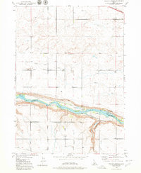 1979 Niagara Springs1980 Print · USGSThe Snake River canyon near the Gooding and Twin Falls county line is captured here in the late seventies. Researchers can trace the region's spring-fed aquaculture and irrigation network, from the Grange Hall to the fish hatcheries at Niagara Springs and Crystal Springs.2 unique versions available
End of results
Showing maps 1-6 of 6
Top cities of Gooding County
Frequently asked questions
- What are the different types of historical maps available for Gooding County?
- What is the oldest map of Gooding County?
- Where can I purchase historical maps of Gooding County for my home or office?
- Where can I download high-res historical maps of Gooding County?
- Are there historical topographic maps available for Gooding County?
- Is there historical aerial imagery available for Gooding County?
- Where are historical maps of Gooding County sourced from?