1980s Maps of Gooding County, Idaho
Explore 8 historic maps of Gooding County from the 1980s. These maps offer a rare glimpse into what life looked like during the 1980s — showing old roads, neighborhoods, homes, and landmarks that have changed or disappeared over time.
Whether you're researching your family's past, planning a metal detecting trip, or studying how Gooding County's landscape evolved across the 1980s, these high-resolution maps are a powerful tool for exploring the history of this region.
- Focus on a specific era: All maps on this page are from the 1980s, giving you a focused view of this time period.
- See what’s changed: Compare century-old streets, trails, and buildings to today's modern landscape using overlays and satellite layers.
- Research with precision: Use these maps for genealogy, historical research, land use analysis, or educational projects.
- View, download, or print: Maps are fully viewable online in high resolution, and can be downloaded or printed for your own records.
Start exploring Gooding County's history through authentic maps from the 1980s. This is your window into the past.
Gooding County, ID maps
(8)- 1986 Map of Thorn Creek Reservoir
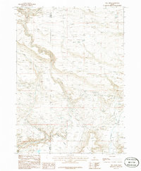
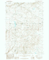 1986 Thorn Creek Reservoir1986 Print · USGSCamas County and its neighbors meet at this high-desert plateau in the mid-1980s, revealing a landscape defined by water management and range life. Researchers can locate remote water sources like Barrel Water Hole, name-bearing springs such as Eusebio Spring, and the drainage of Rattlesnake Canyon.
 - 1986 Map of Fir Grove Mountain
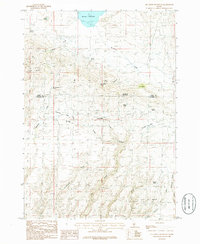 1986 Fir Grove Mountain1986 Print · USGSThe high desert and canyonlands of Camas and Gooding Counties are captured in the mid-1980s, centered on the landmark Fir Grove Mountain. Researchers can trace the water sources and early trails surrounding Mormon Reservoir, Hot Spring, and the unique City of Rocks formation.
 - 1986 Map of Mc Kinney Butte
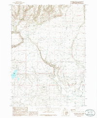 1986 Mc Kinney Butte1986 Print · USGSGooding County's high desert landscape is documented here during the mid-1980s, showcasing the vital irrigation networks that transformed the region. Researchers can trace the paths of the Bostrum Canal, find the Clover Mine, and locate geological landmarks like Mc Kinney Butte.
 - 1986 Map of Davis Mountain SW
 1986 Davis Mountain SW1986 Print · USGSGooding County's arid rangeland is captured here in the 1980s, revealing a landscape defined by its critical water sources. Trace the locations of isolated landmarks like White Arrow Hot Spring, Honey Spring, and the Rattler Reservoir.
 - 1986 Map of Hog Creek
 1986 Hog Creek1986 Print · USGSThe high desert canyons of the Elmore and Gooding County line are captured here in the mid-1980s. Local researchers can locate isolated landmarks like the lonely Cem or name-bearing water sources such as Dead Horse Spring and Hog Creek.
 - 1986 Map of Dempsey Meadows
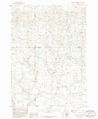 1986 Dempsey Meadows1986 Print · USGSElmore County’s high country is captured here during the mid-1980s, at the intersection of three Idaho counties. Researchers can trace the rugged drainage patterns of Dempsey Meadows and identify landmarks like The Knob and Clover Creek.
 - 1986 Map of Davis Mountain
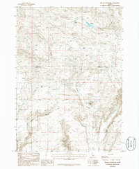
 1986 Davis Mountain1986 Print · USGSThe high plateau of south-central Idaho is captured here in the mid-1980s as a landscape of remote rangelands and vital water sources. Researchers can trace the network of springs and creeks, including Big Spring, Erma Spring, and the prominent peak of Davis Mountain.
 - 1986 Map of Mc Han Reservoir
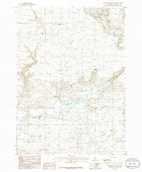
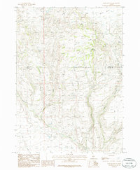
 1986 Mc Han Reservoir1986 Print · USGSThe high plateau of Gooding and Camas Counties is captured in the mid-1980s, showcasing a landscape of basalt flows and desert canyons. Researchers can trace historic water sources like Bull Spring and remote landmarks including the Little City of Rocks and Flat Top Butte.
End of results
Showing maps 1-8 of 8
Top cities of Gooding County
Frequently asked questions
- What are the different types of historical maps available for Gooding County?
- What is the oldest map of Gooding County?
- Where can I purchase historical maps of Gooding County for my home or office?
- Where can I download high-res historical maps of Gooding County?
- Are there historical topographic maps available for Gooding County?
- Is there historical aerial imagery available for Gooding County?
- Where are historical maps of Gooding County sourced from?