Old Maps of Minidoka County, Idaho for Genealogy
Trace your family roots with 145 historic maps of Minidoka County. These high-res maps reveal old neighborhoods, homesites, landmarks, and streets — helping you uncover where your ancestors lived and how the area evolved over time.
- Explore historic neighborhoods: Identify where your relatives may have lived in the 1800s or 1900s.
- Compare maps over time: Trace the changes in streets, buildings, and landmarks for multi-generational research.
- Perfect for genealogy & ancestry research: Used by family historians and researchers to map out lineage and migration.
These maps are an incredible resource for exploring your personal connection to Minidoka County's past.
Minidoka County, ID maps
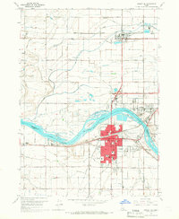
(145)- 1954 Map of Pocatello, 1963 Print
 1954 Pocatello1963 Print · USGSSoutheast Idaho in the mid-1950s reveals a landscape shaped by massive water reclamation and mountain forests. Researchers can trace the development of the Fort Hall Indian Reservation or locate specific landmarks like the Arbon P O and Emerson School.4 unique versions available
 - 1955 Map of Idaho Falls, 1963 Print
 1955 Idaho Falls1963 Print · USGSThe Snake River Plain and its surrounding volcanic peaks are captured in the late fifties, showing the region's unique mix of nuclear research and high-desert ranching. Trace the industrial footprint of the National Reactor Testing Station or find old mining sites like Empire Mine.5 unique versions available
 - 1958 Map of Idaho Falls
 1958 Idaho Falls1958 Print · USGSEastern Idaho in the late fifties showcases the rapid expansion of agricultural and scientific outposts across its volcanic plains. Researchers can locate remote sites like Atomic City, mineral interests at White Knob Mine, and the cultural grounds of St Marys Mission.2 unique versions available
 - 1958 Map of Pocatello
 1958 Pocatello1958 Print · USGSSoutheastern Idaho in the late fifties was a landscape of expanding reservoirs and historic trails. Genealogists and historians can trace the Old Oregon Trail, locate the Bannock Creek Indian Day School, and study the many Union Pacific rail sidings.2 unique versions available
 - 1959 Map of Lake Walcott, 1961 Print
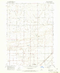
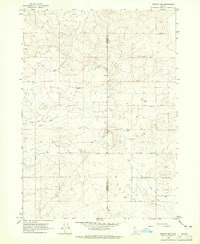
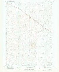
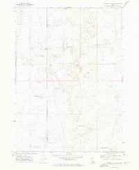
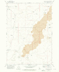
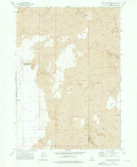
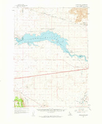 1959 Lake Walcott1961 Print · USGSSouthern Idaho in the late fifties was defined by the intersection of industrial progress and wildlife preservation along the Snake River. Researchers can trace the Union Pacific line through Hawley, locate the Cotterel (Site), and see the Minidoka Dam in its mid-century state.
 - 1964 Map of Burley SW, 1965 Print
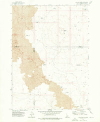
 1964 Burley SW1965 Print · USGSSouthern Idaho in the mid-sixties shows an agricultural landscape defined by the Snake River and its massive irrigation projects. Genealogists and historians can trace the early river economy through sites like Starrhs Ferry and rail stops at Schodde or Hynes.2 unique versions available
 - 1964 Map of Rupert SE, 1965 Print
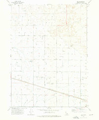
 1964 Rupert SE1965 Print · USGSAgricultural life in Cassia County during the mid-sixties revolved around the town of Declo and its sophisticated irrigation network. Genealogists and researchers can trace the Old Railroad Grade, locate the High Sch, and find family-named sites like the Newcomb Substation.2 unique versions available
 - 1964 Map of Burley NE, 1965 Print
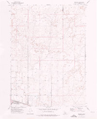
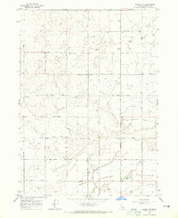 1964 Burley NE1965 Print · USGSMinidoka County farmland is shown in transition during the mid-sixties, dominated by a grid of rural roads and irrigation works. Researchers can trace local landmarks like Paul Cem, the Grange Hall, and engineering details such as the Main Drain and flume.2 unique versions available
 - 1964 Map of Rupert NW, 1965 Print
 1964 Rupert NW1965 Print · USGSMinidoka County agriculture was in full swing during the mid-sixties as irrigation canals reshaped the Idaho desert. Genealogists and local historians can trace the rural landscape through the Pioneer Sch, the Rupert Cemetery, and the Union Pacific rail line.2 unique versions available
 - 1964 Map of Burley NW, 1965 Print
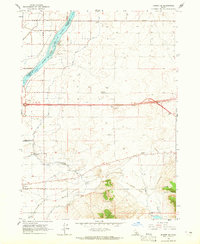
 1964 Burley NW1965 Print · USGSSouthern Idaho agricultural expansion is in full effect during the early sixties, shown here along the Jerome Co border. Genealogists and historians can trace the vital irrigation infrastructure of the era, from the Main Drain to the Aqueduct and numerous farm wells.
 - 1964 Map of Acequia, 1965 Print
 1964 Acequia1965 Print · USGSThe Snake River Plain in the mid-sixties reveals a landscape defined by irrigation and rail. Genealogists and local historians can locate the Jackson Cem, trace the Union Pacific through Acequia, and find the river crossing at Jackson Bridge.
 - 1964 Map of Rupert SW, 1966 Print
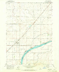
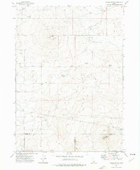
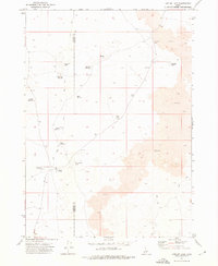
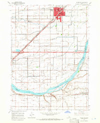 1964 Rupert SW1966 Print · USGSMinidoka County agriculture and rail life are at the forefront in the mid-1960s, showing the intersection of the Snake River and the Union Pacific line. Trace the development of Rupert and find rural landmarks like the Declo Cem, Springdale Sch, and the County Fairgrounds.3 unique versions available
 - 1964 Map of Burley SE, 1966 Print
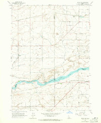
 1964 Burley SE1966 Print · USGSThe Snake River corridor in the mid-sixties reveals a landscape of growing towns and river islands at the border of Minidoka and Cassia counties. Researchers can trace the development of Burley and Heyburn, or locate landmarks like Starrhs Ferry and Grange Hall.2 unique versions available
 - 1972 Map of Kimama, 1976 Print
 1972 Kimama1976 Print · USGSKimama and the surrounding Snake River Plain come alive in this early 1970s survey of the Lincoln and Minidoka county line. Researchers can trace the diagonal path of the Union Pacific railroad and locate water infrastructure like the Siphon and Sage Lake.
 - 1972 Map of Kimama Butte, 1976 Print
 1972 Kimama Butte1976 Print · USGSIn the early 1970s, the high desert of southern Idaho remained a landscape of volcanic buttes and critical water management. Researchers can locate remote features like Kimama Butte Cave, the Kimama Butte Lookout Radio Tower, and Sid Reservoir.
 - 1972 Map of Bear Park SW, 1976 Print
 1972 Bear Park SW1976 Print · USGSSouthern Idaho in the early seventies is revealed through its stark volcanic geology at the boundary of Minidoka Co and Blaine Co. Researchers can trace the precise extent of the Lava flows across this segment of the Snake River Plain.2 unique versions available
 - 1972 Map of Community Lake, 1976 Print
 1972 Community Lake1976 Print · USGSThe high desert border of Lincoln and Minidoka counties comes into focus in the early 1970s. Researchers can trace the development of vital water infrastructure through named features like the Kimama Marsh Reservoir, Peavey Well, and Community Lake.
 - 1972 Map of Minidoka, 1976 Print
 1972 Minidoka1976 Print · USGSMinidoka appears as a vital rail settlement in the early 1970s, positioned along the historic route of the Union Pacific. Researchers can trace the rural infrastructure of the era, from the local Landing Strip to the grid of 1100 North Road and family-named routes like Cherry Road.
 - 1972 Map of Max, 1976 Print
 1972 Max1976 Print · USGSMinidoka County agriculture and infrastructure are on full display in the early seventies, centered on the settlement of Max. Local historians can trace the Union Pacific Railroad route and irrigation works like the Aqueduct and Main Drain.
 - 1972 Map of Laidlaw Lake, 1976 Print
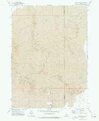
 1972 Laidlaw Lake1976 Print · USGSThe volcanic plains of Idaho's Snake River region are captured here in the early 1970s, showing a remote landscape defined by ranching and water management. Researchers can trace the network of isolated desert outposts like Laidlaw Corrals and remote water sources including Steamboat Lake and Jean Reservoir.
 - 1972 Map of Bear Den Butte, 1976 Print
 1972 Bear Den Butte1976 Print · USGSThe volcanic Snake River Plain is captured here in the early 1970s, showing the high-desert landscape of Minidoka County. Researchers can trace remote livestock waterings at Cream Can Lake and Aspitarte Lake or locate landmarks like Bear Den Butte and Lava Point.
 - 1972 Map of Laidlaw Butte, 1976 Print
 1972 Laidlaw Butte1976 Print · USGSThe volcanic Snake River Plain is captured here in the early 1970s, marking the intersection of Blaine, Lincoln, and Minidoka counties. Trace remote water sources like Baird Reservoir and landmarks like Laidlaw Butte via early Jeep Trails.
 - 1972 Map of Bottleneck Lake, 1976 Print
 1972 Bottleneck Lake1976 Print · USGSThe Minidoka County desert in the early seventies is a stark volcanic landscape accessible only by a primitive network of tracks. Researchers can trace the layout of water catchments like Pronghorn Reservoir and isolated features like Bottleneck Lake or Larkspur Park.
 - 1972 Map of Norland, 1976 Print
 1972 Norland1976 Print · USGSAgriculture and industry define the Minidoka County landscape in the early 1970s as the railroad drives local development. Researchers can trace the Union Pacific corridor through Adelaide and Norland, locating rural landmarks like the Cem and Glawson Substation.
 - 1972 Map of Bear Park West, 1976 Print
 1972 Bear Park West1976 Print · USGSThe volcanic high desert along the border of Blaine and Minidoka counties is documented here in the early 1970s. Trace the reach of Lava flows and locate isolated landmarks like Coyote Butte and Bear Den Lake.
Showing maps 1-25 of 145
Top cities of Minidoka County
- Rupert historical maps
- Heyburn historical maps
- Paul historical maps
- Acequia historical maps
- Minidoka historical maps
Frequently asked questions
- What are the different types of historical maps available for Minidoka County?
- What is the oldest map of Minidoka County?
- Where can I purchase historical maps of Minidoka County for my home or office?
- Where can I download high-res historical maps of Minidoka County?
- Are there historical topographic maps available for Minidoka County?
- Is there historical aerial imagery available for Minidoka County?
- Where are historical maps of Minidoka County sourced from?