
1972 Map of Max
USGS Topo · Published 1976About this map
The settlement of Max serves as a central point in this early 1970s survey of Minidoka County, situated within a highly engineered agricultural landscape. The region's development is defined by an extensive grid of irrigation infrastructure, including a prominent Aqueduct and the Main Drain, which transformed the arid terrain for cultivation. Near the center of the map, the Idaho Youth Ranch occupies a pocket of this rural landscape, bordered by numerous wells and storage bins that signify the local farming economy.
Find a feature on this map
21 named features on this map. Tap any name to fly to it.
Don’t see what you’re looking for? This feature index may not catch every label — zoom into the map to look around manually.
Map Details
Editions of this 1972 Max Map
This is the sole edition of this map. No revisions or reprints were ever made.
Other maps of this area

1954 · Pocatello
USGS Topo · 1:250,000

1958 · Pocatello
USGS Topo · 1:250,000

1959 · Lake Walcott
USGS Topo · 1:62,500

1964 · Rupert NW
USGS Topo · 1:24,000

1964 · Acequia
USGS Topo · 1:24,000

1972 · Community Lake
USGS Topo · 1:24,000

1972 · Minidoka
USGS Topo · 1:24,000
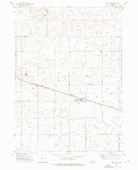
1972 · Norland
USGS Topo · 1:24,000
1972 · Brigham Point
USGS Topo · 1:24,000
1972 · Larkspur Park
USGS Topo · 1:24,000