
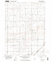
1964 Map of Rupert NW
USGS Topo · Published 1965About this map
The agricultural expansion of Minidoka County is captured here in the mid-1960s, showing the edge of Rupert where the high desert terrain was transformed by an intricate irrigation system. The landscape is defined by the B-1 Canal, B-2 Canal, and numerous secondary waterways like the A Drain, all of which supported the region's homesteads and farms. These water features enabled the growth of a structured grid of rural routes, including the Main North Road, which connected scattered homesteads to the community center.
Find a feature on this map
17 named features on this map. Tap any name to fly to it.
Don’t see what you’re looking for? This feature index may not catch every label — zoom into the map to look around manually.
Map Details
Editions of this 1964 Rupert NW Map
2 editions found
Other maps of this area

1954 · Pocatello
USGS Topo · 1:250,000

1958 · Pocatello
USGS Topo · 1:250,000

1964 · Rupert SE
USGS Topo · 1:24,000

1964 · Burley NE
USGS Topo · 1:24,000

1964 · Acequia
USGS Topo · 1:24,000

1964 · Rupert SW
USGS Topo · 1:24,000

1964 · Burley SE
USGS Topo · 1:24,000

1972 · Kimama
USGS Topo · 1:24,000

1972 · Max
USGS Topo · 1:24,000
1972 · Norland
USGS Topo · 1:24,000