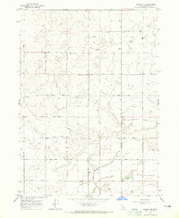
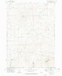
1964 Map of Burley NE
USGS Topo · Published 1965About this map
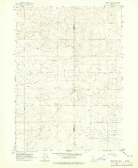
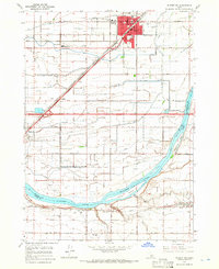
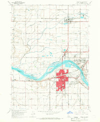
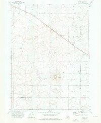
Agricultural development and irrigation engineering define this 1960s landscape in Minidoka County. The map reveals an intricate network of water management, including the Main Drain, various Canals, and a specialized lift pump system serving the local farms. At the center of the rural community, the Grange Hall and Paul Cem serve as important landmarks for genealogical and local history research. The terrain is structured by a rigid grid of transit corridors, from 100 North Road up to 900 North Road, reflecting the deliberate surveyed expansion of Idaho's high desert farmland. Industrial and utility footprints are noted by the Substation and multiple storage bins, marking the infrastructure required to support the mid-century agricultural economy in this region.
Find a feature on this map
29 named features on this map. Tap any name to fly to it.
Don’t see what you’re looking for? This feature index may not catch every label — zoom into the map to look around manually.
Map Details
Editions of this 1964 Burley NE Map
2 editions found
Other maps of this area

1954 · Pocatello
USGS Topo · 1:250,000

1958 · Pocatello
USGS Topo · 1:250,000
1964 · Burley SW
USGS Topo · 1:24,000
1964 · Rupert NW
USGS Topo · 1:24,000
1964 · Burley NW
USGS Topo · 1:24,000
1964 · Rupert SW
USGS Topo · 1:24,000
1964 · Burley SE
USGS Topo · 1:24,000
1972 · Kimama
USGS Topo · 1:24,000
1972 · Kimama Butte
USGS Topo · 1:24,000
1972 · Norland
USGS Topo · 1:24,000