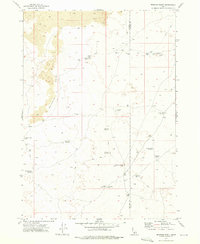
1972 Map of Brigham Point
USGS Topo · Published 1976About this map
Volcanic geology dominates the landscape of southern Idaho along the border of Minidoka and Blaine Counties during the early 1970s. The terrain is defined by extensive Lava flows and unique geological formations, most notably the Bear Trap Lava Tube in the northeastern section and the prominent rise of Whiskey Butte. This arid environment is marked by an intricate system of ephemeral water sources and catchments, including Big Sinks Reservoir, Gabettas Reservoir, and Antelope Reservoir.
Find a feature on this map
24 named features on this map. Tap any name to fly to it.
Don’t see what you’re looking for? This feature index may not catch every label — zoom into the map to look around manually.
Map Details
Editions of this 1972 Brigham Point Map
This is the sole edition of this map. No revisions or reprints were ever made.
Other maps of this area

1954 · Pocatello
USGS Topo · 1:250,000

1955 · Idaho Falls
USGS Topo · 1:250,000

1958 · Idaho Falls
USGS Topo · 1:250,000

1958 · Pocatello
USGS Topo · 1:250,000

1972 · Schodde Well
USGS Topo · 1:24,000

1972 · Bear Trap Cave
USGS Topo · 1:24,000

1972 · Mule Butte
USGS Topo · 1:24,000

1972 · Bear Park SW
USGS Topo · 1:24,000

1972 · Minidoka
USGS Topo · 1:24,000

1972 · Max
USGS Topo · 1:24,000