1960s Maps of Twin Falls County, Idaho
Explore 21 historic maps of Twin Falls County from the 1960s. These maps offer a rare glimpse into what life looked like during the 1960s — showing old roads, neighborhoods, homes, and landmarks that have changed or disappeared over time.
Whether you're researching your family's past, planning a metal detecting trip, or studying how Twin Falls County's landscape evolved across the 1960s, these high-resolution maps are a powerful tool for exploring the history of this region.
- Focus on a specific era: All maps on this page are from the 1960s, giving you a focused view of this time period.
- See what’s changed: Compare century-old streets, trails, and buildings to today's modern landscape using overlays and satellite layers.
- Research with precision: Use these maps for genealogy, historical research, land use analysis, or educational projects.
- View, download, or print: Maps are fully viewable online in high resolution, and can be downloaded or printed for your own records.
Start exploring Twin Falls County's history through authentic maps from the 1960s. This is your window into the past.
Twin Falls County, ID maps
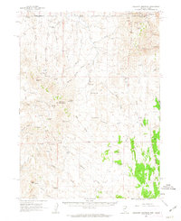
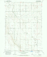
(21)- 1961 Map of Wells
 1961 Wells1961 Print · USGSNortheastern Nevada's high basin and range country is captured here during the early sixties, showing the vital rail corridors and ranching outposts. Researchers can trace the heritage of remote settlements like Metropolis, locate the Delano Mines, and follow the path of the Southern Pacific through the Pequop Mountains.
 - 1961 Map of Gollaher Mountain, 1963 Print
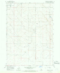
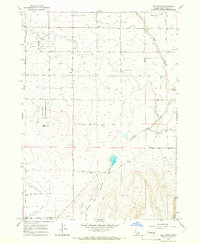
 1961 Gollaher Mountain1963 Print · USGSThe Nevada-Idaho borderlands come into focus in the early sixties, showing a landscape shaped by high-desert springs and remote peaks. Researchers can locate named water sources like Indian Mike Spring and Moonshine Spring or trace routes through Devils Pass.2 unique versions available
 - 1964 Map of Kimberly, 1965 Print
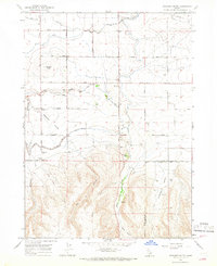
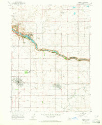 1964 Kimberly1965 Print · USGSSouthern Idaho's agricultural heartland and the deep Snake River canyon are captured here in the mid-sixties. Genealogists and local historians can trace the rail-side growth of Kimberly and Hansen or locate the historic Springtown (Site) near the Hansen Bridge.2 unique versions available
 - 1964 Map of Twin Falls, 1965 Print
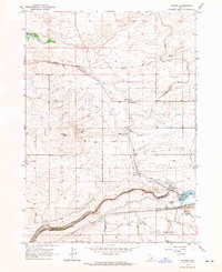
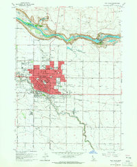 1964 Twin Falls1965 Print · USGSTwin Falls is shown at a point of significant post-war growth in the mid-sixties, with its urban center expanding toward the Snake River canyon. Researchers can trace local industry and education through the Sugar Factory, St Edwards Sch, and the Perrine Memorial Bridge.2 unique versions available
 - 1964 Map of Eden, 1965 Print
 1964 Eden1965 Print · USGSThe high desert of Jerome County comes alive in the early 1960s through its complex irrigation networks and rail-side settlements. Researchers can trace the agricultural heart of Eden and Hazelton, identifying local landmarks like Valley High Sch and the Grain Elevator.3 unique versions available
 - 1964 Map of Milner, 1965 Print
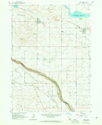
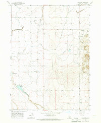
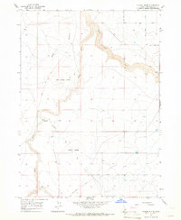
 1964 Milner1965 Print · USGSThe Snake River plains in the 1960s reveal an intricate web of desert irrigation and rail transport. Genealogists and historians can trace small settlements like Greenwood and Milner, alongside landmarks like Hazelton Butte and the Milner Dam.
 - 1964 Map of Roseworth, 1966 Print
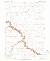
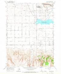
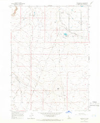 1964 Roseworth1966 Print · USGSTwin Falls County ranchlands come into focus in the mid-sixties, detailing the essential water systems of the high desert. Genealogists and local historians can locate remote family sites like Conover Ranch and follow the route of Pigtail Butte Road past Antelope Spring.
 - 1965 Map of Hollister SW, 1966 Print
 1965 Hollister SW1966 Print · USGSTwin Falls County in the mid-sixties reveals an agricultural landscape shaped by the Main Canal and its canyon rim. Trace the early water systems of the Snake River Plain through landmarks like the Siphon and the Lower Deep Creek Res.
 - 1965 Map of Roseworth SE, 1966 Print
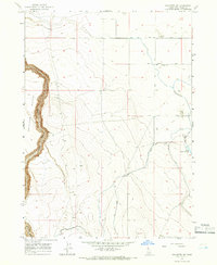
 1965 Roseworth SE1966 Print · USGSTwin Falls County is seen here in the mid-1960s, defined by the deep canyon of Salmon Falls Creek and high desert plateaus. Researchers can trace the path of the Cedar Mesa Canal or locate local landmarks like Secret Cabin Butte and Emery Butte.
 - 1965 Map of Roseworth NE, 1966 Print
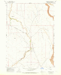
 1965 Roseworth NE1966 Print · USGSTwin Falls County in the mid-1960s was defined by the deep-cut drainage of Salmon Falls Creek and the irrigation efforts of the Idaho desert. Trace the remote landscape of Antelope Pocket and the rugged path of the High Line Canal.
 - 1965 Map of Milner Butte, 1966 Print
 1965 Milner Butte1966 Print · USGSThe high desert of southern Idaho comes into focus in the mid-sixties as an engineered agricultural landscape. Researchers can trace the complex water systems of the Main Canal, locate the Lake Substation, and find early local landmarks like Milner Butte.2 unique versions available
 - 1965 Map of Hollister, 1966 Print
 1965 Hollister1966 Print · USGSHollister and Amsterdam thrived as agricultural and rail hubs on the Idaho high desert during the mid-sixties. Local researchers can trace the development of the Union Pacific corridor, finding landmarks like the Grain Elevator, Hollister Sch, and Nat-Soo-Pah Warm Spring.
 - 1965 Map of Stricker Butte, 1966 Print
 1965 Stricker Butte1966 Print · USGSTwin Falls and Cassia counties meet here in the mid-1960s, showing a landscape defined by massive irrigation projects and early settlement roots. History buffs can locate the Stricker Cabin, Rock Creek Cemeteries, and the Pleasant Valley Sch amidst a network of canals.
 - 1965 Map of Berger, 1966 Print
 1965 Berger1966 Print · USGSThe high desert south of Twin Falls is captured in the mid-1960s as the rail-side settlement of Berger anchors a landscape of irrigated farms. Genealogists and historians can trace the Union Pacific line, locate the Landing Strip, and map old water routes like Desert Creek.
 - 1965 Map of Berger Butte, 1966 Print
 1965 Berger Butte1966 Print · USGSTwin Falls County in the mid-sixties shows a landscape defined by irrigation and high-desert infrastructure. Researchers can trace the path of the High Line Canal and locate specific sites like the Lookout Tower and Berger Butte.
 - 1965 Map of Grand View Peak, 1966 Print
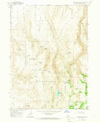
 1965 Grand View Peak1966 Print · USGSThe high country of the Sawtooth National Forest near the Twin Falls and Cassia county border is shown here in the mid-1960s. Genealogists and outdoor historians can trace early backcountry access through family-named sites like Crockett Spring and Schipper Campground.3 unique versions available
 - 1965 Map of Tuanna Butte, 1966 Print
 1965 Tuanna Butte1966 Print · USGSTwin Falls County in the mid-1960s reveals a landscape shaped by deep basalt canyons and prominent volcanic landmarks. Researchers can trace historic access points like Big Bend Crossing and the rugged terrain surrounding Tuanna Butte and Devil Creek Butte.
 - 1965 Map of Hub Butte, 1966 Print
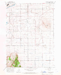
 1965 Hub Butte1966 Print · USGSTwin Falls is shown during the mid-sixties as a vital aviation and irrigation hub on the Idaho plateau. Genealogists and researchers can trace the early layout of Joslin Field, the Grange Hall, and landmarks like Hub Butte.
 - 1965 Map of Murtaugh, 1966 Print
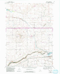
 1965 Murtaugh1966 Print · USGSThe Snake River Plain in the mid-sixties reveals an intensive network of canals and rail lines supporting the agricultural communities of Twin Falls and Cassia counties. Researchers can trace irrigation history and local genealogy through Murtaugh, the Bower Cem, and the rail-side infrastructure of the Union Pacific.2 unique versions available
 - 1965 Map of Mc Mullen Basin, 1967 Print
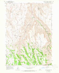
 1965 Mc Mullen Basin1967 Print · USGSSouthern Idaho ranching and forest lands are captured here during the mid-1960s. You can trace the high-country water network through remote landmarks like McMullen Cow Camp, Moonshine Spring, and Dry Cottonwood Reservoir.2 unique versions available
 - 1965 Map of Milner, 1992 Print
 1965 Milner1992 Print · USGSJerome and Twin Falls counties are shown in the 1960s during a period of significant hydroelectric and agricultural development along the canyon. Researchers can trace the massive Milner Gooding Canal system, locate the Parsons (Site), and find family landmarks near Hazelton Butte.
End of results
Showing maps 1-21 of 21
Top cities of Twin Falls County
- Twin Falls historical maps
- Buhl historical maps
- Kimberly historical maps
- Filer historical maps
- Hansen historical maps
- Castleford historical maps
See more
Frequently asked questions
- What are the different types of historical maps available for Twin Falls County?
- What is the oldest map of Twin Falls County?
- Where can I purchase historical maps of Twin Falls County for my home or office?
- Where can I download high-res historical maps of Twin Falls County?
- Are there historical topographic maps available for Twin Falls County?
- Is there historical aerial imagery available for Twin Falls County?
- Where are historical maps of Twin Falls County sourced from?