1990s Maps of Twin Falls County, Idaho
Explore 4 historic maps of Twin Falls County from the 1990s. These maps offer a rare glimpse into what life looked like during the 1990s — showing old roads, neighborhoods, homes, and landmarks that have changed or disappeared over time.
Whether you're researching your family's past, planning a metal detecting trip, or studying how Twin Falls County's landscape evolved across the 1990s, these high-resolution maps are a powerful tool for exploring the history of this region.
- Focus on a specific era: All maps on this page are from the 1990s, giving you a focused view of this time period.
- See what’s changed: Compare century-old streets, trails, and buildings to today's modern landscape using overlays and satellite layers.
- Research with precision: Use these maps for genealogy, historical research, land use analysis, or educational projects.
- View, download, or print: Maps are fully viewable online in high resolution, and can be downloaded or printed for your own records.
Start exploring Twin Falls County's history through authentic maps from the 1990s. This is your window into the past.
Twin Falls County, ID maps
(4)- 1992 Map of Indian Butte
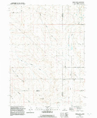 1992 Indian Butte1992 Print · USGSThe high desert of southern Idaho is captured in the 1990s at the intersection of three counties, where the Oregon Trail still marks the land. Researchers can trace the path of historic migration alongside landmarks like Indian Butte and Big Pilgrim Gulch.
 - 1992 Map of Ticeska
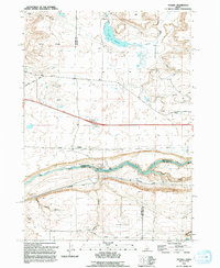 1992 Ticeska1992 Print · USGSThe high-desert terrain of the Snake River canyon comes into focus during the early nineties, showing where three counties meet at the water's edge. Researchers can trace infrastructure such as the Bliss Dam, the small settlement of Ticeska, and curious local routes like Main Shoestring Road.
 - 1992 Map of Glenns Ferry
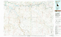 1992 Glenns Ferry1992 Print · USGSThe Snake River valley in the early nineties remains a landscape of pioneer paths and modern military ranges. Genealogists and historians can trace the EMIGRANT TRAIL past Glenns Ferry or locate remote desert landmarks like Broken Wagon Flat and the community of Clover.
 - 1992 Map of Rogerson
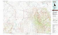 1992 Rogerson1992 Print · USGSThe high-desert ranching and forest lands of the Idaho-Nevada border are captured here in the late twentieth century. Trace the old Union Pacific line as it passes through Rogerson and the canyonlands of Salmon Falls Creek.
End of results
Showing maps 1-4 of 4
Top cities of Twin Falls County
- Twin Falls historical maps
- Buhl historical maps
- Kimberly historical maps
- Filer historical maps
- Hansen historical maps
- Castleford historical maps
See more
Frequently asked questions
- What are the different types of historical maps available for Twin Falls County?
- What is the oldest map of Twin Falls County?
- Where can I purchase historical maps of Twin Falls County for my home or office?
- Where can I download high-res historical maps of Twin Falls County?
- Are there historical topographic maps available for Twin Falls County?
- Is there historical aerial imagery available for Twin Falls County?
- Where are historical maps of Twin Falls County sourced from?