1980s Maps of Twin Falls County, Idaho
Explore 17 historic maps of Twin Falls County from the 1980s. These maps offer a rare glimpse into what life looked like during the 1980s — showing old roads, neighborhoods, homes, and landmarks that have changed or disappeared over time.
Whether you're researching your family's past, planning a metal detecting trip, or studying how Twin Falls County's landscape evolved across the 1980s, these high-resolution maps are a powerful tool for exploring the history of this region.
- Focus on a specific era: All maps on this page are from the 1980s, giving you a focused view of this time period.
- See what’s changed: Compare century-old streets, trails, and buildings to today's modern landscape using overlays and satellite layers.
- Research with precision: Use these maps for genealogy, historical research, land use analysis, or educational projects.
- View, download, or print: Maps are fully viewable online in high resolution, and can be downloaded or printed for your own records.
Start exploring Twin Falls County's history through authentic maps from the 1980s. This is your window into the past.
Twin Falls County, ID maps
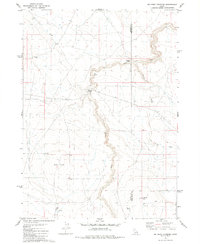
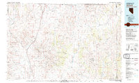
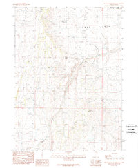
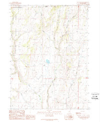
(17)- 1980 Map of Castleford Butte
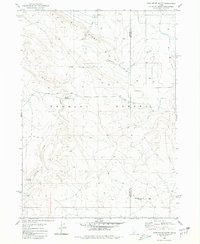 1980 Castleford Butte1980 Print · USGSThe high Idaho desert near the Owyhee and Twin Falls county line is captured in the early eighties as a land of remote ranching and rugged basalt ridges. Trace the vital water sources of the era at Hewitt Watering, Freeland Watering, and along the banks of Deadman Creek.
 - 1980 Map of Crows Nest NE
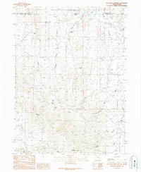
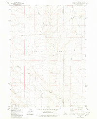 1980 Crows Nest NE1980 Print · USGSThe Owyhee and Twin Falls county line splits this desert landscape during the late 1970s, showcasing the high-plateau geography of the Bruneau Desert. Trace the paths of Crows Nest Road and Blue Ridge Trail past Deadman Creek and several Well sites.
 - 1980 Map of Curtis Draw
 1980 Curtis Draw1980 Print · USGSThe high-desert borderlands of Idaho and Nevada come into focus during the early 1980s, revealing a landscape of remote ranching outposts and vital desert springs. Researchers can trace historic movements through the area at Three Mile Crossing and locate isolated landmarks like Stanley Cabin or Devil Creek Ranch.2 unique versions available
 - 1980 Map of Grassy Hills
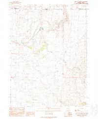
 1980 Grassy Hills1980 Print · USGSSouthern Idaho ranching and water management are the focus of this 1980 survey along the Owyhee and Twin Falls county border. Researchers can trace the layout of the House Creek Ranch and remote crossings like Bengeochea Crossing or The Windmill.2 unique versions available
 - 1980 Map of Big Bend Crossing
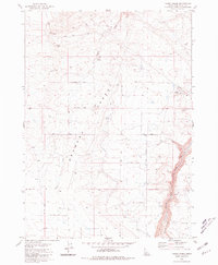
 1980 Big Bend Crossing1980 Print · USGSThe high desert canyons of the Owyhee and Twin Falls county line come into focus in the 1970s. Trace historic passage points across the deep volcanic rimrock at Big Bend Crossing and Old Bend Crossing, or locate ranching landmarks like Heil Well and Black Butte.
 - 1980 Map of Yahoo Creek, 1981 Print
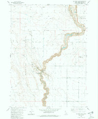
 1980 Yahoo Creek1981 Print · USGSThe Bruneau Desert of Idaho in the late seventies reveals a landscape of high-desert ranching and water engineering. Researchers can trace the path of the Magic Water Canal, locate old water sources like Coyote Spring, and explore the steep terrain of Sinking Canyon.
 - 1980 Map of Balanced Rock, 1981 Print
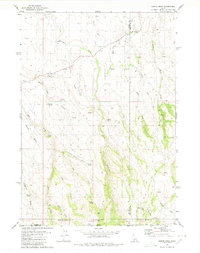
 1980 Balanced Rock1981 Print · USGSTwin Falls County is seen here in the early eighties as a rugged high-desert landscape defined by deep canyons and critical water engineering. Researchers can locate Balanced Rock State Park, the Buhl National Guard Rifle Range, and the winding Salmon Falls Creek.2 unique versions available
 - 1981 Map of Jarbidge Mts
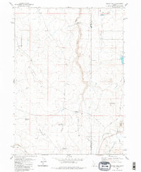
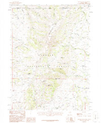
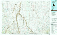
 1981 Jarbidge Mts1981 Print · USGSThe high desert and mountain peaks of northern Elko County are captured here in the early eighties. Researchers can trace remote settlements like Jarbidge, identify mining sites such as the Rio Tinto Mine, and locate the Gold Creek Ranger Sta.3 unique versions available
 - 1982 Map of Jackpot
 1982 Jackpot1982 Print · USGSThe high desert borderlands of Nevada, Idaho, and Utah are captured here in the early eighties as a hub of mining and transport. Researchers can locate remote operations like Gold Note Mine and trace the Union Pacific line past Delaplain.
 - 1986 Map of Elk Mountain, 1987 Print
 1986 Elk Mountain1987 Print · USGSThe high desert borderlands of Nevada and Idaho come alive in the mid-1980s, centered on the heights of Elk Mountain. Genealogists and historians can locate the Twin Meadows Ranch and trace the proximity of early Prospects near O'Neil Creek.
 - 1989 Map of Stratton Spring
 1989 Stratton Spring1989 Print · USGSThe high desert border between Nevada and Idaho is captured here in the late eighties, showing a remote landscape of canyons and springs. Researchers can trace the rugged Deadline Ridge and locate vital water sources like Stratton Spring and Hot Springs.
 - 1989 Map of Jackpot
 1989 Jackpot1989 Print · USGSJackpot straddles the Idaho-Nevada line in the late eighties, functioning as a vital border crossing and recreational hub. You can trace the Old Railroad Grade through the desert or locate local landmarks like the Rodeo Ground, Delaplain, and Jackpot Airport.
 - 1989 Map of Browns Bench Ranch
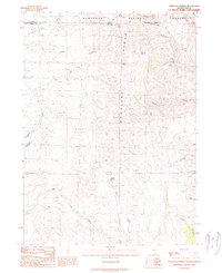
 1989 Browns Bench Ranch1989 Print · USGSThe high plateau country along the Nevada and Idaho border is documented here in the late eighties. Researchers can locate remote ranching infrastructure like Browns Bench Ranch and water sources including Magpie Spring and Burnt Spring.
 - 1989 Map of Gollaher Mountain
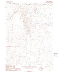
 1989 Gollaher Mountain1989 Print · USGSThe Nevada-Idaho borderlands are captured here in the late 1980s, detailing the remote ranching landscape of the high desert. Researchers can trace historic water rights and stock paths through Milligan Ditch, Indian Mike Spring, and Gollaher Bottom.
 - 1989 Map of Sheep Creek
 1989 Sheep Creek1989 Print · USGSOwyhee County and the Idaho-Nevada borderlands are mapped here in the late eighties, showing a landscape defined by ranching and deep river chasms. Researchers can trace remote landmarks like Grasmere, the Bruneau Canyon, and the Duck Valley Indian Reservation.
 - 1989 Map of East of Jackpot
 1989 East of Jackpot1989 Print · USGSThe high desert borderlands of the Great Basin are captured here in the late 1980s. Local history researchers can trace the seasonal water sources and drainages essential to the region, including Warm Springs, Deer Springs, and Cow Creek.
 - 1989 Map of Bear Mountain
 1989 Bear Mountain1989 Print · USGSThe high desert of the Nevada-Idaho border comes into focus in the late 1980s, documenting a remote ranching and forest landscape. Researchers can trace the rugged drainage of North Fork Salmon Falls Creek and locate landmarks like the Gully Ranch or Bear Mountain.
End of results
Showing maps 1-17 of 17
Top cities of Twin Falls County
- Twin Falls historical maps
- Buhl historical maps
- Kimberly historical maps
- Filer historical maps
- Hansen historical maps
- Castleford historical maps
See more
Frequently asked questions
- What are the different types of historical maps available for Twin Falls County?
- What is the oldest map of Twin Falls County?
- Where can I purchase historical maps of Twin Falls County for my home or office?
- Where can I download high-res historical maps of Twin Falls County?
- Are there historical topographic maps available for Twin Falls County?
- Is there historical aerial imagery available for Twin Falls County?
- Where are historical maps of Twin Falls County sourced from?