Old Maps of Edwardsburg, Idaho for Hiking & Exploration
Hike through history with 12 historic maps of Edwardsburg. Explore old trails, ghost towns, and forgotten backroads — perfect for outdoor adventurers and local explorers.
- Rediscover forgotten places: Map out old mining camps, roads, and footpaths that no longer exist on modern maps.
- Layer with modern tools: Combine with LiDAR or satellite views to plan hikes through historical terrain.
- Made for exploration: Popular among hikers, overlanders, and local history lovers.
Use these maps to find adventure and explore the hidden past of Edwardsburg.
Edwardsburg, ID maps
(12)- 1937 Map of Big Creek
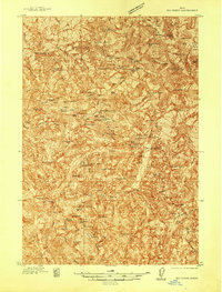 1937 Big Creek1937 Print · USGSMid-century mining activity in the Idaho backcountry centers on the remote outposts of Edwardsburg and Big Creek. Genealogists and historians can trace lode claims like the Golden Hand Mine and Moscow Mine alongside early structures like Hand Cabin.2 unique versions available
 - 1942 Map of Big Creek
 1942 Big Creek1942 Print · USGSThe remote Idaho backcountry during the 1930s is revealed as a landscape of isolated cabins and active lode mines. Genealogists and historians can trace the foundations of local industry at the Golden Hand Mine, find early homesteads like Mahan Cabin, and locate the small settlement of Edwardsburg.
 - 1956 Map of Elk City, 1963 Print
 1956 Elk City1963 Print · USGSThe Idaho backcountry in the mid-fifties remains a landscape of isolated mining camps and remote forest outposts. Researchers can trace historical mining operations at Stibnite Mine and Blackbird Mine or locate riverside landmarks like Mackay Bar and Campbell's Ferry.3 unique versions available
 - 1960 Map of Elk City
 1960 Elk City1960 Print · USGSThe Central Idaho wilderness and Bitterroot Range are captured here during the peak of mid-century industrial mining. Researchers can trace remote backcountry settlements like Burgdorf and Warren, alongside major mineral sites including the Blackbird Mine and Ima Mine.2 unique versions available
 - 1969 Map of Edwardsburg, 1971 Print
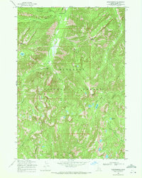 1969 Edwardsburg1971 Print · USGSThe remote mining country of central Idaho is captured here in the late sixties, highlighting the isolated settlements of Edwardsburg and Logan. Researchers can trace old mountain routes like the Pack Trail and locate the Sunday Mine near Logan Mountain.2 unique versions available
 - 1981 Map of Warren
 1981 Warren1981 Print · USGSCentral Idaho’s high backcountry is revealed here in the early eighties, where isolated mining camps and wilderness boundaries met. Genealogists and historians can trace old claims like the Czizek Mine and Red Metals Mine or the remote outpost of Edwardsburg.
 - 2004 Map of Edwardsburg, 2007 Print
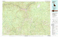
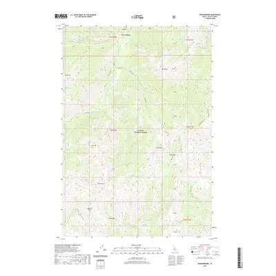
 2004 Edwardsburg2007 Print · USGSThe mountain settlement of Edwardsburg is captured here in the early 2000s, positioned at the threshold of Idaho's protected backcountry. Researchers can trace historic mining activity at Sunday Mine and explore high-altitude landmarks like Missouri Ridge and Bear Lake.
 - 2011 Map of Edwardsburg, 2011 Print
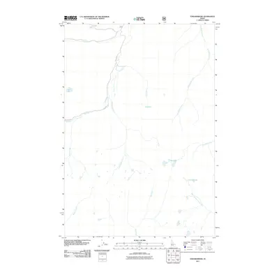 2011 Edwardsburg2011 Print · USGSCovers Edwardsburg, including Valley County, United States, and other nearby areas
 - 2013 Map of Edwardsburg, 2013 Print
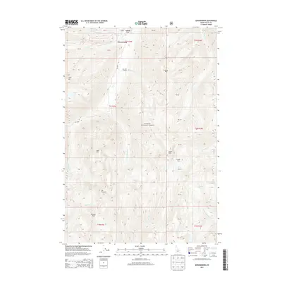 2013 Edwardsburg2013 Print · USGSCovers Edwardsburg, including Valley County, United States, and other nearby areas
 - 2017 Map of Edwardsburg, 2017 Print
 2017 Edwardsburg2017 Print · USGSCovers Edwardsburg, including Valley County, United States, and other nearby areas
 - 2020 Map of Edwardsburg, 2020 Print
 2020 Edwardsburg2020 Print · USGSCovers Edwardsburg, including Valley County, United States, and other nearby areas
 - 2024 Map of Edwardsburg, 2024 Print
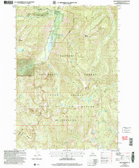
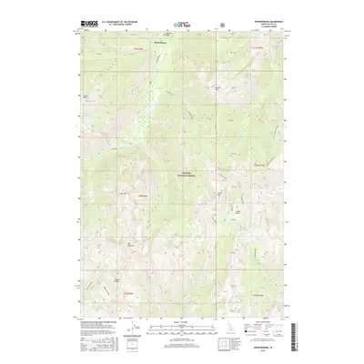
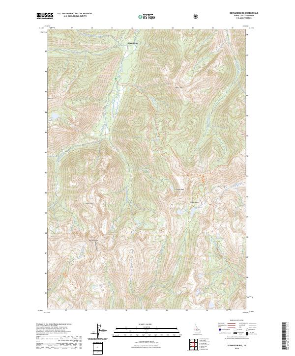 2024 Edwardsburg2024 Print · USGSEdwardsburg remains a remote outpost within the Idaho backcountry, situated where the national forest meets the wilderness in the 2020s. Researchers can trace historic mountain routes like Big Creek Rd and find alpine landmarks including Bear Lake and The Pinnacles.
End of results
Showing maps 1-12 of 12
Frequently asked questions
- What are the different types of historical maps available for Edwardsburg?
- What is the oldest map of Edwardsburg?
- Where can I purchase historical maps of Edwardsburg for my home or office?
- Where can I download high-res historical maps of Edwardsburg?
- Are there historical topographic maps available for Edwardsburg?
- Is there historical aerial imagery available for Edwardsburg?
- Where are historical maps of Edwardsburg sourced from?