Old Maps of Washington County, Idaho for Hiking & Exploration
Hike through history with 271 historic maps of Washington County. Explore old trails, ghost towns, and forgotten backroads — perfect for outdoor adventurers and local explorers.
- Rediscover forgotten places: Map out old mining camps, roads, and footpaths that no longer exist on modern maps.
- Layer with modern tools: Combine with LiDAR or satellite views to plan hikes through historical terrain.
- Made for exploration: Popular among hikers, overlanders, and local history lovers.
Use these maps to find adventure and explore the hidden past of Washington County.
Washington County, ID maps
(271)- 1894 Map of Squaw Creek
 1894 Squaw Creek1894 Print · USGSCentral Idaho in the 1890s was a landscape of mountain valleys and river crossings where early pioneers established remote outposts. Trace the locations of historic river access at Smith Ferry and early industry at Walker Mill or the settlement of Ola.5 unique versions available
 - 1897 Map of Weiser
 1897 Weiser1897 Print · USGSThe Idaho-Oregon borderlands come alive in the 1890s as the Oregon Short Line connects river towns along the Snake River. Researchers can trace the early footprints of Weiser, Payette, and Middle Valley alongside now-obscure points like Mosquite and Washoe.5 unique versions available
 - 1915 Map of Pine
 1915 Pine1915 Print · USGSEastern Oregon was a hub of gold mining and river commerce in the early twentieth century. Researchers can trace the legacy of pioneer families and industry at the Sanger Mine, follow the old Oregon-Washington Railroad, or locate the Mineral P O along the river.3 unique versions available
 - 1951 Map of Moores Hollow, 1952 Print
 1951 Moores Hollow1952 Print · USGSThe high desert of Malheur County meets the winding Snake River in the early fifties, marking the border between Oregon and Idaho. Researchers can trace early irrigation networks like the Owyhee Canal and find family-named landmarks such as Jacobsen Gulch and McRea Island.4 unique versions available
 - 1951 Map of Moores Hollow, 1953 Print
 1951 Moores Hollow1953 Print · USGSThe Oregon-Idaho borderlands thrive on river-fed irrigation and rail transport in the early fifties. Genealogists can trace family footprints near Annex and Ontario Heights or locate the historic path of the Oregon Trail as it nears the Snake River.3 unique versions available
 - 1951 Map of Weiser South, 1971 Print
 1951 Weiser South1971 Print · USGSThe borderlands of Idaho and Oregon come alive in this mid-century survey of the Snake River valley. Local historians can trace the transition of rural education and irrigation through Eastside Sch, Annex Cem, and the extensive Hyline Ditch network.2 unique versions available
 - 1952 Map of Weiser Cove, 1953 Print
 1952 Weiser Cove1953 Print · USGSThe Weiser River valley in the early fifties reveals an intricate network of irrigation canals and rural life. Genealogists and historians can trace local landmarks like Jeffreys School or the Pleasant View School (Aban'd) among the hills of Weiser Cove.2 unique versions available
 - 1952 Map of Olds Ferry NW, 1954 Print
 1952 Olds Ferry NW1954 Print · USGSThe Snake River canyon at the Idaho-Oregon border is captured here in the early 1950s, showing the intersection of river navigation and rail transport. Genealogists and historians can trace the remote Hibbard Creek School, the settlement at Prevost, and hazardous river crossings like Shoofly Rapids.4 unique versions available
 - 1952 Map of Olds Ferry, 1954 Print
 1952 Olds Ferry1954 Print · USGSThe Snake River crossing at the Idaho-Oregon border was a vital transit point for pioneers and early rail travelers during the mid-twentieth century. Trace the path of the Old Oregon Trail Highway past the Original Site Olds Ferry and the Coal Mine near Indian Head Mtn.3 unique versions available
 - 1952 Map of Olds Ferry, 1956 Print
 1952 Olds Ferry1956 Print · USGSThe Snake River canyon and the historic Oregon-Idaho borderlands are captured here in the early fifties, showing the region's transition from pioneer routes to modern infrastructure. Researchers can trace the Oregon Trail, locate early crossing points like Olds Ferry (Site), and find defunct rural schoolhouses such as Eaton Sch (Aband).3 unique versions available
 - 1952 Map of Olds Ferry SE, 1976 Print
 1952 Olds Ferry SE1976 Print · USGSThe Snake River borderlands in the early fifties show a landscape of irrigation canals and early schoolhouses. Genealogists can trace the location of Porters Ferry (Site) and several rural campuses like Central School and Hale School.
 - 1953 Map of Mann Creek, 1955 Print
 1953 Mann Creek1955 Print · USGSThe agricultural valleys of Washington County come alive in this early 1950s survey of the river country near Weiser. Genealogists can trace a network of rural schoolhouses and landmarks including Saling Sch, Mann Creek Cem, and the Union Pacific Railroad.2 unique versions available
 - 1955 Map of Baker, 1964 Print
 1955 Baker1964 Print · USGSThe Oregon-Idaho borderlands are captured here in the mid-fifties as the Snake River underwent massive changes from dam construction. Trace the Oregon Trail Memorial Monument near Baker, find early mines like Virtue Mine, and follow the Union Pacific Railroad through Huntington.4 unique versions available
 - 1957 Map of Halfway, 1958 Print
 1957 Halfway1958 Print · USGSEagle Valley and the surrounding Whitman National Forest are shown in the late fifties, just before the landscape was altered by hydroelectric development. Researchers can trace the original site of Robinette before it was submerged, alongside local landmarks like Union HS and Mehlhorn Mill.2 unique versions available
 - 1957 Map of Cambridge, 1958 Print
 1957 Cambridge1958 Print · USGSThe Weiser River valley in the late fifties shows a rural Idaho landscape defined by cattle country and rail lines. Genealogists and historians can trace the foundations of Middle Valley, Keithly, and the defunct Cove School (Aban'd).2 unique versions available
 - 1957 Map of Crane Creek Reservoir, 1958 Print
 1957 Crane Creek Reservoir1958 Print · USGSThe Weiser River valley and its surrounding high-desert plateaus are captured here in the late fifties, showcasing a complex system of reservoirs and irrigation canals. Genealogists and historians can locate the Midvale townsite, the Midvale Cemetery, and rural landmarks like the Cozy Corners School (Aban'd).2 unique versions available
 - 1957 Map of Copperfield, 1958 Print
 1957 Copperfield1958 Print · USGSThe Snake River canyon was on the verge of total transformation in the late fifties as hydroelectric projects began to reshape the Idaho-Oregon border. Researchers can trace the original river course and landmarks like Brownlee Dam, Copperfield, and the Oxbow Sch before water levels rose.3 unique versions available
 - 1957 Map of Hornet, 1958 Print
 1957 Hornet1958 Print · USGSThe high country of the Adams and Washington county line is captured here in the late fifties during a period of forest management and industrial transition. Researchers can trace the legacy of remote mountain living at Upper Dale School and the North Hornet Mine.3 unique versions available
 - 1957 Map of Sturgill Peak, 1959 Print
 1957 Sturgill Peak1959 Print · USGSThe Hitt Mountains and Shoe Peg Valley are documented here in the late fifties during a period of active forest management and rural growth. Researchers can locate the Advent School, the Brownlee Ranger Station, and the isolated Mann Creek Guard Station.2 unique versions available
 - 1957 Map of Mineral, 1959 Print
 1957 Mineral1959 Print · USGSThe Snake River canyon at the Oregon and Idaho border was a landscape of remote mining camps and rail sidings in the late fifties. Genealogists and historians can trace the Union Pacific line to old sites like Mineral and the Connor Creek Mine.
 - 1959 Map of Baker
 1959 Baker1959 Print · USGSThe Oregon and Idaho borderlands come alive in the late fifties, showing the rugged corridor along the Snake River and the high peaks of the Wallowa Mountains. Researchers can trace the legacy of the Union Pacific railroad or locate historic mining sites like the Flagstaff Mine and Virtue Mine.2 unique versions available
 - 1970 Map of Dodson Pass, 1973 Print
 1970 Dodson Pass1973 Print · USGSThe Gem and Washington county line in the early 1970s is a landscape of remote forest outposts and high-mountain passes. Trace old wilderness access routes to Third Fork Guard Station, Dodson Pass, and the waters of Beech Lake.
 - 1970 Map of Paddock Valley Reservoir, 1973 Print
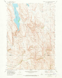 1970 Paddock Valley Reservoir1973 Print · USGSThe high-desert ranching country of western Idaho is captured here in the early 1970s, focused on the critical water management of the region. Researchers can trace historic grazing routes and water sources across Little Willow Flat or follow the drainages of Indian Creek and Rattlesnake Creek.
 - 1970 Map of Coonrod Gulch, 1973 Print
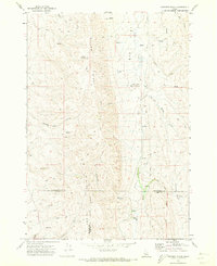 1970 Coonrod Gulch1973 Print · USGSSouthwestern Idaho ranching country is captured here in the early seventies, where Washington, Payette, and Gem counties meet. Trace the remote Butte Ranch and the network of high-country water sources like Mossman Spring and French Spring.
 - 1970 Map of Granger Butte, 1973 Print
 1970 Granger Butte1973 Print · USGSThe high basalt plateaus between the Adams and Washington county lines are captured here in the early seventies. Genealogists and land historians can trace grazing landmarks like Corrals, the remote Landing Strip, and family-named water sources like Bill George Spring.2 unique versions available
Showing maps 1-25 of 271
Top cities of Washington County
Frequently asked questions
- What are the different types of historical maps available for Washington County?
- What is the oldest map of Washington County?
- Where can I purchase historical maps of Washington County for my home or office?
- Where can I download high-res historical maps of Washington County?
- Are there historical topographic maps available for Washington County?
- Is there historical aerial imagery available for Washington County?
- Where are historical maps of Washington County sourced from?